Mountain Caribou Project presents: Cowboy Coffee
Everything you ever needed to know about making a really bad cup of coffee in the wilderness....and a little bit about endangered mountain caribou too!
Everything you ever needed to know about making a really bad cup of coffee in the wilderness....and a little bit about endangered mountain caribou too!
Guest blog post by Marcus Reynerson; photography by David MoskowitzMarcus Reynerson joined me for a week and a half on the Mountain Caribou Project in the Columbia mountains and Rocky mountains last month. Here are a the first of his reflections from our time in the field.--DM

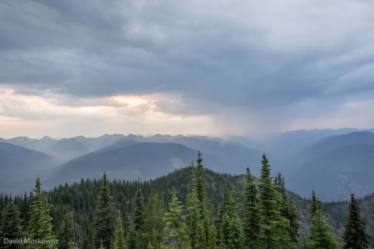
The end of 88 km of logging roads in the Columbia Mountains. A recent rainforest clearcut.
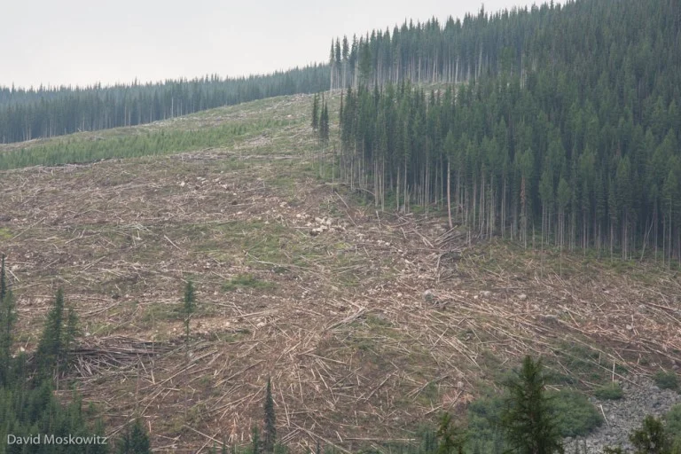
Humans. Sometimes I find myself so unimpressed. After driving kilometer upon kilometer of BC logging roads though a clear-cut landscape, parts of which were old-growth inland temperate rainforest just 5 years ago, I could not escape my disappointment with Homo sapiens. It boggles my mind to think about how often we accept and value short-term gains at the cost of our long-term future. At the cost of our health, our children’s health, and the health of the planet that gives us life. The more blunt thought that pervaded my travels: “We are just a bunch of dumb apes.”

Marcus Reynerson inspecting a caribou antler he discovered in the old growth forest just uphill from the end of the road and the last clearcut in the valley.
Dave and I were on the trail to find sign – and eventually a live sighting hopefully – of the elusive mountain caribou. Dave was in the field for almost three weeks when I joined him in the Columbia mountains of southern British Columbia. Mountain caribou have developed a survival strategy that is based on being extremely hardy. Basically, they’ve adapted to thrive in environments that are marginal at best for other similar species. Unfortunately, Humans have heavily encroached upon an already hard-pressed landscape. Places ideal for these caribou to call home are dwindling at a precipitous rate. Climate change is taking a strong toll. As the temperature warms, plant communities and ecology are rapidly changing. In some places, the moist cool sub-alpine meadows that have historically supported caribou are disappearing as they become more forested. Overharvesting of timber is creating habitat amenable to deer, elk and moose, which bring predators that are following these ungulates into closer contact with caribou.

Log truck carrying old-growth cedar trees out of caribou country.
It was an incredible tension that I felt cruising the logging roads of British Columbia. For some reason, the province is still harvesting old-growth trees. I found myself incredulous that this was happening still in 2015. The valleys where caribou call home are so beautiful, while at the same time so sad and tragic. Such beauty and devastation all in one place, as far as the eye could see. I’m excited to dig deeper into this story. And I’m also nervous. While it’s a story about the Mountain caribou, it’s also a story about humans. I’m so impressed with the former. At this point I can’t say the same about the latter. More thoughts to come...
When Marcus Reynerson isn't waxing philosophical on the role of humans and caribou in the world, he is the coordinator of the Anake Outdoors School at Wilderness Awareness School in Duvall Washington.
Click here to learn more about the Mountain Caribou Project.

Trees at the edge of a clearcut. Upper Seymour River valley, British Columbia.
After 28 days searching for mountain caribou, exploring the places they call home, or have recently disappeared from, here is a summary of some of what I discovered:

Marcus Reynerson making his way across a wet meadow system in the Tonquin Valley, Rocky Mountains. Jasper National Park.

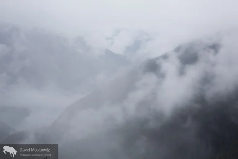
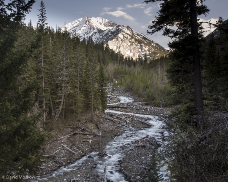
Fresh snow on the summit of a peak in the Columbia mountains after a summer storm.
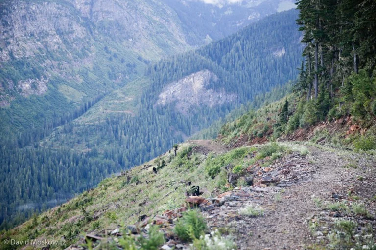
The end of 88 km (55 miles) of logging roads in the Seymour River watershed. Here avalanche chutes mix with recent clearcuts of inland temperate rainforest and remnant patches of old cedar forests where caribou still linger.

The Tonquin Valley, accessible only by trail, and completely contained within Jasper National Park, is home to the largest remaining concentration of caribou in the park but even here caribou numbers are declining rapidly.

Mount Edith Cavell, a famous peak and glacier in Jasper National Park and area still occupied by caribou. Like mountain environments around the globe, the glaciers in the Canadian Rockies and Columbia mountains are retreating quickly. Most of the glaciers I observed while in the field had no accumulation zone anymore, leaving them as large blocks of ice melting in the warming climate.

Moose tracks in the mud in the southern Selkirks. On my first trip to the area in 2009 I found only caribou sign in the area. On this trip all I could find was moose, elk and deer. Burgeoning moose and deer populations across much of the range of mountain caribou have lead to increased predation on caribou from wolves, mountain lions, and other carnivores whose populations are tied to moose and deer.
The survival of mountain caribou is not at all assured across much of their range. In the weeks and months to come I will continue to be researching this topic, planning future trips back to caribou country, collaborating with conservation organizations to help get the word out about this pressing conservation topic. Stay tuned!
Looking across the Rocky Mountain Trench at the Hart Mountains from the Cariboo Mountains. The Fraser River oxbows through the trench which divides these two mountain ranges.
I made my furthest trip north for the project to explore a small corner of the Cariboo Mountains, just south of the town of Prince George, British Columbia. In these mountains and across the Rocky Mountain Trench, in the Hart Ranges, caribou numbers are fairing a bit better than further south. However, with lots of room to spread out in the summer across multiple vast mountain ranges, finding them this time of year proved to be a challenge. During the summer mountain caribou disperse across the subalpine forests of these mountains in order to reduce the chance of being detected by predators. This strategy apparently also works effective for avoiding curious humans as well!

Treeline meadows and ponds where I searched for caribou in the area.
The wet meadow system was miles from the closes road or trail. With huge amounts of inaccessible forested landscapes to spread out in, mountain caribou can seemingly disappear into these mountains.
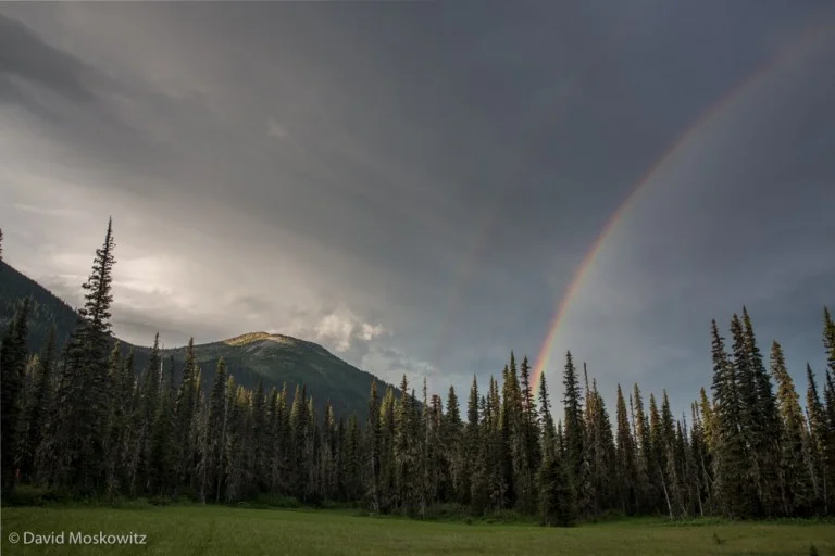
A double rainbow at sunrise precedes a violent thunderstorm that rolled across the landscape shortly afterwards.
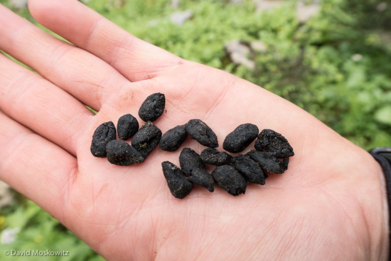
The closest I came to caribou on my excursion–some old scats found while out exploring.
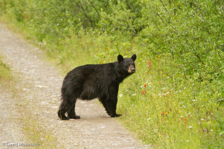
I stumbled upon this little black bear while walking back to my truck at the end of a long day in the field.

Mount Sir Alexander, 10,745 ft (3275m) towers above the peaks around it in the Canadian Rockies, across the Rocky Mountain trench from the Cariboo Mountains.
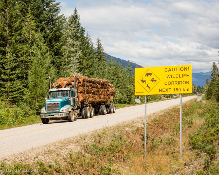
A log truck carrying western red cedar logs out of the home range of the Columbia North Caribou herd, past a sign warning motorists to watch out for wildlife on the road.
The timber industry has been the backbone of the economy in most of the interior of British Columbia for several generations. Industrial scale logging is also the primary source of the majority of challenges facing Mountain caribou. Because of this, sorting out how to protect caribou habitat while at the same time dealing with the demands of the very powerful timber industry (and modern civilization for that matter) for lumber has been an especially challenging task in attempts to conserve and restore caribou populations.
How well this has been done varies in different locations around the province. A few thing are clear. Mountain caribou depend on low and middle elevation old growth forests for early winter habitat, and high elevation old growth for winter habitat. Clearcuts and early stages of forest regeneration are prime habitat for moose and deer which attract attention from wolves and mountain lions who then prey on caribou more often in landscapes with a large logging footprint in them. Logging roads become access routes for humans on snowmobile in the winter to areas that are sensitive for caribou who are easily displaced by human recreation activities in the winter. A large amount of habitat has been set aside for mountain caribou which has curtailed logging in some areas and road use restrictions have been put in place as well. However, logging of both old growth and second growth forests continue in mountain caribou habitat in some places.

Lumber yard in Revelstoke, British Columbia. The logging industry is a primary employer in much of the region.

Mill worker on his way to work at the lumber mill in Revelstoke, British Columbia, a town where both timber and tourism are major and at times competing components of the economy. Mountain caribou conservation has put stresses on both in terms of restrictions on logging as well as the heliski and snowmobile recreation which are big business in the area.
British Columbia is the last place in the Pacific Northwest with significant stands of old growth forest still slatted for logging, both on the coast and in the interior. Conservation groups have used caribou protection as a tool to curtail logging in these ancient forests, much the spotted owl was used in the United States several decades ago—imperfectly in both cases. With caribou populations continueing to decline in much of their range logging interests have started looking at having these restrictions lifted once the caribou disappear from an area while conservation groups are looking at what might be the next lever for protecting whats left of this unique inland temperate rainforest.

A recently logged second growth forest in the Seymour River watershed. Industrial scale logging which employs large machinery to cut and remove logs often leaves a devastated appearing landscape behind, including lots of wood cut and left on the ground, to expensive to transport out for the value of what can be made from it.

The likely destination of the logs cut in the landscape above. Stacked lumber with floating logs beyond them close to Salmon Arm, British Columbia

Kim Shelton takes in the grandeur of a remnant stand of old growth western red cedar close to Trout Lake British Columbia. How we as a society place value on forests and trees such as these is highly varied. Whether places such as this, and the animals such as mountain caribou whom depend on them, will continue to exist in any significant quantity for future generations to argue about seems tenuous at the moment.

Looking out across the section of the Columbia Mountains I explored within the home range of the North Columbia Caribou herd.
The town of Revelstoke, British Columbia sits on the banks of the Columbia River. North of town, on both banks of the reservoir created by the impounded Columbia lives the North Columbia caribou herd. This herd has been fairing better in the past several years than many of the herds further south. The reasons for this appear to include a collection of issues including habitat protections, limits on recreational impacts from snowmobiling and helicopter ski opporations and a drastic reduction in moose populations (through human hunting) which has lead to a natural decline in wolf populations and in turn less pressure on caribou. This herd has also been the focus of a program to pen some of the herd's pregnant females during the spring and early summer. The females and their calves which were born in the protection of the pen are released in the midsummer where they rejoin the rest of the caribou in the wild. This project is in its second year (Learn more about it at Revelstoke Caribou Rearing in the Wild). I spent three days in the heart of their range for this herd in the mountains northwest of Revelstoke.
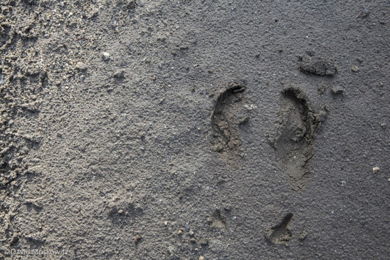
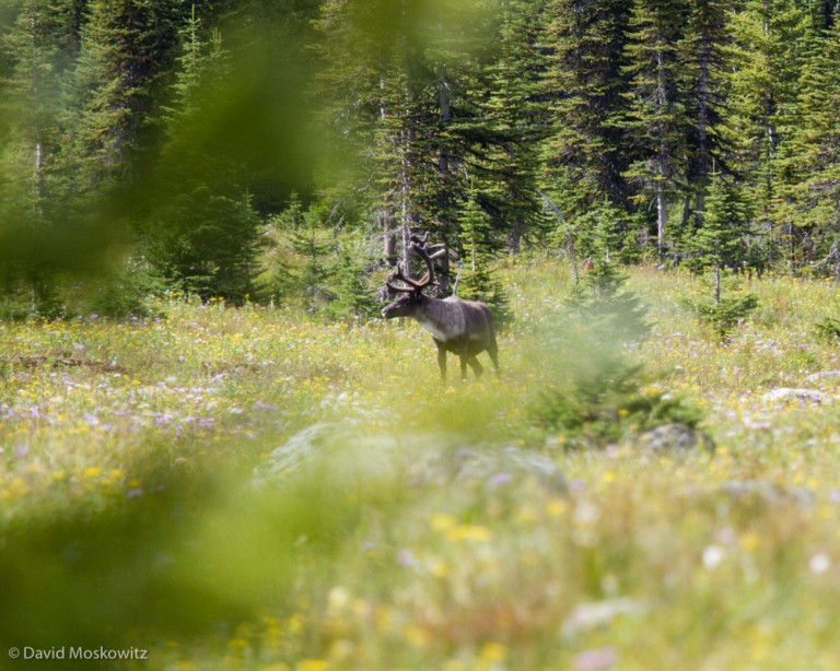
Numerous sets of fresh caribou tracks in the area told me I was in the right spot. Pictured is the hind foot of a bull caribou. Caribou are the only native North American hoofed mammal to regularly show dewclaws (the marks behind the main cleaves, feral pigs found in many places, though none in caribou habitat, also often register their dewclaws), though they show up more regularly in the fronts than hinds.

Early one morning, close to first light, I caught my first glimpse of a mountain caribou, a bull with antlers in velvet. Female caribou also have antlers, though smaller than the males, another unique feature of this species.

The subalpine landscape that caribou appear to prefer is one made of dense forests and wet meadows. This is a species that is definitely NOT afraid to get its feet wet.

The older tracks of a grizzly bear warned me that these creatures might be in the area. I spotted a mom and cub in the morning twilight on the day after I spotted the caribou. They didn’t spot me as they crossed an opening in the forest but also didn’t linger long enough for me to capture a photo of them. Though intrigued, I choose not to follow them to see if I might get another chance to see them. A little ways on I discovered the fresh tracks of a bull moose and calf heading into the same section of forest. An interesting story might have unfolded between these mothers and children of two of North America’s most ornery large mammals. I left this one as another one of the many mysteries that these dark forests hold.
The mosquitos and black flies were atrocious.
Mountain caribou have a distinctive migration pattern which involves moving up and down in elevation twice a year. In the late fall and early winter, as deep unconsolidated snows begin to blanket the higher elevations in the mountains, caribou head down in elevation and seek shelter and food in late successional western red cedar and western hemlock forests. These cedar-hemlock forests are amazingly similar to the rainforests found along the coast in the Pacific Northwest, creating a very unusual habitat--interior rainforest.

Kim Shelton marvels at ancient trees. Mature stands of western red cedar such as this one, have become very rare in mountain caribou habitat because of their valuable timber.

A much more common sight in the southern end of mountain caribou habitat. Over a century of logging have left the majority of low and mid-elevation temperate rainforests in a fragmented state with few late-successional stands left. These landscapes provide less food, less shelter and greater access to competitive ungulates and predators into caribou habitat. As caribou move into remnent patches of old trees they become more vulnerable to predators as compared to when they could spread out across a larger and less predator rich environment.
As the winter proceeds and the snowpack builds, caribou head up in elevation to mature stands of subalpine forest dominated by Engelmann spruce and subalpine fir where they feed almost exclusively on black tree lichen which grows on these trees close to treeline.

Kim Shelton reaches up toward the black tree lichen which grows along the trunk of this subalpine fir. The height of lichen growth indicates the approximate snowline in winters in these forests. Note that the lower portion of the tree has been scarred by a bear feeding on the inner-bark of the tree.
Black tree lichen on a subalpine fir, the chief food item in the winter diet of mountain caribou.
Climate change models predict significant changes to the landscapes that caribou call home--with potentially much warmer and drier summers being possibly the most significant change to these landscapes. The impacts of a changing climate on both caribou and humans, who also depend on these forests for water which produces huge amounts of hydro-power in the United States and Canada, and wood which is the chief driver of the economy in this part of Canada, is not precisely known. It appears safe to say that it will add additional stresses to both the human and caribou economy.

Streams like this one coming out of Waldie lake in the southern Selkirks are feed by winter snowpack which provides defacto water storage for hydro-electric projects downstream. Climate models predict that this water storage service will be significantly reduced as the regional climate warms.
text by Kim Shelton, photos by David Moskowitz Monday morning David and I connected with Dark Woods Preserve manager Adrian Leslie at a coffee shop in the town Salmo. He was incredibly helpful, gave us a map, a forest service road radio to help us not get run over by barreling logging trucks and and then a tour of promising locations on the preserve. We toured through the miles of gravel roads of the Dark Woods preserve, a chunk of land with prime caribou habitat segmented by private land running right through the middle and countless clear cuts.
A cloudy day on Devils Hole, a subalpine lake in the Dark Woods Preserve.
That afternoon we walked out to Devils Hole lake, a subalpine lake in a remote corner of the preserve, at the end of over 30 km of logging roads. We went hoping to find caribou sign. What we found was ironic: an animal even more rare than the 12 Caribou in the area. We laughed at the rarity of them, wolverine tracks dotted the shoreline of Devils Hole lake.

The track of a wolverine along the shore of Devils Hole.
A white tailed deer grazed in the meadow on the opposite side of the lake as we snuck through the forest along a well used bear trail. Grizzly and black bear tracks marked the ground as we stalked along, pausing for Dave to get some shots of the deer as the mosquitos marauded us and we donned our head nets. We eventually spooked the deer and moved into the meadow to search for caribou sign. Nothing but more bear sign. As we made our way back along the trail Dave excitedly motioned me forward to see “screaming fresh” bear scat – right on the path we walked to come this way. A moment later a crack of breaking branches on the hill! I became very aware of the location of my bear spray on my body. The bear didn't show itself and we made our way back to the vehicle, pausing to dunk in the lake and ease the itching of mosquito bites all over our bodies.

Wet meadows at the upper end of Devil’s Hole. The scared tree in the foreground is a favorite marking post of the local bears.
We drove back to our camp spot, through the nature conservancy – clear cuts and logging roads--always conscious of any tracks in the road dust. An incredible day but no mountain caribou.

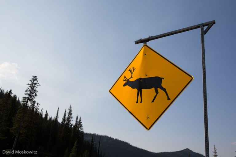
Caribou crossing sign close to Kootenay Pass on Canada’s Highway 3.
The South Selkirks herd is the last group of mountain caribou that still range back and forth across the international border between British Columbia and Washington and Idaho. Just north of the border Canadian Highway 3 crosses the Selkirk mountains over Kootenay Pass, where occasionally caribou are spotted by passing motorists, in Stagleap Provincial Park.
North of Stagleap, the Nature Conservancy of Canada has acquired a large parcel of land with the intention of preserving and restoring vital habitat for this herd of mountain caribou--the Darkwoods Conservation Area. However, these mountains are far from pristine--both the provincial lands and the Darkwoods Conservation Area are crisscrossed with forestry roads, and clearcuts of all sizes and ages. In many drainages, it is only the upper ends of the basin that have been spared cutting at one point or another. The Nature Conservancy of Canada purchased a large tract of land that had been previously managed for timber production. Since its purchase, along with stopping all timber harvest in caribou habitat within the preserve and protecting the existing uncut forest stands, the Nature Conservancy has been deactivating roads in caribou habitat.
Thunderstorm over the Darkwoods Conservation Area in the Selkirk Mountains of British Columbia

Stand of mature western red cedar and western hemlock preserved within the Darkwoods Conservation Area. Late successional stands such as this one are very rare in the southern Selkirks after decades of logging and fires at low and middle elevations in the region.
This landscape creates a maze of fragmented forest types for caribou to navigate while also leading to increased moose and deer populations at higher elevations. Kim Shelton joined me for a week to help search for caribou sign and carry photo equipment on ridiculous buggy bushwacks to several promising remote corners of these mountains. In a week of searching, location after location, where caribou where once abundant, we discovered the tracks and sign of moose, deer, and elk but the only tracks we found of caribou in a week of searching were a set of old tracks close to Kootenay Pass on Highway 3.

Linear features such as this road and power line corridor in the range of the Southern Selkirk herd, often act as routes for wolves, who hunt caribou, and humans, who’s presence can displace caribou, to access mountain caribou habitat.

Wolf tracks along the road running alongside the power line corridor. The province of British Columbia has carried out extensive predator control in this area, killing wolves from three different packs in an attempt to protect the remaining 13 caribou in the South Selkirks herd. These predator control efforts have been extremely contentious amongst various groups involved in caribou conservation.

Porcupine Lake in the Darkwoods Conservation Area. The Nature Conservancy of Canada completely removed a road that had been built into this lake to reduce human access and increase the quality of habitat for caribou in this subalpine basin.
A large clearcut south of the Darkwoods Conservation Area, outside of the preserve on private timber land. The Nature Conservancy of Canada purchased Darkwoods to protect quality caribou habitat from ending up looking like this.
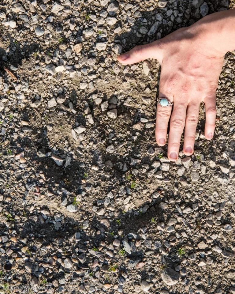
The large round front print of a mountain caribou.

Kim Shelton plowing through the subalpine brush in the heavily forested Selkirk mountains searching for signs of one the remaining members of the Southern Selkirks caribou herd.

Sunset on the dark woods of the Darkwoods Conservation Area.
Tomorrow I embark on a month of travels through the interior of British Columbia to learn about and photograph the world of mountain caribou. The mountain caribou of British Columbia, Washington, and Idaho are one of the most southern herd of caribou found anywhere on earth and their continued existence is threatened by a myriad of conservation challenges. Follow along here and on my instagram feed to learn more about these beautiful and endangered throwbacks to the Pleistocene. Over the course of the month, besides exploring and photographing in caribou country, I will also be meeting with people involved in caribou conservation and scouting for future trips to the region to fully capture the story of mountain caribou and the wild lands they call home. Below are a few photos of mine from past trips to mountain caribou country. Many more to follow!

Caribou country in northeastern Washington’s Selkirk mountains.

Tracks of one of the members of the South Selkirks herd which travel back and forth across the USA-Canada border.

Caribou trail in the Selkirk mountains of southern British Columbia.

Grizzly bear tracks just north of the Washington-British Columbia border. Grizzly bears are also a sensitive species in much of this region. Over the next month I will be exploring and documenting the ecology of caribou and how they interact with the mountains they call home, the other wildlife they share the landscape with, and the people that live, work, and play in caribou country.

Maligne Lake in Jasper National Park. Mountain caribou populations are being closely monitored in even large wilderness landscapes such as in the Canadian Rockies.
To learn more about the life history and conservation challenges of mountain caribou check out these websites as well:
This spring I spent a week out in the field with several colleagues from Cybertracker Conservation honing our tracking and trailing skills following the trails of black bears on the western slope of the North Cascades. I put together a brief video describing the art of trailing and documenting some of what we discovered on our adventures in the temperate rainforest.
Interested in learning to trail bears and other wildlife? I offer custom classes in a wide variety of tracking subjects, including wildlife trailing.

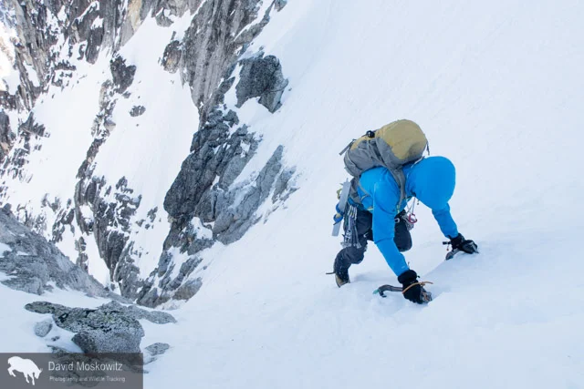
Dragon tail Peak in the moonlight. The Triple Couloirs route starts in the obvious snow gully around the center of the face. Note the headlamps on the right side of the face. From our camp on the lake we watched a party retreat off of the face via multiple rappels in the dark.
The Pacific Northwest's mild winter has created early spring conditions in the mountains--a more stable snowpack up high and little snow at lower elevations making access to the high country easier. This weekend Cam Alford and I trekked into the edge of the Enchantment range in Washington's North Cascades to take a crack at the classic alpine mountaineering route Triple Couloirs. The route is one of several that ascends the northwest face of Dragontail Peak.

Cam Alford making his bed for our brief evening at Colchuck Lake, using our climbing rope as part of his mattress.

Inspecting equipment for our early morning start.

In the moonlight, Cam makes coffee for our pre-dawn start.
After we left camp at 5 am, unfortunately, my camera stayed tucked in my pack until high up on the route as we navigated three pitches of ice and the first two couloirs. After safely navigating into the third couloir, with all of the significant technical obstacles behind us I snapped a few shots. Here Cam ascends steep snow towards the bottom of the third couloir.

Close to the summit of the Triple Couloirs on Dragontail Peak, Cam Alford looks out over the snow covered North Cascades.
A strait forward descent around the backside of the mountain brought us back to our camp and several grueling hours of hiking on a very icy trail and gated road got us back to our car and the end of 14 hours of almost continuous movement. Beers and burgers in Leavenworth shortly there after--sorry no photos of that either.
With over half a year gone by since we completed the OR7 Expedition, our team has been busy working on the educational products which were a key motivator to take on the expedition to begin with. We have been delivering slideshows up and down the west coast and abroad (for a list of upcoming events I am speaking at click here, and for a complete list of all events by all our team members click here).
The fact that OR7 found a mate and has produced a litter of pups in southwestern Oregon, well over 200 miles from the closest know breeding population of wolves demonstrates the amazing capacity for wolves to reestablish themselves in areas they have been absent from for decades. It also speaks to the excellent habitat condition for wolves which currently exist across much of the west including large sections of northern California. As has been made clear, in studies from around the globe, that large terrestrial carnivores play important roles ecologically in the natural systems they inhabit--especially in concert with each other. The re-establishment of wolves in parts of California, alongside the existing recovered populations of mountain lions and black bears in the state, would be a very real step forward towards creating more diverse, resilient, and self-regulating wildlife populations and biological communities in parts of California where humans have significantly altered the landscape through removal of some species and heavy management of others.
The world is a very different place now than it was in the early 1900's when the last wolves were being extirpated from the west coast. Human populations have shifted away from rural areas towards urban centers. Even in the last 50 years, since our society adopted the concept of protecting wild landscapes in the form of Wilderness, the world has shifted greatly. OR7 shows the scale at which we need to think about conservation and co-existance. Wolves speak to the very real limitations of Wilderness preservation. As we have begun to understand how interconnected ecological processes are we have learned about the vulnerability and ineffectiveness of islands of protected Wilderness. Conservation in the 21st century must look at protecting and restoring broad connected landscapes. With such a broad perspective on the types of lands that need to be incorporated into conservation planning, its impossible to consider removing human uses from all these areas. Because of this, modern conservation needs to take a hard look at the human-nature dichotomy which was enshrined in the Wilderness Act and move towards an appreciation that humans and human uses are part of the natural world. Rather than isolation of our impacts from nature and maintaining space for wild things like wolves in places far from where most people live, the way forward must be one of intermingled uses. A modern wolf like OR7 has learned to deal with a landscape covered with roads, high speed traffic, industrial scale agriculture and forestry. Similarly modern humans need to learn how to share the landscape once again with large carnivores, wild rivers, unmanaged forests, and landscapes with both the capacity to feed us, and preserve the diversity of life on which we as a species ultimately depend.
Here is a time lapse of the entire Wolf OR7 Expedition created by my team member Jay Simpson and set to an original poem of another team member Galeo Saintz. Enjoy!

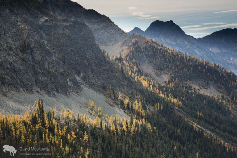
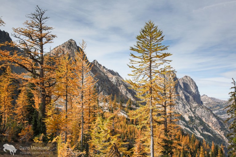
An alpine larch and the granite spires of Kangaroo Ridge in the North Cascades.
All along the high ridges and basins of the eastern slope of the North Cascades, lives a distinctive tree. The alpine larch (Larix lyallii) eeks out its existence at the very edge of tree-line in these mountains, acting as the gateway to the alpine above and the immense trees which characterize lower elevations in these mountains. Larch trees are the only conifer tree in the world that has deciduous needles and each fall the brilliant gold of these trees lights up the crisp fall air in the high mountains.

Darcy Ottey on a fall outing in the North Cascades of Washington.

During the fall, the limited range of alpine larch is illuminated brilliantly all along the edge of treelike in the high country.

At the lower elevations in their range alpine larch blend with subalpine fir and Engelmenn spruce.

A grove of alpine larch below the snow covered north face of Frisco Peak and the Lyle glacier.

A few alpine larch dot the upper reaches of Early Winters Creek with the iconic Liberty Bell massif beyond.


I have been lucky enough to spend the end of August climbing in the French Alps out of the town of Chamonix with my friends Erin Smart and Forest McBrian, owners and guides for Borealis Mountain Guides. Erin, who has been skiing and climbing in the French Alps since she was a teenager provided me with a brilliant introduction to the climbing culture of the area. Having known Forest for many years and his love of all things related to the art of Alpinism and most things French, it was a pleasure to finally experience the mountains which I had heard about from his stories--mountains which have inspired generations of world class alpinists including Forest (whose exploits include first ascent mountaineering routes and first descent ski mountaineering routes, as well as a burgeoning writing career including a recent article in Alpinist on the famed Pickets Range in the North Cascades).
Having come of age in the mountains of western North America, reading about the exploits of John Muir and Fred Becky, I always assumed that suffering through long approaches, doing battle with dense brush, brutal mosquitoes, crossing raging snowmelt filled creeks was part of the entrance fees for access to the splendor of the high mountains. Here in Europe, there is a bit of different sensibility. Approaches are manicured, ladders and footholds are added to the landscape to expedite travel, cable cars provide access from the valley bottom to the heart of the glacier in minutes, beautiful helicopter serviced mountain huts await with wine or tea to be had on the deck at the end of a day of climbing followed by 3 course dinners and a cozy place to spend the night. And just beyond the hut, or the exit from the lift, lays some of the most stunning mountain scenery and stellar alpine climbing routes of anywhere in the world.
Erin Smart heads out on the snow arete leading away from the Aguille du Midi. Amazingly enough this photo was taken just a few meters from where the lift drops tourists, climbers and skiers off, leaving right from the town of Chamonix. One minute I was on the street eating a fresh pastry from a local bakery and 15 minutes later I found myself in some of the most stunning alpine terrain I have traversed in my life.
Erin navigating fresh snow on the Cosmiques arete, a classic climbing route on the west side of the Aguille du Midi.

Erin smart leading out on mixed terrain.

At 4810 meters (15,781 feet), Mount Blanc is the highest peak in the Alps. Clouds stream off of the lee side of the heavily glaciered peak.

The Mere de Glace glacier flows down off of Mount Blanc and the surrounding peaks. While still miles long, the thickness of the glacier has shrunk dramatically over recent decades…an example of the shifting climate in the region.

Erin Smart on the trail into the Envers Hut, situated above the Mere du Glace.

Situated in an almost fairy tale like setting, the Envers des Aguilles Hut, managed by the French Alpine club provides lodging and food for climbers.

Mountain guide Miles Smart at a belay on a route above the Envers hut.

Forest McBrian examines the Eperon des Cosmiques route before our ascent.

Forest McBrian leading out on a traversing pitch lower on the route.

Erin getting into the crux moves of the route, a series of cracks leading through a large roof.

Erin pulling over another thoughtful move on the same crux pitch of the route.

Forest wandering up through a series of cracks in beautiful granite towards the top of the route.

The view from a belay stance on the route. Mount Blanc in the background.

Darcy Ottey on the approach to the Colonial Glacier cirque. Colonial Creek falls off to the left with Colonial Peak above it.
In August, Darcy Ottey and I went to explore a corner of the North Cascades we had never been to: the high peaks and glaciers just above the the south end Diablo reservoir, off of the North Cascades Scenic Highway in northern Washington State. After years of seeing Colonial Peak from the Highway when driving through, we picked what turned out to be a stormy summer week to venture into the area.
Hours of grinding up a steep but established climbers route through lower and mid elevation forests eventually popped us out above treeline on glacier carved slabs along a ridgeline leading towards Pyramid Peak. From hear a short traverse across talus and old avalanche debris got us to the entrance to a glaciated citadel of mountains—the upper Colonial Creek cirque.

Camp on the edge of the recently formed lake at the terminous of the Colonial glacier.

A blanket of clouds cover lower elevations in the North Cascades with high peaks sitting like islands in the sea at sunrise. The image is similar to how these mountains often appeared during the ice age when glaciers often covered lower elevations in much the same way.
Not surprisingly, when we reached where the map noted the snout of the Colonial glacier should be we found no ice. The glacier, like most glaciers in the North Cascades (and indeed across the planet), has receded significantly. Nearly a quarter mile up stream we found the new terminus of the glacier, where it ends in a newly exposed lake, in a depression carved out by the glacier and now filled with melt water and icebergs—detached chunks of the crumbling glacier. Thunderstorms roiled a we elected to avoid campsites on the exposed rock prow above the lake, instead choosing to set up camp on the only flat spot we could find adjacent to the lake.
Receeding glaciers leave behind moonscapes of scoured bedrock covered with piles of rubble and rock flour.

Glacial ice exposed at the very top of the Colonial glacier (upper left of this photo) suggests that this glacier no longer has an accumulation zone. Under current conditions, it is just a matter of time before the glacier disappears completeley–perhaps within the next several decades.

Current maps show glacial ice extending much further down then where the actual terminous of the glacier is now. The retreat of the glacier has created this newly formed lake. Chunks of glacial ice still float in the lake, demonstrating how quickly this landscape is changing due to shifts in the climate.

Glacial lakes such as this one are filled with large amounts of ground rock powder giving the water a dark milky green appearance.

Earth, sky and water merge with a heavy fog sitting over the snow and ice choked glacial lake.


Inclement weather dashed our plans for several peak climbs but did not deter us from venturing further south, over the Colonial glacier and onto the Neve glacier.
Inclement weather dashed our plans for several peak climbs but did not deter us from venturing further south, over the Colonial glacier and onto the Neve glacier.

The vast exapanse of one of the largest glaciers in the North Cascades, the Neve Glacier with Snowfield Peak sitting at its head, on the left side of the frame. Seen from the Neve-Colonial glaicer col.


On the broad expanse of the glacier, the peaks and landmarks disappear leaving an eerie world with land and sky blending together into a world of white.

Paul Bunyon’s Stump, Pinnicle, and Pyramid peaks from Colonial-Neve glacier col.

Looking north from the area into the upper Skagit river valley. Ross Lake, a large reservoir built to provide hydro-electric power for the city of Seattle is a more obvious sign of our species quest for energy then the retreating glaciers of the region but both reflect the long reach of modern human’s influence on even the most wild and rugged landscapes in the world.
Descending into the clouds from the glacial cirque back into the forests of the North Cascades.

Sections of forests on the western slope of the North Cascades get enough precipitation to qualify as temperate rainforest. Only 10,000 years ago these slopes likely appeared much like the higher elevations do now, having just been released from retreating glaicers which filled the mountains and flowed down into the ocean. Climate models predict these mountains to get warmer and wetter in the decades to come. Glaciers will retreat and forests will advance unslope in an ongoing advance of forests through these mountains which began millenia ago.
This July I had the pleasure of joining the Learn and Serve Environmental Anthropology Field School (LEAF School) as a guest instructor on a service learning program. We joined the Blue Heron Canoe Family on their canoe expedition from the Puget Sound in northern Washington all the way to Bella Bella on the central coast of British Columbia. The LEAF School is a program of Edmonds Community College run by Dr. Thomas Murphy. I joined the journey about midway up the eastern coast of Vancouver Island.
Each year, indigenous nations from up and down the Northwest Coast of the United States and Canada, as well as first nations with canoeing traditions from the interior of the region and beyond (this year's journey included several Maori people from New Zealand as well as a number of Hawaiians!) travel by canoe, often from their traditional territories to a common destination. Begun in 1989, this is a powerful celebration of the canoeing tradition. This years destination was the Heiltsuk Nation, whose primary village is the town of Bella Bella (Waglisla in Heiltsuk).

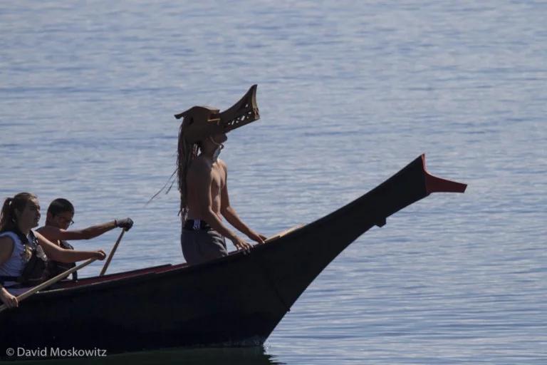
Members of the Blue Heron Canoe family and students of the LEAF school paddle the canoe along the shores of an island on the central coast of British Columbia.


Along the route to Bella Bella, canoe families were often hosted for dinner and celebration by the nation whose traditional territory they passed. Here, members of about 20 canoes and their support boats came ashore and were hosted by the Wuikinuxv First Nation in a bay called Open Bight on the mainland coast of British Columbia.

Meals often included traditional foods such as salmon and many other foods from the sea.

Salmon cooking over an open fire in a traditional methods using split cedar to secure the fish.

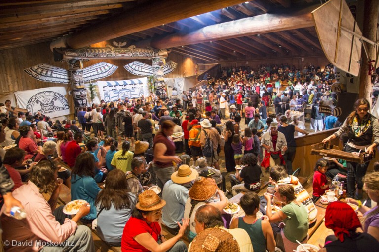
Before coming ashore, a ceremonial landing often took place. The most elaborate landing protocol at the end when all 42 of this years canoes landed in Bella Bella. Each canoe presented its self and asked for permission to land and share songs and dances with the hosts. The request was responded to with a heartfelt welcome.

Skipper and canoe-builder Michael Evans presents Blue Heron Canoe of the Snohomish people, at the landing ceremony in Bella Bella.
In the evenings, after landing in a new host nation’s territory and enjoying a meal provided by the hosts, each tribe would share songs and dances with the hosts. This evening, in the territory of the Namgis, was hosted in their beautiful long house in Alert Bay, British Columbia.


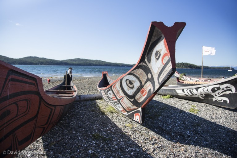
Canoes are treated with a great deal of respect as they function not just as a vehicle to move people but as a vessel of culture. The journey is an opportunity for each tribe to celebrate and rejuvenate its unique cultural relationship to the land, sea, and human neighbors.


Besides participating in canoeing and cultural activities, students in the class learned about traditional uses of plants and animals along the route.

Dr. Murphy explains the identity of a crab found in the intertidal zone close to Fort Rupert, British Columbia.
Dr. Murphy explains the identity of a crab found in the intertidal zone close to Fort Rupert, British Columbia.

Exploring a remote beach in Cape Scott Provincial Park on the northern tip of Vancouver Island.
With years of exploring the Pacific Northwest, I can honestly say this journey was one of the most amazing opportunities I have had to deepen my appreciation and understanding of the people and landscapes of the Pacific Northwest, an opportunity I feel very grateful for.


With a bit more than a week at home between expeditions this June, besides catching up on emails and the odds and ends of keeping "the rest of my life" rolling, I managed to get a few outings done in my backyard here in the Methow Valley. These included a day of climbing with friends, a solo traverse of some of the local high country, retrieving remote camera's I had out for a bit over a month while I was gone, and an evening in a makeshift blind at a local beaver pond close to the Methow River. Here are a few of the images from my week....

A brief pause for a very flighty creature.

Supper on the water.

Female and cub black bears inspecting a well traveled game trail.


A wolf investigating along a lightly traveled forest road.

Some one doesn’t need any notification that the Saskatoon berries are coming on here in the valley!

Vasiliki Ridge, Silver Star Peak, and Snagtooth Ridge as seen from the base of the base of Big Kangaroo Mountain…one of my favorite parts of the North Cascades.

Looking down into the upper stretch of Cedar Creek and towards the peaks of the northern Sawtooth range on the eastern edge of the North Cascades, Washington.

Ryan Audett taped up and racked up for a pitch on First Ammendment on the formation known as “Le Petite Cheval” in the Early Winters Creek Drainage.

Josh Cole reviews the route description as Ryan sets off on another pitch of the route. Liberty Bell and the road cut of the North Cascades Scenic Highway can be seen in the distance.

Ryan peers around the corner sorting out the best line on a route none of us had done previously.

Looking down the Willow Creek Basin towards Early Winters Creek and the North Cascades Scenic Highway, framed by Kangaroo Ridge and the Silver Star Massif beyond.
Just a few days ago I my team and I stepped off the trail, at the end of over a month of biking and hiking at the southern end of wolf OR7's current home range. Over the weeks prior we traversed over 1000 miles on foot and bike, retracing the route this wolf took dispersing from where it was born in the Wallawa mountains of northeastern Oregon to northern California and back up into southwestern Oregon. Along the way we met numerous fascinating people whom live, work, and play in the landscapes OR7 traversed, observed bountiful wildlife, slept out under the stars and tried to experience the lands we passed through as the wolf might have.


The expedition crew a few days before the end of the route.
With the expedition complete the team is now turning its attention to production of a wide variety of educational materials to help share the stories from our trip and create a forum for community dialogue around coexistence with large carnivores. Read more about the details of our trip and forthcoming materials at or7expedition.org.
Thanks to our many supporters, and sponsors including Xplore and Sculpt the Future Foundation. Learn about all the many people and organizations that helped make this expedition a success here.

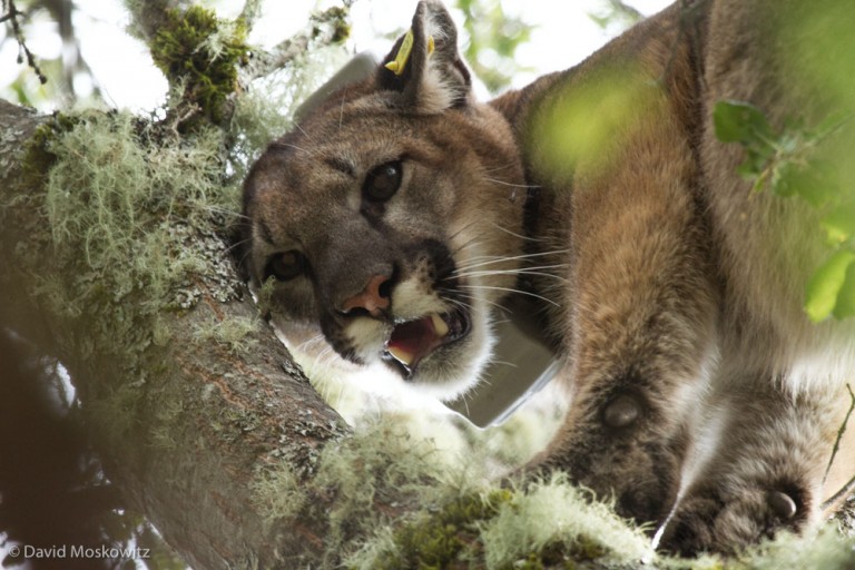
In February I had the opportunity to spend a couple of weeks in the field with the Santa Cruz Puma Project, an ongoing research program based out of University of California Santa Cruz. Along with learning about the general biology and ecology of mountain lions, researchers and graduate students are looking specifically at how these large cats interact with human populations, neighborhoods, and roads.

The San Francisco Bay area is one of the largest metropolitan areas in the United States but still includes a matrix of open spaces and wild lands that mountain lions have managed to carve out an existence in.

The primary study area for the project is the Santa Cruz mountains which run south from San Francisco. Plant communities range from redwood forests to arid chaparral and oak woodlands.

On the eastern edge of the Santa Cruz mountains, residential areas intermix with parklands and forested mountains creating a fragmented landscape that mountain lions travel through carefully.
In order to get detailed information on the movements of mountain lions, the project live captures mountain lions and attaches a GPS collar to them.

Hounds are used to track the cat which typically climb a tree to evade the dogs. Researchers can anesthetize the mountain lion, give it a physical exam and secure a radio collar to the cat. Here roundsman Dan Tichenor has just released one of his hounds on the fresh trail of a mountain lion.

Treed mountain lion in a Pacific madrone tree.

Besides a GPS unit, the collars also include a radio signal transmitter which researchers can use to get close enough to the cat to wirelessly download data from the collar. Other collars have a transmitter which allows GPS data to be transmitted via cell service. All of the lions in the project with these collars are currently on a family plan I was told (seriously!). Here wildlife biologist Paul Houghtaling is attempting to locate a collared cat in a large stand of redwood trees.

Once the data has been collected from the collar’s the detailed geographic information collected can be used to address a wide variety of research questions.

One big question that the project is studying is about the diet of mountain lions and specifically where on the landscape they are hunting in relationship to various habitat types and levels of human presence on the landscape. Here field technician Chris Fust has used information from a collared cat to discover the remains of a deer killed by the mountain lion.

Another topic of great interest to the project and numerous other conservationists in the area are the effects of roads and highways on mountain lions ability to move around the region. I spent a day out in the field with Tanya Diamond (pictured here) and Ahiga Snyder from Pathways For Wildlife whom are studying wildlife crossings of numerous roads in the region.

Researcher Ahiga Snyder servicing a remote camera at a break in a fence adjacent to Highway 1 which wildlife have been using to access the roadway.

Sunset over the Pacific Ocean from Wilder State Park just north of Santa Cruz California. Stunning natural beauty has drawn hundreds of thousands of people to the San Francisco Bay area for decades creating the current challenges the region is facing to conserve local wild lands and wildlife but also a human population deeply invested in the outcome.
