Why is Representative Newhouse defending the coal industry and silent on climate change?

Why is Representative Newhouse defending the coal industry and silent on climate change?

David Moskowitz, February 3, 2017, Winthrop Washington

Last week our US Representative, Dan Newhouse took the floor in Congress and delivered a lengthy commentary on the need to roll back regulations put in place by the Obama administration to protect streams from coal mining waste. He laid out his case for why these regulations are a threat specifically to America’s coal industry. The merits, or lack there of, of his case can be debated—the regulations he discussed are complicated as are how to evaluate them. The coal industry is not a substantive presence in our district, a fact that makes this subject even more challenging for us, his constituents, to fully grasp. Which presents the truly questionable nature of his remarks. Why is our Representative spending his time (our time) defending an industry that is both absent from our district and demonstrably poses significant threats to the vibrant economy we do have here?

Representative Newhouse has made his position that he recognizes that climate change is real and has even proactively engaged in working to support efforts on the federal level to deal with some of the consequences of climate change on our region. Those of us truly interested in a bright future for our region should be grateful our Representative isn’t living in the world of “alternative facts” which drive many in the Republican party to deny the reality of this very real problem we are facing. That being said, in past statements, Newhouse has also suggested that it doesn’t appear much can be done to reverse climate change and even questioned whether climate change was caused by humans at all. This is either a case of a politician attempting to take both sides of an issue publically, or an indication that perhaps our Representative does occasionally indulge in the world of “alternative facts” which are eroding our social dialogue and political process in this nation.

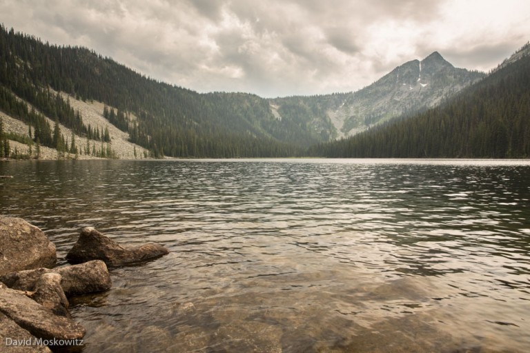
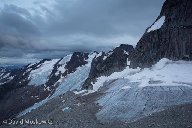
The fact of the matter is, coal and fossil fuel consumption around the globe is driving climate change and the impacts do not look good for our district. Increasing wildlife risk, increasing shortages of agricultural water are real issues we are facing now which are predicted to get worse. Perhaps most ironically, the bountiful hydropower which provides reliable, affordable, and carbon neutral energy for our region could be threatened by the variable weather conditions and decreased snowpack our region will face. In this sense, our Representative is actually spending our time working against our best interests.

Why doesn’t Newhouse let members of Congress from coal country advocate for the needs of their constituents? We need our Representative to represent ours. Our regions is both poised to support and benefit from our nation continuing a transition away from a fossil fuel economy. Alternately, we have much to loose from the impacts of climate change if we do not address it in a real and meaningful way. It's a shame Dan Newhouse is apparently more concerned about the vitality of the American coal industry then the citizens of his Congressional District.

Open Letter to Patty Murray, United States Senator

  Senator Patty Murray, 154 Russell Senate Office Building, Washington, D.C. 20510

November 17, 2016

Dear Senator Murray:

Your actions now as a Democratic senator will weigh heavily in the history of this country. Just as climate change is making our historical record increasingly worthless for predicting the future, so to have we entered a new phase in our nation’s political history. Now is the time to take unflinching actions to protect the people and places you represent, and to step out of the norms of politics as usual in Washington DC.

As a senator from a deeply progressive state, you are uniquely situated to represent the will of the people of Washington and the majority of citizens from across this country who are horrified about recent election results. We look to you to do everything within your power to resist the backwards social, economic, and environmental policies put forward by Republicans. The fact that Hilary Clinton won the popular vote across the country gives Senate Democrats both the mandate and responsibility to take every opportunity to resist, slow, amend, or stop policies which are contrary to the progressive values of our nation.

The electoral college has once again thwarted the will of the majority of Americans. The redistricting carried out after the last national census has similarly allowed the minority of people in this country to impose their will in the U.S. House of Representatives. The unraveling of campaign finance reforms and voter protections by a conservative leaning Supreme Court has further moved our nations governance away from the will of the people.

Republicans set a precedent for the blatant disregard for the standards of treatment for Supreme Court nominees. Democrats in the Senate must not accommodate or reward this behavior. The majority of Americans in this country voted for a candidate that promised progressive Supreme Court nominees. The need for this is now more important than ever to fulfill the Constitution’s goal of a balance of power within our federal government.

As we can see from numerous other nations around the planet, no matter how powerful the institutions of government, they cannot survive in the long run if they move contrary to the will of the people. For our Democracy to survive, this must change. Please use the full weight of your office and influence to mitigate, arrest, or reverse these trends in our government. Specifically, oppose any Supreme Court nominee put forward by President-elect Trump that does not represent the views of the majority of American’s.

The majority of Americans understand climate change is not a hoax as Donald Trump has claimed. The most pressing global issue of our time, we must deal with it now to mitigate the worst impacts it will have for people and the planet. As I’m sure you know, people that have the least will suffer the most from this issue left untended. In the long run, Trump and the Republican party’s refusal to recognize and address this issue will amount to a global tragedy. Please know that anything and everything you can do to uphold our participation in global initiatives to deal with this is appreciated and expected.

Some say we must give Trump a chance. He has had many chances to rectify his bigoted statements and shortsighted policy proposals. His initial actions since the election demonstrate clearly his intent to follow through on them. Given both the extreme personality and proposals of Trump, and the track record of obstinance to compromise by Senate and House Republicans, “working together” is not likely in the cards for the years to come. To the contrary, the evidence at hand indicates Republicans will take anything given to them and demand more.

Now is a time for clear, firm boundaries. As the most senior elected representative of mine in the federal government, I implore you to use all the tools you have within your power to RESIST the agenda set forward by the Donald Trump administration and the Republican party.

David Moskowitz

Winthrop, Washington

Mountain Caribou Project: "The Wet Belt"

Inland Temperate Rainforest and Caribou

Mountain caribou have a distinctive migration pattern which involves moving up and down in elevation twice a year. In the late fall and early winter, as deep unconsolidated snows begin to blanket the higher elevations in the mountains, caribou head down in elevation and seek shelter and food in late successional western red cedar and western hemlock forests. These cedar-hemlock forests are amazingly similar to the rainforests found along the coast in the Pacific Northwest, creating a very unusual habitat--interior rainforest.

Kim Shelton marvels at ancient trees. Mature stands of western red cedar such as this one, have become very rare in mountain caribou habitat because of their valuable timber.

Kim Shelton marvels at ancient trees. Mature stands of western red cedar such as this one, have become very rare in mountain caribou habitat because of their valuable timber.

A much more common sight in the southern end of mountain caribou habitat. Over a century of logging have left the majority of low and mid-elevation temperate rainforests in a fragmented state with few late-successional stands left. These landscapes …

A much more common sight in the southern end of mountain caribou habitat. Over a century of logging have left the majority of low and mid-elevation temperate rainforests in a fragmented state with few late-successional stands left. These landscapes provide less food, less shelter and greater access to competitive ungulates and predators into caribou habitat. As caribou move into remnent patches of old trees they become more vulnerable to predators as compared to when they could spread out across a larger and less predator rich environment.

Subalpine Snow Forests

As the winter proceeds and the snowpack builds, caribou head up in elevation to mature stands of subalpine forest dominated by Engelmann spruce and subalpine fir where they feed almost exclusively on black tree lichen which grows on these trees close to treeline.

Kim Shelton reaches up toward the black tree lichen which grows along the trunk of this subalpine fir. The height of lichen growth indicates the approximate snowline in winters in these forests. Note that the lower portion of the tree has been scarr…

Kim Shelton reaches up toward the black tree lichen which grows along the trunk of this subalpine fir. The height of lichen growth indicates the approximate snowline in winters in these forests. Note that the lower portion of the tree has been scarred by a bear feeding on the inner-bark of the tree.

Black tree lichen on a subalpine fir, the chief food item in the winter diet of mountain caribou.

Black tree lichen on a subalpine fir, the chief food item in the winter diet of mountain caribou.

Forests, caribou, and people in a changing climate

Climate change models predict significant changes to the landscapes that caribou call home--with potentially much warmer and drier summers being possibly the most significant change to these landscapes. The impacts of a changing climate on both caribou and humans, who also depend on these forests for water which produces huge amounts of hydro-power in the United States and Canada, and wood which is the chief driver of the economy in this part of Canada, is not precisely known. It appears safe to say that it will add additional stresses to both the human and caribou economy.

Streams like this one coming out of Waldie lake in the southern Selkirks are feed by winter snowpack which provides defacto water storage for hydro-electric projects downstream. Climate models predict that this water storage service will be signific…

Streams like this one coming out of Waldie lake in the southern Selkirks are feed by winter snowpack which provides defacto water storage for hydro-electric projects downstream. Climate models predict that this water storage service will be significantly reduced as the regional climate warms.

MCP Field Notes: A Day at Devils Hole

text by Kim Shelton, photos by David Moskowitz Monday morning David and I connected with Dark Woods Preserve manager Adrian Leslie at a coffee shop in the town Salmo. He was incredibly helpful, gave us a map, a forest service road radio to help us not get run over by barreling logging trucks and and then a tour of promising locations on the preserve. We toured through the miles of gravel roads of the Dark Woods preserve, a chunk of land with prime caribou habitat segmented by private land running right through the middle and countless clear cuts.

A cloudy day on Devils Hole, a subalpine lake in the Dark Woods Preserve.

A cloudy day on Devils Hole, a subalpine lake in the Dark Woods Preserve.

That afternoon we walked out to Devils Hole lake, a subalpine lake in a remote corner of the preserve, at the end of over 30 km of logging roads. We went hoping to find caribou sign. What we found was ironic: an animal even more rare than the 12 Caribou in the area. We laughed at the rarity of them, wolverine tracks dotted the shoreline of Devils Hole lake.

The track of a wolverine along the shore of Devils Hole.

The track of a wolverine along the shore of Devils Hole.

A white tailed deer grazed in the meadow on the opposite side of the lake as we snuck through the forest along a well used bear trail. Grizzly and black bear tracks marked the ground as we stalked along, pausing for Dave to get some shots of the deer as the mosquitos marauded us and we donned our head nets. We eventually spooked the deer and moved into the meadow to search for caribou sign. Nothing but more bear sign. As we made our way back along the trail Dave excitedly motioned me forward to see “screaming fresh” bear scat – right on the path we walked to come this way. A moment later a crack of breaking branches on the hill! I became very aware of the location of my bear spray on my body. The bear didn't show itself and we made our way back to the vehicle, pausing to dunk in the lake and ease the itching of mosquito bites all over our bodies.

Wet meadows at the upper end of Devil’s Hole. The scared tree in the foreground is a favorite marking post of the local bears.

Wet meadows at the upper end of Devil’s Hole. The scared tree in the foreground is a favorite marking post of the local bears.

We drove back to our camp spot, through the nature conservancy – clear cuts and logging roads--always conscious of any tracks in the road dust. An incredible day but no mountain caribou.

We set a camera trap close to Devils Hole which I will check in about a month. Stay tuned for results!

Tribal Canoe Journey to Bella Bella

Qatuwas 2014: Paddle to Bella Bella

This July I had the pleasure of joining the Learn and Serve Environmental Anthropology Field School (LEAF School) as a guest instructor on a service learning program. We joined the Blue Heron Canoe Family on their canoe expedition from the Puget Sound in northern Washington all the way to Bella Bella on the central coast of British Columbia. The LEAF School is a program of Edmonds Community College run by Dr. Thomas Murphy. I joined the journey about midway up the eastern coast of Vancouver Island.

Each year, indigenous nations from up and down the Northwest Coast of the United States and Canada, as well as first nations with canoeing traditions from the interior of the region and beyond (this year's journey included several Maori people from New Zealand as well as a number of Hawaiians!) travel by canoe, often from their traditional territories to a common destination. Begun in 1989, this is a powerful celebration of the canoeing tradition. This years destination was the Heiltsuk Nation, whose primary village is the town of Bella Bella (Waglisla in Heiltsuk).

Members of the Blue Heron Canoe family and students of the LEAF school paddle the canoe along the shores of an island on the central coast of British Columbia.

Members of the Blue Heron Canoe family and students of the LEAF school paddle the canoe along the shores of an island on the central coast of British Columbia.

MG_9675-768x512.jpg
Along the route to Bella Bella, canoe families were often hosted for dinner and celebration by the nation whose traditional territory they passed. Here, members of about 20 canoes and their support boats came ashore and were hosted by the Wuikinuxv …

Along the route to Bella Bella, canoe families were often hosted for dinner and celebration by the nation whose traditional territory they passed. Here, members of about 20 canoes and their support boats came ashore and were hosted by the Wuikinuxv First Nation in a bay called Open Bight on the mainland coast of British Columbia.

Meals often included traditional foods such as salmon and many other foods from the sea.

Meals often included traditional foods such as salmon and many other foods from the sea.

Salmon cooking over an open fire in a traditional methods using split cedar to secure the fish.

Salmon cooking over an open fire in a traditional methods using split cedar to secure the fish.

Before coming ashore, a ceremonial landing often took place. The most elaborate landing protocol at the end when all 42 of this years canoes landed in Bella Bella. Each canoe presented its self and asked for permission to land and share songs and da…

Before coming ashore, a ceremonial landing often took place. The most elaborate landing protocol at the end when all 42 of this years canoes landed in Bella Bella. Each canoe presented its self and asked for permission to land and share songs and dances with the hosts. The request was responded to with a heartfelt welcome.

Skipper and canoe-builder Michael Evans presents Blue Heron Canoe of the Snohomish people, at the landing ceremony in Bella Bella.

Skipper and canoe-builder Michael Evans presents Blue Heron Canoe of the Snohomish people, at the landing ceremony in Bella Bella.

In the evenings, after landing in a new host nation’s territory and enjoying a meal provided by the hosts, each tribe would share songs and dances with the hosts. This evening, in the territory of the Namgis, was hosted in their beautiful long house…

In the evenings, after landing in a new host nation’s territory and enjoying a meal provided by the hosts, each tribe would share songs and dances with the hosts. This evening, in the territory of the Namgis, was hosted in their beautiful long house in Alert Bay, British Columbia.

10B9737-768x512.jpg
10B9798-768x614.jpg
10B9834-768x512.jpg
10B2010-768x512.jpg
10B1954-768x512.jpg

A canoe is more than a simple boat

Canoes are treated with a great deal of respect as they function not just as a vehicle to move people but as a vessel of culture. The journey is an opportunity for each tribe to celebrate and rejuvenate its unique cultural relationship to the land, sea, and human neighbors.

10B0623-768x512.jpg
10B0691-768x512.jpg
10B0311-768x614.jpg
10B0280-768x512.jpg
10B0258-768x512.jpg

Cultural uses of plants and animals

Besides participating in canoeing and cultural activities, students in the class learned about traditional uses of plants and animals along the route.

 Dr. Murphy explains the identity of a crab found in the intertidal zone close to Fort Rupert, British Columbia.

 Dr. Murphy explains the identity of a crab found in the intertidal zone close to Fort Rupert, British Columbia.

 Dr. Murphy explains the identity of a crab found in the intertidal zone close to Fort Rupert, British Columbia.

Exploring a remote beach in Cape Scott Provincial Park on the northern tip of Vancouver Island.

Exploring a remote beach in Cape Scott Provincial Park on the northern tip of Vancouver Island.

An amazing journey through a landscape rich in natural and cultural beauty

With years of exploring the Pacific Northwest, I can honestly say this journey was one of the most amazing opportunities I have had to deepen my appreciation and understanding of the people and landscapes of the Pacific Northwest, an opportunity I feel very grateful for.

MG_9926-768x512.jpg
MG_9809-768x512.jpg
MG_9904-768x512.jpg
MG_0143-768x512.jpg
MG_0082-768x614.jpg
10B1599.jpg
10B0795-768x431.jpg
10B0355-768x614.jpg
10B0181-768x512.jpg

A Night Out, Methow Valley Style

Winter nights are long in the rural Methow Valley, tucked away on the eastern edge of the North Cascades. Here are few shots from a recent overnight trip to a local summit.

Starlight on the North Cascades…3897 second exposure, 12 degrees Fahrenheit.

Starlight on the North Cascades…3897 second exposure, 12 degrees Fahrenheit.

Big Dipper over WInthrop Washington.

Big Dipper over WInthrop Washington.

Stars circling around Polaris, the North Star.

Stars circling around Polaris, the North Star.

Low clouds sit over the valley at the first light of the day.

Low clouds sit over the valley at the first light of the day.

Low clouds cover the Methow Valley as the first light of the day hits the high peaks of the Pasayten Wilderness on the eastern edge of the North Cascades.

Low clouds cover the Methow Valley as the first light of the day hits the high peaks of the Pasayten Wilderness on the eastern edge of the North Cascades.

First light on Oval Peak, one of the highest summits the Lake Chelan-Sawtooth Wilderness.

First light on Oval Peak, one of the highest summits the Lake Chelan-Sawtooth Wilderness.

Reynolds Peak, another one of the high summits in the Sawtooth Wilderness, and often a climbing objective for students on mountaineering courses through the Northwest Outward Bound School which has a basecamp in the Methow Valley.

Reynolds Peak, another one of the high summits in the Sawtooth Wilderness, and often a climbing objective for students on mountaineering courses through the Northwest Outward Bound School which has a basecamp in the Methow Valley.

Check out more of myLandscape Imagesfrom the Methow and far beyond.

Just interested in images from the North Cascades? My image collection is searchable by keyword. Check it out!Custom Prints Available.

Cybertracker Conservation Track and Sign Certification: Northwestern Oregon

At the end of September, 10 hearty wildlife trackers braved wind and many inches of rain to have their skills evaluated and certified by Mark Elbroch and myself along the Columbia River and in the Oregon Coast range. Here are a few highlights from the evaluation.

Garth Oldman inspects the work of a black bear who bit and ripped the bark off of this western red cedar tree. Such activity is typical scent marking behavior of bears. Oregon Coast Range.

Garth Oldman inspects the work of a black bear who bit and ripped the bark off of this western red cedar tree. Such activity is typical scent marking behavior of bears. Oregon Coast Range.

The distinctive circular opening and fine toothmarks of a deer mouse feeding on Oregon white oak (Quercus garryana) acorns. Found in a space under a fallen log along the Columbia River, downstream from Portland Oregon.

The distinctive circular opening and fine toothmarks of a deer mouse feeding on Oregon white oak (Quercus garryana) acorns. Found in a space under a fallen log along the Columbia River, downstream from Portland Oregon.

The scapula and humerus of a male sea lion found on Deer Island in the Columbia River. Male sea lions swim up the Columbia River to feed on salmon where they converge at fish passages below the first dam on the river.

The scapula and humerus of a male sea lion found on Deer Island in the Columbia River. Male sea lions swim up the Columbia River to feed on salmon where they converge at fish passages below the first dam on the river.

The unusual track pattern of a coyote missing one of its front feet. Note the circular imprint of the leg without the foot just to the left of a plant. The tracks of a raccoon can be found to the left of the coyote.

The unusual track pattern of a coyote missing one of its front feet. Note the circular imprint of the leg without the foot just to the left of a plant. The tracks of a raccoon can be found to the left of the coyote.

Despite very challenging field conditions due to the weather, eight Level III certificates were awarded during this evaluation and one Level I certificate. For a complete list of certified wildlife trackers in North America click here.

Alpine Climbing in the Bugaboos, British Columbia.

In August, Erin Smart and I took a week-long trip to the world famous Bugaboo Mountains in the Purcell Range of British Columbia. Here an amazing collection of granite spires rise out of alpine glaciers draw climbers from around the world while temperamental weather conditions add to the unpredictable nature of climbing in the area.

One of the spires of the Bugaboos comes into view during the hike up.

One of the spires of the Bugaboos comes into view during the hike up.

The trail up to the alpine includes one ladder and several sections with bolted chains to assist with a safe ascent along the trail.

The trail up to the alpine includes one ladder and several sections with bolted chains to assist with a safe ascent along the trail.

Erin Smart reviews her climbing guide below Bugaboo Spire.

Erin Smart reviews her climbing guide below Bugaboo Spire.

Applebee camp sits on the granite prow below Eastpost Spire.

Applebee camp sits on the granite prow below Eastpost Spire.

Sunrise on Snowpatch Spire, above the Crescent Glacier. Bugaboo Range.

Sunrise on Snowpatch Spire, above the Crescent Glacier. Bugaboo Range.

Sunrise over peaks to the North of the Bugaboo Range and the massive tongue of the Vowell glacier below them. As seen from the ridge between Bugaboo Spire and Crescent Spire.

Sunrise over peaks to the North of the Bugaboo Range and the massive tongue of the Vowell glacier below them. As seen from the ridge between Bugaboo Spire and Crescent Spire.

Just as we arrived to the base of the steepest section of Bugaboo Spire’s northeast ridge an electrical storm rolled in. Erin shares her thoughts about the situation from where she hunkered down in the talus. Snowpatch Spire beyond disappears into t…

Just as we arrived to the base of the steepest section of Bugaboo Spire’s northeast ridge an electrical storm rolled in. Erin shares her thoughts about the situation from where she hunkered down in the talus. Snowpatch Spire beyond disappears into the clouds.

After the lightning passed we retrieved our metal climbing gear from under a blanket of hale at the base of the route and retreated down the ridge.

After the lightning passed we retrieved our metal climbing gear from under a blanket of hale at the base of the route and retreated down the ridge.

Erin Smart laying out gear to dry out after the storm in the Bugaboos.

Erin Smart laying out gear to dry out after the storm in the Bugaboos.

Climber on the second pitch of MacTech Arete (5.10b) on Crescent Spire, a beautiful line on a magnificent granite face.

Climber on the second pitch of MacTech Arete (5.10b) on Crescent Spire, a beautiful line on a magnificent granite face.

Erin racks up to lead out on MacTech Direct on Crescent Spire. Snowpatch Spire and the Crescent Glacier beyond.

Erin racks up to lead out on MacTech Direct on Crescent Spire. Snowpatch Spire and the Crescent Glacier beyond.

Erin Smart getting down to business on a roof on the forth pitch of the route (5.9).

Erin Smart getting down to business on a roof on the forth pitch of the route (5.9).

Erin Smart sending the roof on the 4th Pitch of McTech Direct.

Erin Smart sending the roof on the 4th Pitch of McTech Direct.

Jason Cramm leading high on the route next door to us, Paddle Flake Direct.

Jason Cramm leading high on the route next door to us, Paddle Flake Direct.

Jason Cramm on Paddle Flake Direct with the northeast ridge of Bugaboo Spire beyond.

Jason Cramm on Paddle Flake Direct with the northeast ridge of Bugaboo Spire beyond.

Unidentified climber on the false summit of Pigeon Spire. Howser Spires and the upper Vowell Glacier beyond.

Unidentified climber on the false summit of Pigeon Spire. Howser Spires and the upper Vowell Glacier beyond.

Second attempt was a success for Erin and I on Bugaboo Spire’s northeast ridge (Grade IV, 5.8). Here Erin traverses from the north summit to the south summit for our descent down the south ridge of the mountain.

Second attempt was a success for Erin and I on Bugaboo Spire’s northeast ridge (Grade IV, 5.8). Here Erin traverses from the north summit to the south summit for our descent down the south ridge of the mountain.

Looking down on Snowpatch Spire from close to the summit of Bugaboo Spire.

Looking down on Snowpatch Spire from close to the summit of Bugaboo Spire.

This beautiful mountain range is quickly changing–not from the climbers that flock to the area but climate change. Glaciers in this part of the Purcell Mountains are in fast retreat due to climate change, apparent here from the vast stretches of bar…

This beautiful mountain range is quickly changing–not from the climbers that flock to the area but climate change. Glaciers in this part of the Purcell Mountains are in fast retreat due to climate change, apparent here from the vast stretches of bare glacial ice and the very thin remaining snow cover of much of the rest of them. The Crescent glacier, in the foreground, no longer has an accumulation zone and it is only a matter of time before the ice which remains disappears completely. Learn more about climate change at 350.org.

A basket of “mucky fires” and a pint of IPA at the Pedal and Tap in Kimberly, BC was a perfect way to celebrate a successful trip to a stunning location! 

A basket of “mucky fires” and a pint of IPA at the Pedal and Tap in Kimberly, BC was a perfect way to celebrate a successful trip to a stunning location!


The Remains of an Owl and Other Finds from the Field

This weekend was the 6th weekend of 9 for the year-long Wildlife Tracking Intensive I teach for Wilderness Awareness School. This month we spent Saturday searching for signs of large carnivores and other creatures in the dense rainforests of the Middle Fork of the Snoqualmie River on the western slope of the Cascades. Among other things we discovered the following tracks and signs:

  • Feeeding and scent marking signs of black bears
  • Scent marking signs of a mountain lion
  • Beaver feeding and dam building activity
  • Black-tailed deer and elk sign including antler rubs, trails, tracks, scats and feeding sign
Teaching assistant Dan Gusset and student Erin Campbell inspect the bite mark of a black bear found on a small tree along a game trail. Such marks are commonly produced by scent marking bears whom also claw and rub such trees in efforts to attach th…

Teaching assistant Dan Gusset and student Erin Campbell inspect the bite mark of a black bear found on a small tree along a game trail. Such marks are commonly produced by scent marking bears whom also claw and rub such trees in efforts to attach their scent to tree for other bears to find.

Douglas Cowan inspects a pika hay mound found under a bridge along the Snoqualmie River. Pika typically live at higher elevations in the Cascades but here were making use of the large boulders laid down at the base of the bridge which mimic higher e…

Douglas Cowan inspects a pika hay mound found under a bridge along the Snoqualmie River. Pika typically live at higher elevations in the Cascades but here were making use of the large boulders laid down at the base of the bridge which mimic higher elevation talus fields. Pika’s collect vegetation in mounds for later consumption in the rocks where they live.

Trever Ose examines some elk hair on an antler rub. Antler rubs are an important scent marking behavior of bull elk associated with the breeding season. After abraiding the bark of the tree with his antlers, the elk will then rub the tree with his f…

Trever Ose examines some elk hair on an antler rub. Antler rubs are an important scent marking behavior of bull elk associated with the breeding season. After abraiding the bark of the tree with his antlers, the elk will then rub the tree with his face, shoulders and the base of his antlers to attach his scent to the tree. The scent acts as an advertisement to female elk in the area and a challenge to other males.

On Sunday we ventured out to the banks of the Puget Sound where students were quizzed on a wide variety of tracks and signs, including identifying and interpreting the story behind the remains of numerous species of birds we discovered. Tracks and signs we found included:

  • Tracks of: racoon, river otter, feral house cat, mink, muskrat, opossum, black rat, deer mouse, shrew, American robin, sparrow, black-crowned night heron, teal.
  • River otter scent marking sign
  • Pellets from several species of owls containing vole remains
  • Northern harrier pellets
  • The remains of a barn owl, a short-eared owl, several snow geese, a female pheasant, and several species of ducks most of which appeared to have been predated by areal predators.

On Sunday, besides tracks and signs, the birding was quite good. We observed four snowy owls, a short-eared owl, numerous Northern harriers and other hawks, dunlin, yellow-legs, pintails, widgeons, western meadowlarks, snow geese, trumpeter swans, and many other species.

Front (below) and hind tracks of a muskrat in fine river mud.

Front (below) and hind tracks of a muskrat in fine river mud.

All four feet (two fronts at bottom of the frame, hinds above) of a river otter.

All four feet (two fronts at bottom of the frame, hinds above) of a river otter.

The wings of a snow goose which had likely been consumed by a bald eagle on the banks of the Puget Sound.

The wings of a snow goose which had likely been consumed by a bald eagle on the banks of the Puget Sound.

Identifying bird feathers found in the field at the end of the day.

Identifying bird feathers found in the field at the end of the day.

Feathers from a barn owl (left) and short-eared owl, both found on the edge of a large field filled with vole sign where each owl had likely been hunting when they were killed. The short-eared owl remains where found scattered in the brush bellow so…

Feathers from a barn owl (left) and short-eared owl, both found on the edge of a large field filled with vole sign where each owl had likely been hunting when they were killed. The short-eared owl remains where found scattered in the brush bellow some trees in a location where a larger bird, such as a great-horned owl or bald eagle might perch to consume a meal. The barn owl feathers where found below another tree on the ground and was also likely consumed by a raptor.

The class under a particularly large Sitka spruce on the bank of the Middle Fork of the Snoqualmie River. The large amount of reddish debris at the base of the tree is the result of a feeding Douglas squirrel. Such a midden is created when the squir…

The class under a particularly large Sitka spruce on the bank of the Middle Fork of the Snoqualmie River. The large amount of reddish debris at the base of the tree is the result of a feeding Douglas squirrel. Such a midden is created when the squirrel consumes conifer cones from a favored perch and discards the remains onto the forest floor below the perch.

Grand Canyon Wildlife, Birds, and Tracks

Wildlife and signs of wild animals abound along the Colorado River in the Grand Canyon. The silty banks of the river hold the tracks of many species large and small while birds, from tiny canyon wrens to California Condors can be spotted on the water, in the brush or soaring above the canyon walls. Here is a little bit of what I found on my recent float trip down the river.

Animal Tracks in the Grand Canyon

Footprints of a wild animals were abundant along the banks of the Colorado river. Here are a bunch of wildlife tracks I took while on the river along with a few clues on how to tell what they are!

 Grand Canyon Birds

Though I am not much of a birder I amassed a species list of about 35 birds during my November-December trip down the Canyon. The abundance and diversity of birds definately increased towards the end of the trip. Here are a few I managed to snap a photo of.

A great blue heron takes flight along the Colorado River. Grand Canyon, Arizona.

A great blue heron takes flight along the Colorado River. Grand Canyon, Arizona.

Ross’s x Snow goose hybrid. We saw a single pair on the river. They had probably stopped during their southern fall migration.

Ross’s x Snow goose hybrid. We saw a single pair on the river. They had probably stopped during their southern fall migration.

Canyon Wrens were one of the most common birds to see or hear along much of the river. Their beatiful lyrical song echoeing off the canyon walls was one of the most amazing sounds on the river. Grand Canyon, Arizona.

Canyon Wrens were one of the most common birds to see or hear along much of the river. Their beatiful lyrical song echoeing off the canyon walls was one of the most amazing sounds on the river. Grand Canyon, Arizona.

A common raven looks out from a perch on a sandstone ledge. Grand Canyon, Arizona.

A common raven looks out from a perch on a sandstone ledge. Grand Canyon, Arizona.

A first winter white-crowned sparrow. Grand Canyon, Arizona.

A first winter white-crowned sparrow. Grand Canyon, Arizona.

Rock wren. Grand Canyon, Arizona.

Rock wren. Grand Canyon, Arizona.

Patience and careful observation revealed this ruby-crowned kinglet in the brush up a side canyon. Grand Canyon, Arizona.

Patience and careful observation revealed this ruby-crowned kinglet in the brush up a side canyon. Grand Canyon, Arizona.

See more of my Bird Photography here!

Grand Canyon Mammals

While footprints revealed the presence of a great many more species of mammals than we actually had live sightings of our party saw bighorn sheep on several occasions and had some notable interactions with ringtails. Perhaps most unusual was the discovery of a ringtail in one of our party's tent when he retired for the evening!

A bighorn sheep ram foraging along the shore of the Colorado River. Grand Canyon, Arizona.

A bighorn sheep ram foraging along the shore of the Colorado River. Grand Canyon, Arizona.

A group of bighorn sheep ewes in Tuckup Canyon, a tributary to the Colorado River in the Grand Canyon, Arizona.

A group of bighorn sheep ewes in Tuckup Canyon, a tributary to the Colorado River in the Grand Canyon, Arizona.

Check out more of my mammal photography here!

Mount St. Helens Institute Track and Sign Certification

This past weekend the Mount St. Helens Institute, in collaboration with the Mount Adams Institute, hosted a Cybertracker Conservation Track and Sign Certification Event close to the town of Trout Lake in the southern Washington Cascades, a landscape with a diversity of plant communities, striking geography, and bountiful wildlife.

Matt Nelson, Track and Sign Specialist, assisted me in the delivery of the evaluation. Here Matt is leading a discussion around the remains of a mule deer which was killed and butchered by a human hunter and subsequently scavenged by coyotes. Questi…

Matt Nelson, Track and Sign Specialist, assisted me in the delivery of the evaluation. Here Matt is leading a discussion around the remains of a mule deer which was killed and butchered by a human hunter and subsequently scavenged by coyotes. Questions around this carcass led to a lengthy and detailed discussion on how to differentiate the patterns of sign left behind around carcasses by other large carnivores such as mountain lions, black bears, and wolves.

Naturalist Dan Daly inspecting a beaver chewed stick along the banks of the Klickitat River. Dan performed impressively and with a score of 98.5, earned his second Level 3 Certification. Nice work Dan!

Naturalist Dan Daly inspecting a beaver chewed stick along the banks of the Klickitat River. Dan performed impressively and with a score of 98.5, earned his second Level 3 Certification. Nice work Dan!

Matt Nelson photographed me leading a discussion on the identification of a collection of feathers from a Ruffed grouse found on the side of a forest road. David Scott (Track and Sign Specialist) and Casey McFarland (Specialist and Evaluator for Cyb…

Matt Nelson photographed me leading a discussion on the identification of a collection of feathers from a Ruffed grouse found on the side of a forest road. David Scott (Track and Sign Specialist) and Casey McFarland (Specialist and Evaluator for Cybertracker Conservation) are the authors of the excellent resource pictured here, Bird Feathers: A Guide to North American Species.

The camber of this primary wing feather is an important clue about the original owner of it. The heavy downward curve in wing weathers is typical for game birds such as Ruffed grouse. This curve helps give them explosive take off power, an important…

The camber of this primary wing feather is an important clue about the original owner of it. The heavy downward curve in wing weathers is typical for game birds such as Ruffed grouse. This curve helps give them explosive take off power, an important survival trait for ground birds trying to escape terrestrial predators.

Congratulations to everyone who earned a Track and Sign Certification through the Event! For a complete list of certified Trackers in North America click here.

Level 1

Corwin Scott

Hanna D. Gomes

Fred Engelfried

Level 2

Heather Harding

Levi Old

Level 3

Maureen Corlas

Ashley Conley

Daniel P. Daly

Making Hay in the Caucasus Mountains of the Republic of Georgia

September is harvest season for folks who live in the Sveneti Region of Georgia's Caucasus Mountains. The Caucasus Mountains are a land steeped in history and located at a geographic and cultural crossroads of Asia and Europe. Traveling through the remote villages situated among the soaring ridges and peaks of the Caucasus Mountains, felt at points like a trip back in time. This feeling was perhaps most distinct in watching the process of cutting and storing hay which was in full swing during my time in the region.

Three men from the village of Iprali work in concert cutting wild hay in a high elevation meadow in the Sveneti region of the Republic of Georgia.

Three men from the village of Iprali work in concert cutting wild hay in a high elevation meadow in the Sveneti region of the Republic of Georgia.

Careful attention to keeping you blade sharp is required for cutting hay with a scythe. Men will typically sharpen their blade after each row of hay they cut and the distinctive sound of sharpening stones against the metal blades of scythes rung out…

Careful attention to keeping you blade sharp is required for cutting hay with a scythe. Men will typically sharpen their blade after each row of hay they cut and the distinctive sound of sharpening stones against the metal blades of scythes rung out across many of the mountain valley’s we traversed during our fall travels in the region.

Often, hay is carefully collected into mounds which are left to dry before being hauled back to the village and stored for the winter.

Often, hay is carefully collected into mounds which are left to dry before being hauled back to the village and stored for the winter.

Hay mounds dotted hillsides up and down the mountainsides across much of Sveneti during the fall. Caucasus Mountains, Republic of Georgia.

Hay mounds dotted hillsides up and down the mountainsides across much of Sveneti during the fall. Caucasus Mountains, Republic of Georgia.

Hay mounds are eventually collected and loaded onto either trucks or wooden sleds pulled by cattle to be hauled into the village.

Hay mounds are eventually collected and loaded onto either trucks or wooden sleds pulled by cattle to be hauled into the village.

Hay being hauled out of the mountains to the village of Ushguli. Sveneti, Republic of Georgia.

Hay being hauled out of the mountains to the village of Ushguli. Sveneti, Republic of Georgia.

A wooden hay sled sits in front of a modern barn built with a traditional design, while two cows rigged for hauling it rest in the shade. Hay is stored in the top while livestock are penned below during the winter. Sveneti, Republic of Georgia.

A wooden hay sled sits in front of a modern barn built with a traditional design, while two cows rigged for hauling it rest in the shade. Hay is stored in the top while livestock are penned below during the winter. Sveneti, Republic of Georgia.

A massive and growing ravine sits on the edge of a village in Sveneti. Intensive and long term cattle and other livestock production have left many hillsides scared with with such erosion, while thistles and other weedy species that tolerate heavy g…

A massive and growing ravine sits on the edge of a village in Sveneti. Intensive and long term cattle and other livestock production have left many hillsides scared with with such erosion, while thistles and other weedy species that tolerate heavy grazing pressure flourish in much of the range lands in Sveneti.

Part of the welcoming committee for the village of Ushguli. On our walk into the village we were also greeted by a horse, several pigs, and a very large but quite amiable dog. Caucasus Mountains, Republic of Georgia.

Part of the welcoming committee for the village of Ushguli. On our walk into the village we were also greeted by a horse, several pigs, and a very large but quite amiable dog. Caucasus Mountains, Republic of Georgia.

The abandoned village of Ghuli sits below the imposing summit of Mount Ushba. While wolves and bears are reported to still roam these mountains, during two weeks of trekking in the region I never saw sign of even a single wild hoofed mammal or any o…

The abandoned village of Ghuli sits below the imposing summit of Mount Ushba. While wolves and bears are reported to still roam these mountains, during two weeks of trekking in the region I never saw sign of even a single wild hoofed mammal or any other terrestrial wildlife larger than a fox. Millennia of pastoralism have left a heavy mark on this staggeringly beautiful landscape. Sveneti, Republic of Georgia


Mother of Rivers: the Mountains of Georgia's Caucasus Range

The massive relief of the Caucuses Range in the the Republic of Georgia's Sveneti Region are staggering in their own right for their sheer natural beauty. Though much less well known then the Alps in western Europe, the Causcuses, straddling the southern border between Europe and Asia are the highest mountain range in Europe. During the first part of my recent trip to the region, I spent several days trekking around Mount Ushba, one of the most striking mountains I have ever encountered. Like most of the highest peaks in Georgia, it sits along the international border with Russia.

Though not the highest peak in the range, at 4,710 m (15,453 ft), Mount Ushba is a massive peak and generally considered the most challenging mountaineering objective in the range. Seen hear at sunset with a steady stream of clouds forming and strea…

Though not the highest peak in the range, at 4,710 m (15,453 ft), Mount Ushba is a massive peak and generally considered the most challenging mountaineering objective in the range. Seen hear at sunset with a steady stream of clouds forming and streaming off of the lee side of the summit.

Mount Ushba (left), neighboring Mazerie Peak, and the massive rock covered lower portion of the Ushba Glacier photographed via moon and starlight.

Mount Ushba (left), neighboring Mazerie Peak, and the massive rock covered lower portion of the Ushba Glacier photographed via moon and starlight.

Murky waters pour out of the snout of the Ushba Glacier, one of the headwaters of the Inguri River, one of the largest and economically most important river in Georgia.

Murky waters pour out of the snout of the Ushba Glacier, one of the headwaters of the Inguri River, one of the largest and economically most important river in Georgia.

Intrepid traveler crossing the ragging glacial outflow several miles downstream from the snout of the Ushba glacier in the Republic of Georgia’s Sveneti region.

Intrepid traveler crossing the ragging glacial outflow several miles downstream from the snout of the Ushba glacier in the Republic of Georgia’s Sveneti region.

The torrent of water pouring over the glacier carved cliffs bellow Mount Ushba have carved out a deep ravine into the landscape. Svaneti Region, Republic of Georgia.

The torrent of water pouring over the glacier carved cliffs bellow Mount Ushba have carved out a deep ravine into the landscape. Svaneti Region, Republic of Georgia.

The Shkhara massif sits south and east of Mount Ushba and includes Mount Shkhara and several other 5000+ meter peaks, the highest part of the Caucuses in Georgia. Fall temperatures had turned the mountain ash red on the alpine mountain slopes and dusted the ridgetops, peaks, and glaciers with fresh snow.

The massive bulk of Jhanga peak and Mount Shkhara from the west, drapped in ice and fresh snow, give birth to another tributary to the Inguri River. Sveneti Region, Republic of Georgia.

The massive bulk of Jhanga peak and Mount Shkhara from the west, drapped in ice and fresh snow, give birth to another tributary to the Inguri River. Sveneti Region, Republic of Georgia.

A rainbow straddles the mountain valley and snout of the valley glacier flowing off of the Shkhara massif. Georgian Caucuses Mountains.

A rainbow straddles the mountain valley and snout of the valley glacier flowing off of the Shkhara massif. Georgian Caucuses Mountains.

Mountain ash’s brilliant red-orange after the onset of fall temperatures above the glacier fed river leading down to the tiny and remote village of Adishi. Sveneti Region, Republic of Georgia.

Mountain ash’s brilliant red-orange after the onset of fall temperatures above the glacier fed river leading down to the tiny and remote village of Adishi. Sveneti Region, Republic of Georgia.

The Lamaria Church, near the town of Ushguli, with the southern face of Mount Shkhara, 5,193 m (17,040 ft), in the background.

The Lamaria Church, near the town of Ushguli, with the southern face of Mount Shkhara, 5,193 m (17,040 ft), in the background.

Downstream, the impacts of primitive sewage systems, unbelievable garbage disposal practices, unfettered livestock access, old mining activity, and a massive hydroelectric dam take their toll on the Inguri River, but here at its headwaters it flows …

Downstream, the impacts of primitive sewage systems, unbelievable garbage disposal practices, unfettered livestock access, old mining activity, and a massive hydroelectric dam take their toll on the Inguri River, but here at its headwaters it flows free and beautiful off of some of the highest peaks in the world.


Conservation Northwest Ocotober Newsletter

newsletter-cover-fall2011.jpg?w=110 The October edition of the Conservation Northwest newsletter is available online and features a number of images from my wolf project along with excellent articles on related topics! Downloaded it at: http://www.conservationnw.org/library/newsletter/newsletter-pdfs/Fall2011-CNWQuarterly.pdf

newslettercover-springsummer112.jpg?w=11

View all of Conservation Northwest's Newsletters at: http://www.conservationnw.org/library/newsletter. The September edition also features a number of my images and excellent related articles.

Day 8: Why I am up here for 21 days

Shearwater Fuel Dock. Featuring gasoline, diesel, and a slot reserved for floatplanes.

Shearwater Fuel Dock. Featuring gasoline, diesel, and a slot reserved for floatplanes.

Rain all morning and wind along with a vey high tide kept me out of the field all day. Luckily I was able to explore the small town of Shearwater, home to a lovely fuel dock and a pub that has a pretty good Pale Ale on tap at the moment.Find out more about my project on Wolves in the Pacific Northwest.

Black-backed Woodpecker Nest

Emily Gibson discovered this active black-backed woodpecker nest while she and I were teaching a program in the Salmon River Mountains of central Idaho.

Wildlife Tracks and Signs

River otter trail with a slide down a short slope.North Cascades, WA

River otter trail with a slide down a short slope.North Cascades, WA

Porcupine, fast walk track pattern. Umpqua Dunes, Oregon Coast

Porcupine, fast walk track pattern. Umpqua Dunes, Oregon Coast

Mountain Lion and Black-tailed Deer tracks in mud. Skagit River, Washington.

Mountain Lion and Black-tailed Deer tracks in mud. Skagit River, Washington.

Canada lynx, walking trail wending through fresh snow. North Cascades, Washington

Canada lynx, walking trail wending through fresh snow. North Cascades, Washington

Pellets of 3 Pacific Northwest Lagomorphs:Black-tailed jackrabbit (left), Nuttal’s cottontail (center), Pygmy rabbit (right) Southeastern Oregon.

Pellets of 3 Pacific Northwest Lagomorphs:Black-tailed jackrabbit (left), Nuttal’s cottontail (center), Pygmy rabbit (right) Southeastern Oregon.

Black bear claw marks on a Ponderosa pine tree. Northwestern Montana.

Black bear claw marks on a Ponderosa pine tree. Northwestern Montana.

Northern River Otter. Right hind foot. Puget Sound, Washington

Northern River Otter. Right hind foot. Puget Sound, Washington

Coyote tracks, front (bellow) and hind (above). Oregon Coast.

Coyote tracks, front (bellow) and hind (above). Oregon Coast.

.