Arctic Light in the Arrigetch Peaks, Brooks Range, Alaska

In July and August, I was part of a team of four people who made a mountaineering pilgrimage to the most northern mountain range in North America. The central Brooks Range (Gwazhał in Athabaskan) is the traditional territory of the Inupiaq-speaking Kuuvanmiit and Nunamiut people and the Athapaskan-speaking Koyukon. Today, the landscape we visited is in included in Gates of the Arctic National Park.

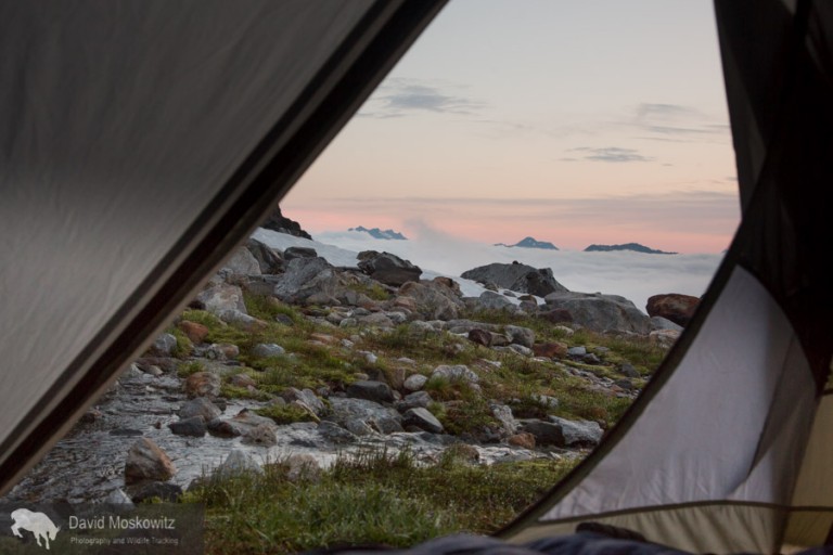
Forest McBrian, Steph Williams, Drew Lovell and myself spent 3 weeks exploring the Arrigetch Peaks region which comprises two drainages of the Alatna River. My first trip to the Arctic, learning about the beautiful long and low light of summer in the far north was amazing as a photographer. Here are a few shots celebrating the season of light in this expansive and wild mountain range. 

Back to where it all began...Alpine climbing in the Alps

I have been lucky enough to spend the end of August climbing in the French Alps out of the town of Chamonix with my friends Erin Smart and Forest McBrian, owners and guides for Borealis Mountain Guides. Erin, who has been skiing and climbing in the French Alps since she was a teenager provided me with a brilliant introduction to the climbing culture of the area. Having known Forest for many years and his love of all things related to the art of Alpinism and most things French, it was a pleasure to finally experience the mountains which I had heard about from his stories--mountains which have inspired generations of world class alpinists including Forest (whose exploits include first ascent mountaineering routes and first descent ski mountaineering routes, as well as a burgeoning writing career including a recent article in Alpinist on the famed Pickets Range in the North Cascades).

Mountaineering, European Style

Having come of age in the mountains of western North America, reading about the exploits of John Muir and Fred Becky, I always assumed that suffering through long approaches, doing battle with dense brush, brutal mosquitoes, crossing raging snowmelt filled creeks was part of the entrance fees for access to the splendor of the high mountains. Here in Europe, there is a bit of different sensibility. Approaches are manicured, ladders and footholds are added to the landscape to expedite travel, cable cars provide access from the valley bottom to the heart of the glacier in minutes, beautiful helicopter serviced mountain huts await with wine or tea to be had on the deck at the end of a day of climbing followed by 3 course dinners and a cozy place to spend the night. And just beyond the hut, or the exit from the lift, lays some of the most stunning mountain scenery and stellar alpine climbing routes of anywhere in the world.

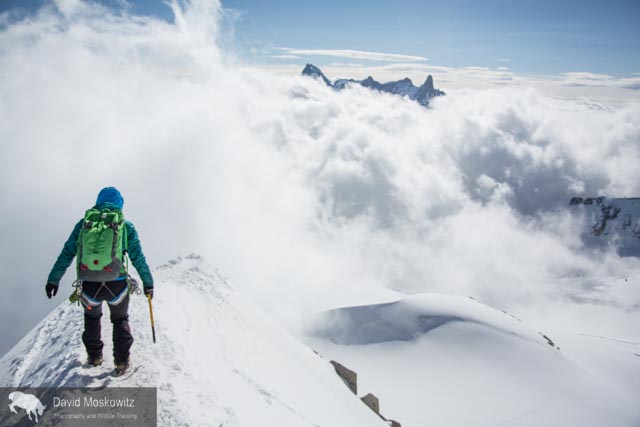
Erin Smart heads out on the snow arete leading away from the Aguille du Midi. Amazingly enough this photo was taken just a few meters from where the lift drops tourists, climbers and skiers off, leaving right from the town of Chamonix. One minute I …

Erin Smart heads out on the snow arete leading away from the Aguille du Midi. Amazingly enough this photo was taken just a few meters from where the lift drops tourists, climbers and skiers off, leaving right from the town of Chamonix. One minute I was on the street eating a fresh pastry from a local bakery and 15 minutes later I found myself in some of the most stunning alpine terrain I have traversed in my life.

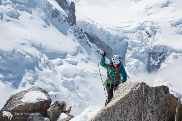
Erin navigating fresh snow on the Cosmiques arete, a classic climbing route on the west side of the Aguille du Midi.

Erin navigating fresh snow on the Cosmiques arete, a classic climbing route on the west side of the Aguille du Midi.

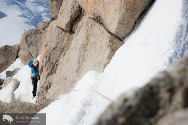
Erin smart leading out on mixed terrain.

Erin smart leading out on mixed terrain.

At 4810 meters (15,781 feet), Mount Blanc is the highest peak in the Alps. Clouds stream off of the lee side of the heavily glaciered peak.

At 4810 meters (15,781 feet), Mount Blanc is the highest peak in the Alps. Clouds stream off of the lee side of the heavily glaciered peak.

_10B3710
_10B3710
The Mere de Glace glacier flows down off of Mount Blanc and the surrounding peaks. While still miles long, the thickness of the glacier has shrunk dramatically over recent decades…an example of the shifting climate in the region.

The Mere de Glace glacier flows down off of Mount Blanc and the surrounding peaks. While still miles long, the thickness of the glacier has shrunk dramatically over recent decades…an example of the shifting climate in the region.

Erin Smart on the trail into the Envers Hut, situated above the Mere du Glace.

Erin Smart on the trail into the Envers Hut, situated above the Mere du Glace.

Situated in an almost fairy tale like setting, the Envers des Aguilles Hut, managed by the French Alpine club provides lodging and food for climbers.

Situated in an almost fairy tale like setting, the Envers des Aguilles Hut, managed by the French Alpine club provides lodging and food for climbers.

Mountain guide  Miles Smart at a belay on a route above the Envers hut.

Mountain guide  Miles Smart at a belay on a route above the Envers hut.

Forest McBrian examines the Eperon des Cosmiques route before our ascent.

Forest McBrian examines the Eperon des Cosmiques route before our ascent.

Forest McBrian leading out on a traversing pitch lower on the route.

Forest McBrian leading out on a traversing pitch lower on the route.

Erin getting into the crux moves of the route, a series of cracks leading through a large roof.

Erin getting into the crux moves of the route, a series of cracks leading through a large roof.

Erin pulling over another thoughtful move on the same crux pitch of the route.

Erin pulling over another thoughtful move on the same crux pitch of the route.

Forest wandering up through a series of cracks in beautiful granite towards the top of the route.

Forest wandering up through a series of cracks in beautiful granite towards the top of the route.

The view from a belay stance on the route. Mount Blanc in the background.

The view from a belay stance on the route. Mount Blanc in the background.

Mountaineering, Glaciers and Climate Change in the North Cascades

Darcy Ottey on the approach to the Colonial Glacier cirque. Colonial Creek falls off to the left with Colonial Peak above it.

Darcy Ottey on the approach to the Colonial Glacier cirque. Colonial Creek falls off to the left with Colonial Peak above it.

In August, Darcy Ottey and I went to explore a corner of the North Cascades we had never been to: the high peaks and glaciers just above the the south end Diablo reservoir, off of the North Cascades Scenic Highway in northern Washington State. After years of seeing Colonial Peak from the Highway when driving through, we picked what turned out to be a stormy summer week to venture into the area.

An arduous approach

Hours of grinding up a steep but established climbers route through lower and mid elevation forests eventually popped us out above treeline on glacier carved slabs along a ridgeline leading towards Pyramid Peak. From hear a short traverse across talus and old avalanche debris got us to the entrance to a glaciated citadel of mountains—the upper Colonial Creek cirque.

Camp on the edge of the recently formed lake at the terminous of the Colonial glacier.

Camp on the edge of the recently formed lake at the terminous of the Colonial glacier.

A blanket of clouds cover lower elevations in the North Cascades with high peaks sitting like islands in the sea at sunrise. The image is similar to how these mountains often appeared during the ice age when glaciers often covered lower elevations i…

A blanket of clouds cover lower elevations in the North Cascades with high peaks sitting like islands in the sea at sunrise. The image is similar to how these mountains often appeared during the ice age when glaciers often covered lower elevations in much the same way.

_10B3353
_10B3353

A dynamic landscape

Not surprisingly, when we reached where the map noted the snout of the Colonial glacier should be we found no ice. The glacier, like most glaciers in the North Cascades (and indeed across the planet), has receded significantly. Nearly a quarter mile up stream we found the new terminus of the glacier, where it ends in a newly exposed lake, in a depression carved out by the glacier and now filled with melt water and icebergs—detached chunks of the crumbling glacier. Thunderstorms roiled a we elected to avoid campsites on the exposed rock prow above the lake, instead choosing to set up camp on the only flat spot we could find adjacent to the lake.

Receeding glaciers leave behind moonscapes of scoured bedrock covered with piles of rubble and rock flour.

Receeding glaciers leave behind moonscapes of scoured bedrock covered with piles of rubble and rock flour.

Glacial ice exposed at the very top of the Colonial glacier (upper left of this photo) suggests that this glacier no longer has an accumulation zone. Under current conditions, it is just a matter of time before the glacier disappears completeley–per…

Glacial ice exposed at the very top of the Colonial glacier (upper left of this photo) suggests that this glacier no longer has an accumulation zone. Under current conditions, it is just a matter of time before the glacier disappears completeley–perhaps within the next several decades.

Current maps show glacial ice extending much further down then where the actual terminous of the glacier is now. The retreat of the glacier has created this newly formed lake. Chunks of glacial ice still float in the lake, demonstrating how quickly …

Current maps show glacial ice extending much further down then where the actual terminous of the glacier is now. The retreat of the glacier has created this newly formed lake. Chunks of glacial ice still float in the lake, demonstrating how quickly this landscape is changing due to shifts in the climate.

Glacial lakes such as this one are filled with large amounts of ground rock powder giving the water a dark milky green appearance.

Glacial lakes such as this one are filled with large amounts of ground rock powder giving the water a dark milky green appearance.

Earth, sky and water merge with a heavy fog sitting over the snow and ice choked glacial lake.

Earth, sky and water merge with a heavy fog sitting over the snow and ice choked glacial lake.

10B3246-768x512.jpg
Inclement weather dashed our plans for several peak climbs but did not deter us from venturing further south, over the Colonial glacier and onto the Neve glacier.

Inclement weather dashed our plans for several peak climbs but did not deter us from venturing further south, over the Colonial glacier and onto the Neve glacier.

Inclement weather dashed our plans for several peak climbs but did not deter us from venturing further south, over the Colonial glacier and onto the Neve glacier.

The vast exapanse of one of the largest glaciers in the North Cascades, the Neve Glacier with Snowfield Peak sitting at its head, on the left side of the frame. Seen from the Neve-Colonial glaicer col.

The vast exapanse of one of the largest glaciers in the North Cascades, the Neve Glacier with Snowfield Peak sitting at its head, on the left side of the frame. Seen from the Neve-Colonial glaicer col.

Darcy Ottey descending onto the Neve Glacier as a cloud rols over the glacier.
Heading into a cloud on the glacier.
On the broad expanse of the glacier, the peaks and landmarks disappear leaving an eerie world with land and sky blending together into a world of white.

On the broad expanse of the glacier, the peaks and landmarks disappear leaving an eerie world with land and sky blending together into a world of white.

Paul Bunyon’s Stump, Pinnicle, and Pyramid peaks from Colonial-Neve glacier col.

Paul Bunyon’s Stump, Pinnicle, and Pyramid peaks from Colonial-Neve glacier col.

Looking north from the area into the upper Skagit river valley. Ross Lake, a large reservoir built to provide hydro-electric power for the city of Seattle is a more obvious sign of our species quest for energy then the retreating glaciers of the reg…

Looking north from the area into the upper Skagit river valley. Ross Lake, a large reservoir built to provide hydro-electric power for the city of Seattle is a more obvious sign of our species quest for energy then the retreating glaciers of the region but both reflect the long reach of modern human’s influence on even the most wild and rugged landscapes in the world.

Descending into the clouds from the glacial cirque back into the forests of the North Cascades.

Descending into the clouds from the glacial cirque back into the forests of the North Cascades.

Sections of forests on the western slope of the North Cascades get enough precipitation to qualify as temperate rainforest. Only 10,000 years ago these slopes likely appeared much like the higher elevations do now, having just been released from ret…

Sections of forests on the western slope of the North Cascades get enough precipitation to qualify as temperate rainforest. Only 10,000 years ago these slopes likely appeared much like the higher elevations do now, having just been released from retreating glaicers which filled the mountains and flowed down into the ocean. Climate models predict these mountains to get warmer and wetter in the decades to come. Glaciers will retreat and forests will advance unslope in an ongoing advance of forests through these mountains which began millenia ago.

Mother of Rivers: the Mountains of Georgia's Caucasus Range

The massive relief of the Caucuses Range in the the Republic of Georgia's Sveneti Region are staggering in their own right for their sheer natural beauty. Though much less well known then the Alps in western Europe, the Causcuses, straddling the southern border between Europe and Asia are the highest mountain range in Europe. During the first part of my recent trip to the region, I spent several days trekking around Mount Ushba, one of the most striking mountains I have ever encountered. Like most of the highest peaks in Georgia, it sits along the international border with Russia.

Though not the highest peak in the range, at 4,710 m (15,453 ft), Mount Ushba is a massive peak and generally considered the most challenging mountaineering objective in the range. Seen hear at sunset with a steady stream of clouds forming and strea…

Though not the highest peak in the range, at 4,710 m (15,453 ft), Mount Ushba is a massive peak and generally considered the most challenging mountaineering objective in the range. Seen hear at sunset with a steady stream of clouds forming and streaming off of the lee side of the summit.

Mount Ushba (left), neighboring Mazerie Peak, and the massive rock covered lower portion of the Ushba Glacier photographed via moon and starlight.

Mount Ushba (left), neighboring Mazerie Peak, and the massive rock covered lower portion of the Ushba Glacier photographed via moon and starlight.

Murky waters pour out of the snout of the Ushba Glacier, one of the headwaters of the Inguri River, one of the largest and economically most important river in Georgia.

Murky waters pour out of the snout of the Ushba Glacier, one of the headwaters of the Inguri River, one of the largest and economically most important river in Georgia.

Intrepid traveler crossing the ragging glacial outflow several miles downstream from the snout of the Ushba glacier in the Republic of Georgia’s Sveneti region.

Intrepid traveler crossing the ragging glacial outflow several miles downstream from the snout of the Ushba glacier in the Republic of Georgia’s Sveneti region.

The torrent of water pouring over the glacier carved cliffs bellow Mount Ushba have carved out a deep ravine into the landscape. Svaneti Region, Republic of Georgia.

The torrent of water pouring over the glacier carved cliffs bellow Mount Ushba have carved out a deep ravine into the landscape. Svaneti Region, Republic of Georgia.

The Shkhara massif sits south and east of Mount Ushba and includes Mount Shkhara and several other 5000+ meter peaks, the highest part of the Caucuses in Georgia. Fall temperatures had turned the mountain ash red on the alpine mountain slopes and dusted the ridgetops, peaks, and glaciers with fresh snow.

The massive bulk of Jhanga peak and Mount Shkhara from the west, drapped in ice and fresh snow, give birth to another tributary to the Inguri River. Sveneti Region, Republic of Georgia.

The massive bulk of Jhanga peak and Mount Shkhara from the west, drapped in ice and fresh snow, give birth to another tributary to the Inguri River. Sveneti Region, Republic of Georgia.

A rainbow straddles the mountain valley and snout of the valley glacier flowing off of the Shkhara massif. Georgian Caucuses Mountains.

A rainbow straddles the mountain valley and snout of the valley glacier flowing off of the Shkhara massif. Georgian Caucuses Mountains.

Mountain ash’s brilliant red-orange after the onset of fall temperatures above the glacier fed river leading down to the tiny and remote village of Adishi. Sveneti Region, Republic of Georgia.

Mountain ash’s brilliant red-orange after the onset of fall temperatures above the glacier fed river leading down to the tiny and remote village of Adishi. Sveneti Region, Republic of Georgia.

The Lamaria Church, near the town of Ushguli, with the southern face of Mount Shkhara, 5,193 m (17,040 ft), in the background.

The Lamaria Church, near the town of Ushguli, with the southern face of Mount Shkhara, 5,193 m (17,040 ft), in the background.

Downstream, the impacts of primitive sewage systems, unbelievable garbage disposal practices, unfettered livestock access, old mining activity, and a massive hydroelectric dam take their toll on the Inguri River, but here at its headwaters it flows …

Downstream, the impacts of primitive sewage systems, unbelievable garbage disposal practices, unfettered livestock access, old mining activity, and a massive hydroelectric dam take their toll on the Inguri River, but here at its headwaters it flows free and beautiful off of some of the highest peaks in the world.