Arctic Light in the Arrigetch Peaks, Brooks Range, Alaska

In July and August, I was part of a team of four people who made a mountaineering pilgrimage to the most northern mountain range in North America. The central Brooks Range (Gwazhał in Athabaskan) is the traditional territory of the Inupiaq-speaking Kuuvanmiit and Nunamiut people and the Athapaskan-speaking Koyukon. Today, the landscape we visited is in included in Gates of the Arctic National Park.

Forest McBrian, Steph Williams, Drew Lovell and myself spent 3 weeks exploring the Arrigetch Peaks region which comprises two drainages of the Alatna River. My first trip to the Arctic, learning about the beautiful long and low light of summer in the far north was amazing as a photographer. Here are a few shots celebrating the season of light in this expansive and wild mountain range. 

A Journey to Bears Ears and Grand Staircase-Escalante

In January of 2018 I took a trip down to the desert southwest to return to landscapes I hadn't visited in a decade and a half. The news about the Trump Administrations attempts to roll back protections for Bears Ears and Grand Staircase-Escalante National Monument has created increased awareness and interest in this part of the United States.

While down there, I was grateful for the chance to meet with Angelo Baca, the Cultural Resources Coordinator for Utah Dine Bikeyah, an indigenous organization that has been at the forefront of efforts to protect many of these lands from continued development and looting. They continue to battle for protections of their ancestral lands. Folks interested in learning more about this region and supporting efforts to protect its natural and cultural heritage can find more information through their website.

This landscape is an international jewel and precious for both the peoples of this landscape and citizens across the United States. Find more images from my trip in my Photo Archive.

Firelight lights up the canyon walls and a cottonwood tree below a winter sky on the Escalante river close to its junction with the Colorado.

Firelight lights up the canyon walls and a cottonwood tree below a winter sky on the Escalante river close to its junction with the Colorado.

Darcy Ottey hopes across the stream running through Coyote Natural Bridge in Coyote Gulch, Grand Staircase-Escalante National Monument.

Darcy Ottey hopes across the stream running through Coyote Natural Bridge in Coyote Gulch, Grand Staircase-Escalante National Monument.

Petroglyph panal along the San Juan River, west of Bluff Utah.

Petroglyph panal along the San Juan River, west of Bluff Utah.

One of the many spectacular ruins on Cedar Mesa, Utah. Bears Ears National Monument.

One of the many spectacular ruins on Cedar Mesa, Utah. Bears Ears National Monument.

Sunrise from Muley Point, Cedar Mesa, Utah. Bears Ears National Monument.

Sunrise from Muley Point, Cedar Mesa, Utah. Bears Ears National Monument.

Field Notes: Winter in the Monashee Mountains

Photos and text by David Moskowitz. Expedition partners: Steph Williams and Forest McBrian.

A Fruitless Search For Caribou

We go to the mountains searching for answers. We go to the forests looking for clues. We watch the clouds roll across the peaks, keen to see what the universe will deliver on the wind. We scan the snow for the tracks of elusive creatures of the wild wonder about their lives when we find them and their absence when we don’t.

Back home, developing images of stark landscapes Carved by forces beyond our comprehension Turned to black and white and every shade of grey in between. Their is a haunting beauty in precarious landscapes Unsettled times What’s missing from our maps? What’s hidden in the clouds? When will these mountains come tumbling down?

_10B7956
_10B7956
_10B7992
_10B7992
_10B8097
_10B8097
_10B8005
_10B8005
_10B8217
_10B8217
_10B8964
_10B8964
_10B8661
_10B8661
_10B8915
_10B8915
_10B9451
_10B9451
_10B9109
_10B9109
_10B9499
_10B9499
_10B9540
_10B9540
_10B8406
_10B8406

Fall in the North Cascades: Alpine Larch

An alpine larch and the granite spires of Kangaroo Ridge in the North Cascades.

An alpine larch and the granite spires of Kangaroo Ridge in the North Cascades.

All along the high ridges and basins of the eastern slope of the North Cascades, lives a distinctive tree. The alpine larch (Larix lyallii) eeks out its existence at the very edge of tree-line in these mountains, acting as the gateway to the alpine above and the immense trees which characterize lower elevations in these mountains. Larch trees are the only conifer tree in the world that has deciduous needles and each fall the brilliant gold of these trees lights up the crisp fall air in the high mountains.

Darcy Ottey on a fall outing in the North Cascades of Washington.

Darcy Ottey on a fall outing in the North Cascades of Washington.

During the fall, the limited range of alpine larch is illuminated brilliantly all along the edge of treelike in the high country.

During the fall, the limited range of alpine larch is illuminated brilliantly all along the edge of treelike in the high country.

At the lower elevations in their range alpine larch blend with subalpine fir and Engelmenn spruce.

At the lower elevations in their range alpine larch blend with subalpine fir and Engelmenn spruce.

A grove of alpine larch below the snow covered north face of Frisco Peak and the Lyle glacier.

A grove of alpine larch below the snow covered north face of Frisco Peak and the Lyle glacier.

A few alpine larch dot the upper reaches of Early Winters Creek with the iconic Liberty Bell massif beyond.

A few alpine larch dot the upper reaches of Early Winters Creek with the iconic Liberty Bell massif beyond.

10B5190-768x512.jpg
10B5225-768x512.jpg
10B5249-768x512.jpg
10B5266-768x512.jpg
MG_7311-768x512.jpg

Back to where it all began...Alpine climbing in the Alps

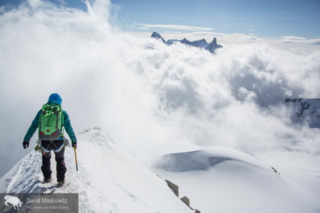
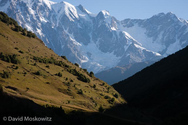
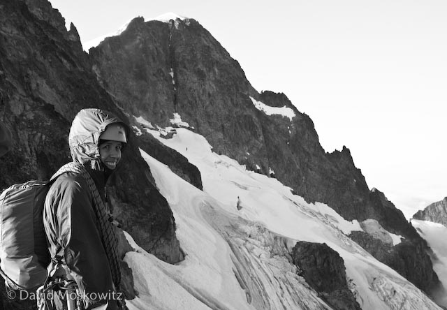
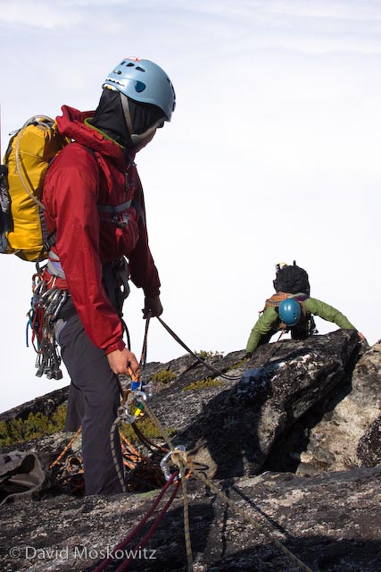
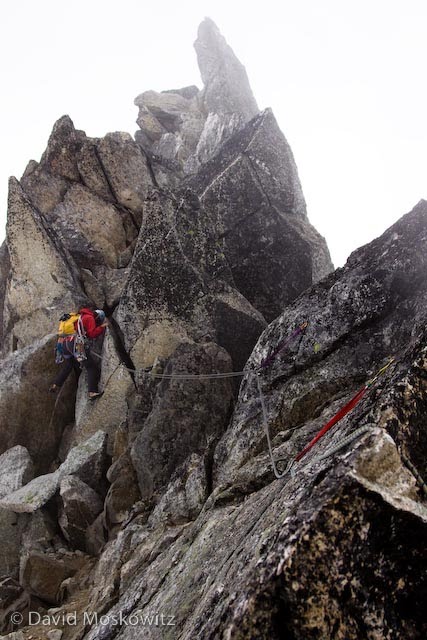
I have been lucky enough to spend the end of August climbing in the French Alps out of the town of Chamonix with my friends Erin Smart and Forest McBrian, owners and guides for Borealis Mountain Guides. Erin, who has been skiing and climbing in the French Alps since she was a teenager provided me with a brilliant introduction to the climbing culture of the area. Having known Forest for many years and his love of all things related to the art of Alpinism and most things French, it was a pleasure to finally experience the mountains which I had heard about from his stories--mountains which have inspired generations of world class alpinists including Forest (whose exploits include first ascent mountaineering routes and first descent ski mountaineering routes, as well as a burgeoning writing career including a recent article in Alpinist on the famed Pickets Range in the North Cascades).

Mountaineering, European Style

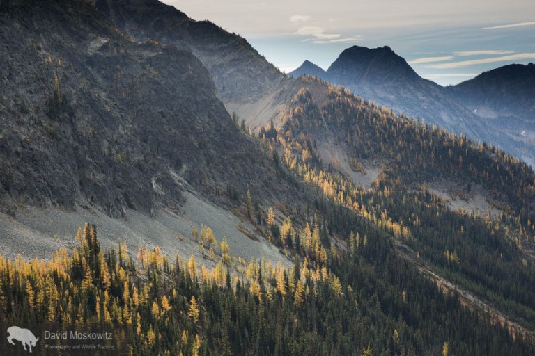
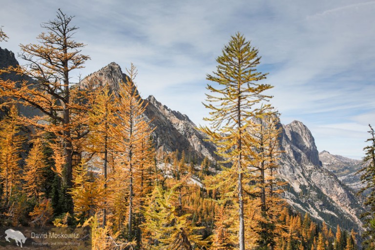
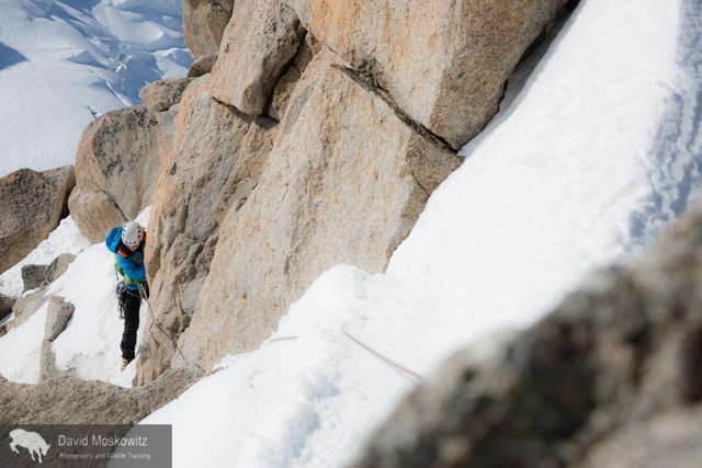
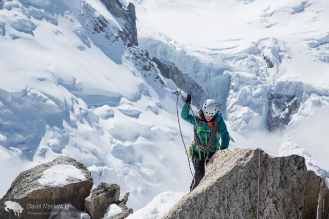
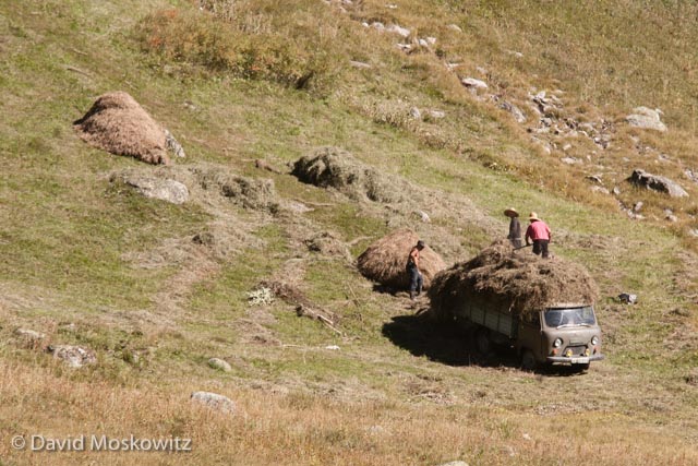
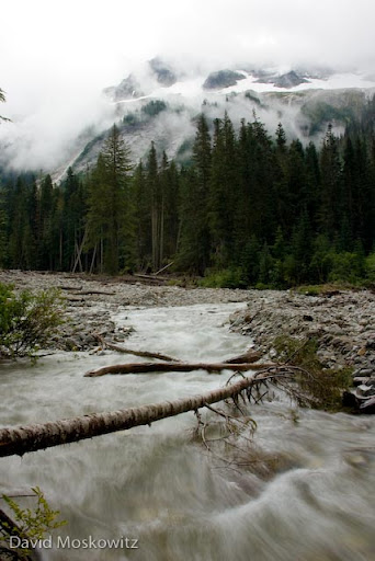
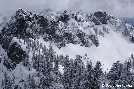
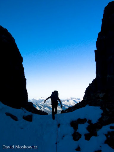
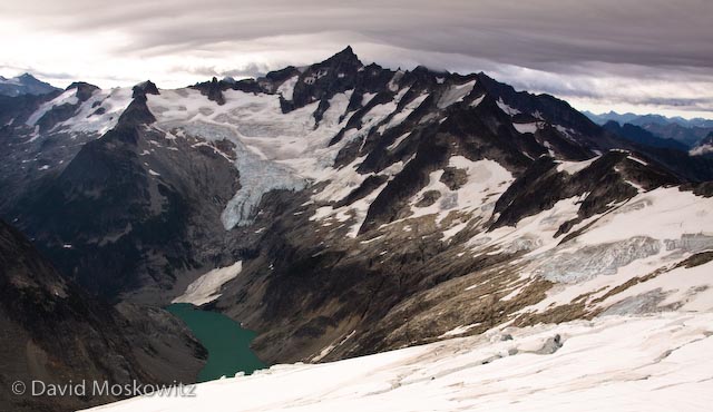
Having come of age in the mountains of western North America, reading about the exploits of John Muir and Fred Becky, I always assumed that suffering through long approaches, doing battle with dense brush, brutal mosquitoes, crossing raging snowmelt filled creeks was part of the entrance fees for access to the splendor of the high mountains. Here in Europe, there is a bit of different sensibility. Approaches are manicured, ladders and footholds are added to the landscape to expedite travel, cable cars provide access from the valley bottom to the heart of the glacier in minutes, beautiful helicopter serviced mountain huts await with wine or tea to be had on the deck at the end of a day of climbing followed by 3 course dinners and a cozy place to spend the night. And just beyond the hut, or the exit from the lift, lays some of the most stunning mountain scenery and stellar alpine climbing routes of anywhere in the world.

Erin Smart heads out on the snow arete leading away from the Aguille du Midi. Amazingly enough this photo was taken just a few meters from where the lift drops tourists, climbers and skiers off, leaving right from the town of Chamonix. One minute I …

Erin Smart heads out on the snow arete leading away from the Aguille du Midi. Amazingly enough this photo was taken just a few meters from where the lift drops tourists, climbers and skiers off, leaving right from the town of Chamonix. One minute I was on the street eating a fresh pastry from a local bakery and 15 minutes later I found myself in some of the most stunning alpine terrain I have traversed in my life.

Erin navigating fresh snow on the Cosmiques arete, a classic climbing route on the west side of the Aguille du Midi.

Erin navigating fresh snow on the Cosmiques arete, a classic climbing route on the west side of the Aguille du Midi.

Erin smart leading out on mixed terrain.

Erin smart leading out on mixed terrain.

At 4810 meters (15,781 feet), Mount Blanc is the highest peak in the Alps. Clouds stream off of the lee side of the heavily glaciered peak.

At 4810 meters (15,781 feet), Mount Blanc is the highest peak in the Alps. Clouds stream off of the lee side of the heavily glaciered peak.

_10B3710
_10B3710
The Mere de Glace glacier flows down off of Mount Blanc and the surrounding peaks. While still miles long, the thickness of the glacier has shrunk dramatically over recent decades…an example of the shifting climate in the region.

The Mere de Glace glacier flows down off of Mount Blanc and the surrounding peaks. While still miles long, the thickness of the glacier has shrunk dramatically over recent decades…an example of the shifting climate in the region.

Erin Smart on the trail into the Envers Hut, situated above the Mere du Glace.

Erin Smart on the trail into the Envers Hut, situated above the Mere du Glace.

Situated in an almost fairy tale like setting, the Envers des Aguilles Hut, managed by the French Alpine club provides lodging and food for climbers.

Situated in an almost fairy tale like setting, the Envers des Aguilles Hut, managed by the French Alpine club provides lodging and food for climbers.

Mountain guide  Miles Smart at a belay on a route above the Envers hut.

Mountain guide  Miles Smart at a belay on a route above the Envers hut.

Forest McBrian examines the Eperon des Cosmiques route before our ascent.

Forest McBrian examines the Eperon des Cosmiques route before our ascent.

Forest McBrian leading out on a traversing pitch lower on the route.

Forest McBrian leading out on a traversing pitch lower on the route.

Erin getting into the crux moves of the route, a series of cracks leading through a large roof.

Erin getting into the crux moves of the route, a series of cracks leading through a large roof.

Erin pulling over another thoughtful move on the same crux pitch of the route.

Erin pulling over another thoughtful move on the same crux pitch of the route.

Forest wandering up through a series of cracks in beautiful granite towards the top of the route.

Forest wandering up through a series of cracks in beautiful granite towards the top of the route.

The view from a belay stance on the route. Mount Blanc in the background.

The view from a belay stance on the route. Mount Blanc in the background.

A Taste of the Canadian Rockies

Banff, Jasper, and Kootenay National Parks

This July I made my first trip to the heart of the Canadian Rockies, having previously only been as far north as Waterton National Park along the Canadian-United States boarder. Joined by fellow adventurer Marcus Reynerson, we departed Seattle on a sunny Thursday, bound for some of the tallest and grandest mountains in North America.

The Kootenay River flows from the crest of the Rockies through Kootenay National Park to the west, its waters eventually joining the Columbia River and heading to the Pacific Ocean.

The Kootenay River flows from the crest of the Rockies through Kootenay National Park to the west, its waters eventually joining the Columbia River and heading to the Pacific Ocean.

The massive peaks and glacier dwarf a canoe on Lake Louis, one of the most popular destinations in Banff National Park. Later in my trip I was joined by several family members who dealt admirably with my camera affliction, including here while on La…

The massive peaks and glacier dwarf a canoe on Lake Louis, one of the most popular destinations in Banff National Park. Later in my trip I was joined by several family members who dealt admirably with my camera affliction, including here while on Lake Louis.

Wildlife of the Canadian Rockies in Banff and Jasper National Parks

Marcus and I spent a number of days exploring alpine tundra, high mountain meadows, wetlands and riparian corridors searching for tracks and signs of wildlife. Highlights included signs of black and grizzly bears, Canadian lynx, and lots of moose and elk sign. Feeding sign of several species of woodpeckers was another highlight in the dense spruce-fir forests which dominated much of the lower elevations of the mountains.

This distinctive pattern on a lodgepole pine is the work of a red-napped sapsucker which drills into the bark to get the tree to exude sap. This sap attracts insects which the sapsucker returns to feed on. Jasper National Park, Alberta.

This distinctive pattern on a lodgepole pine is the work of a red-napped sapsucker which drills into the bark to get the tree to exude sap. This sap attracts insects which the sapsucker returns to feed on. Jasper National Park, Alberta.

Hoary marmot in Banff National Park

A hoary marmot scampers along an alpine ridge. Banff National Park.

 
Bighorn Sheep Ram

A mature bighorn sheep ram lifts his head to pick up scents on the wind. Jasper National Park, Alberta.

 
Clarke's nutcracker

Clarke’s nutcrackers are ubiquitous in the subalpine forests of the Canadian Rockies. Related to crows and jays, these intelligent birds often linger where people are abundant, hoping to score a free meal.

 
American pika

Likely the Rockies cutest mammal inhabitant, an American pika feeds on subalpine plants on the edge of an old glacial moraine. Pika are the mountain specialists of the rabbit family. Banff National Park, Canada.


Road Ecology and Wildlife Crossing Structures in Banff National Park

Given my involvement in an ongoing research project on wildlife and road ecology in the Washington Cascades (Cascade Citizen Wildlife Monitoring Project), I was very excited to check out the crossing structures and fencing along Canadian Highway 1 which runs through the Bow River Valley in the heart of Banff National Park. The design of these structures was ground breaking work for the field and much of the design of our project in the Cascades was deeply influenced by this project.

Highway Crossing strucuture for wildlife

A number of crossing structures both over and under the TransCanadian Highway in Banff National Park allow wildlife to cross the highway and decrease the risk of wildlife getting hit by vehicles along the highway. Highways such as this can be a major obsticle to movement of many species across the landscape.


Fencing to keep wildlife off of the road along with crossing structures such as this wildlife overpass are part of contemporary efforts to reduce the impacts of roads on wildlife movement in critical habitat. Canadian Highway 1 in the Bow Valley, Banff National Park, Alberta.


Astounding mountain scenery

Find a few more images from my trip to the Canadian Rockies in my photography galleries.

Maligne Lake, Jasper National Park.

Still water reflects the evening light and mountains above Maligne Lake. Jasper National Park, Alberta.


Hiking the Kalalau Trail on Kauai's Napali Coast

This March I met Darcy Ottey on the island of Kauai to hike the famous Kalalau trail on the island's rugged Napali coast. A pleasant hike, amazing scenery, cool wildlife, warm water, and excellent company made for an amazing trip.

Waves role in on Kalalau Beach, reached by an 11 mile trail.

Waves role in on Kalalau Beach, reached by an 11 mile trail.

Stunning views highlight much of the Kalalau trail on Kauai’s Napali Coast.

Stunning views highlight much of the Kalalau trail on Kauai’s Napali Coast.

Another ocean view from the trail.

Another ocean view from the trail.

The trail crosses several lovely streams cloaked in tropical forests including this one were we made our dinner and breakfast at our first camp during the hike in.

The trail crosses several lovely streams cloaked in tropical forests including this one were we made our dinner and breakfast at our first camp during the hike in.

A craggy peak juts out of the forest above the warm waters of another one of the streams along the Kalalau trail.

A craggy peak juts out of the forest above the warm waters of another one of the streams along the Kalalau trail.

The Kalalau trail is known for being a bit treacherous in parts. We found it far milder than expected given all the hype. However attention to where you step is definitely required in places such as here where the trail winds through a particularly precipitous cliffy area.

Hikers on the Kalalau trail, dwarfed by the cliffs and ocean beyond.

Hikers on the Kalalau trail, dwarfed by the cliffs and ocean beyond.

Sign along the trail into Kalalau beach.

Sign along the trail into Kalalau beach.

On the final decent to Kalalau beach.

On the final decent to Kalalau beach.

Sunset on Kalalau beach.

Sunset on Kalalau beach.

An endangered Hawaiian monk seal hauled out of the ocean for an afternoon. Kalalau Beach, Kauai.

An endangered Hawaiian monk seal hauled out of the ocean for an afternoon. Kalalau Beach, Kauai.

Hawaiian monk seal returning to the ocean as the sun begins to set.

Hawaiian monk seal returning to the ocean as the sun begins to set.

Evening light on the peaks and coastline. Napali Coast, Kauai

Evening light on the peaks and coastline. Napali Coast, Kauai

Darcy Ottey taking in the evening light from an ocean side perch.

Darcy Ottey taking in the evening light from an ocean side perch.

Like what you saw here? Check out more of David's Adventure and Expeditionary Photography here!

Making Hay in the Caucasus Mountains of the Republic of Georgia

September is harvest season for folks who live in the Sveneti Region of Georgia's Caucasus Mountains. The Caucasus Mountains are a land steeped in history and located at a geographic and cultural crossroads of Asia and Europe. Traveling through the remote villages situated among the soaring ridges and peaks of the Caucasus Mountains, felt at points like a trip back in time. This feeling was perhaps most distinct in watching the process of cutting and storing hay which was in full swing during my time in the region.

Three men from the village of Iprali work in concert cutting wild hay in a high elevation meadow in the Sveneti region of the Republic of Georgia.

Three men from the village of Iprali work in concert cutting wild hay in a high elevation meadow in the Sveneti region of the Republic of Georgia.

Careful attention to keeping you blade sharp is required for cutting hay with a scythe. Men will typically sharpen their blade after each row of hay they cut and the distinctive sound of sharpening stones against the metal blades of scythes rung out…

Careful attention to keeping you blade sharp is required for cutting hay with a scythe. Men will typically sharpen their blade after each row of hay they cut and the distinctive sound of sharpening stones against the metal blades of scythes rung out across many of the mountain valley’s we traversed during our fall travels in the region.

Often, hay is carefully collected into mounds which are left to dry before being hauled back to the village and stored for the winter.

Often, hay is carefully collected into mounds which are left to dry before being hauled back to the village and stored for the winter.

Hay mounds dotted hillsides up and down the mountainsides across much of Sveneti during the fall. Caucasus Mountains, Republic of Georgia.

Hay mounds dotted hillsides up and down the mountainsides across much of Sveneti during the fall. Caucasus Mountains, Republic of Georgia.

Hay mounds are eventually collected and loaded onto either trucks or wooden sleds pulled by cattle to be hauled into the village.

Hay mounds are eventually collected and loaded onto either trucks or wooden sleds pulled by cattle to be hauled into the village.

Hay being hauled out of the mountains to the village of Ushguli. Sveneti, Republic of Georgia.

Hay being hauled out of the mountains to the village of Ushguli. Sveneti, Republic of Georgia.

A wooden hay sled sits in front of a modern barn built with a traditional design, while two cows rigged for hauling it rest in the shade. Hay is stored in the top while livestock are penned below during the winter. Sveneti, Republic of Georgia.

A wooden hay sled sits in front of a modern barn built with a traditional design, while two cows rigged for hauling it rest in the shade. Hay is stored in the top while livestock are penned below during the winter. Sveneti, Republic of Georgia.

A massive and growing ravine sits on the edge of a village in Sveneti. Intensive and long term cattle and other livestock production have left many hillsides scared with with such erosion, while thistles and other weedy species that tolerate heavy g…

A massive and growing ravine sits on the edge of a village in Sveneti. Intensive and long term cattle and other livestock production have left many hillsides scared with with such erosion, while thistles and other weedy species that tolerate heavy grazing pressure flourish in much of the range lands in Sveneti.

Part of the welcoming committee for the village of Ushguli. On our walk into the village we were also greeted by a horse, several pigs, and a very large but quite amiable dog. Caucasus Mountains, Republic of Georgia.

Part of the welcoming committee for the village of Ushguli. On our walk into the village we were also greeted by a horse, several pigs, and a very large but quite amiable dog. Caucasus Mountains, Republic of Georgia.

The abandoned village of Ghuli sits below the imposing summit of Mount Ushba. While wolves and bears are reported to still roam these mountains, during two weeks of trekking in the region I never saw sign of even a single wild hoofed mammal or any o…

The abandoned village of Ghuli sits below the imposing summit of Mount Ushba. While wolves and bears are reported to still roam these mountains, during two weeks of trekking in the region I never saw sign of even a single wild hoofed mammal or any other terrestrial wildlife larger than a fox. Millennia of pastoralism have left a heavy mark on this staggeringly beautiful landscape. Sveneti, Republic of Georgia


Mother of Rivers: the Mountains of Georgia's Caucasus Range

The massive relief of the Caucuses Range in the the Republic of Georgia's Sveneti Region are staggering in their own right for their sheer natural beauty. Though much less well known then the Alps in western Europe, the Causcuses, straddling the southern border between Europe and Asia are the highest mountain range in Europe. During the first part of my recent trip to the region, I spent several days trekking around Mount Ushba, one of the most striking mountains I have ever encountered. Like most of the highest peaks in Georgia, it sits along the international border with Russia.

Though not the highest peak in the range, at 4,710 m (15,453 ft), Mount Ushba is a massive peak and generally considered the most challenging mountaineering objective in the range. Seen hear at sunset with a steady stream of clouds forming and strea…

Though not the highest peak in the range, at 4,710 m (15,453 ft), Mount Ushba is a massive peak and generally considered the most challenging mountaineering objective in the range. Seen hear at sunset with a steady stream of clouds forming and streaming off of the lee side of the summit.

Mount Ushba (left), neighboring Mazerie Peak, and the massive rock covered lower portion of the Ushba Glacier photographed via moon and starlight.

Mount Ushba (left), neighboring Mazerie Peak, and the massive rock covered lower portion of the Ushba Glacier photographed via moon and starlight.

Murky waters pour out of the snout of the Ushba Glacier, one of the headwaters of the Inguri River, one of the largest and economically most important river in Georgia.

Murky waters pour out of the snout of the Ushba Glacier, one of the headwaters of the Inguri River, one of the largest and economically most important river in Georgia.

Intrepid traveler crossing the ragging glacial outflow several miles downstream from the snout of the Ushba glacier in the Republic of Georgia’s Sveneti region.

Intrepid traveler crossing the ragging glacial outflow several miles downstream from the snout of the Ushba glacier in the Republic of Georgia’s Sveneti region.

The torrent of water pouring over the glacier carved cliffs bellow Mount Ushba have carved out a deep ravine into the landscape. Svaneti Region, Republic of Georgia.

The torrent of water pouring over the glacier carved cliffs bellow Mount Ushba have carved out a deep ravine into the landscape. Svaneti Region, Republic of Georgia.

The Shkhara massif sits south and east of Mount Ushba and includes Mount Shkhara and several other 5000+ meter peaks, the highest part of the Caucuses in Georgia. Fall temperatures had turned the mountain ash red on the alpine mountain slopes and dusted the ridgetops, peaks, and glaciers with fresh snow.

The massive bulk of Jhanga peak and Mount Shkhara from the west, drapped in ice and fresh snow, give birth to another tributary to the Inguri River. Sveneti Region, Republic of Georgia.

The massive bulk of Jhanga peak and Mount Shkhara from the west, drapped in ice and fresh snow, give birth to another tributary to the Inguri River. Sveneti Region, Republic of Georgia.

A rainbow straddles the mountain valley and snout of the valley glacier flowing off of the Shkhara massif. Georgian Caucuses Mountains.

A rainbow straddles the mountain valley and snout of the valley glacier flowing off of the Shkhara massif. Georgian Caucuses Mountains.

Mountain ash’s brilliant red-orange after the onset of fall temperatures above the glacier fed river leading down to the tiny and remote village of Adishi. Sveneti Region, Republic of Georgia.

Mountain ash’s brilliant red-orange after the onset of fall temperatures above the glacier fed river leading down to the tiny and remote village of Adishi. Sveneti Region, Republic of Georgia.

The Lamaria Church, near the town of Ushguli, with the southern face of Mount Shkhara, 5,193 m (17,040 ft), in the background.

The Lamaria Church, near the town of Ushguli, with the southern face of Mount Shkhara, 5,193 m (17,040 ft), in the background.

Downstream, the impacts of primitive sewage systems, unbelievable garbage disposal practices, unfettered livestock access, old mining activity, and a massive hydroelectric dam take their toll on the Inguri River, but here at its headwaters it flows …

Downstream, the impacts of primitive sewage systems, unbelievable garbage disposal practices, unfettered livestock access, old mining activity, and a massive hydroelectric dam take their toll on the Inguri River, but here at its headwaters it flows free and beautiful off of some of the highest peaks in the world.


A Winter Day in Eastern Okanogan County

Went exploring in eastern Okanogan County a couple of days ago. A beautiful landscape and one hard to reconcile with Washington's tag line-"the Evergreen State".

Arid valley south of the town of Conconully.

Arid valley south of the town of Conconully.

Abandoned building close to the former town of Nighthawk on the Similkameen River.

Abandoned building close to the former town of Nighthawk on the Similkameen River.

Conconully Cemetery

Conconully Cemetery

Tattered flag flying in the Conconully Cemetery 

Tattered flag flying in the Conconully Cemetery


Blue Lake, Sinlahekin Wildlife Area.

Blue Lake, Sinlahekin Wildlife Area.

Sinlahekin Valley, Sinlahekin Wildlife Area.

Sinlahekin Valley, Sinlahekin Wildlife Area.

Valley north of the town of Loomis, Washington.

Valley north of the town of Loomis, Washington.

Palmer Lake

Palmer Lake

Palmer Lake

Palmer Lake

Similkameen River and Chopaka Mountains.

Similkameen River and Chopaka Mountains.

Similkameen River.

Similkameen River.

Entertainment in the Similkameen River Valley.

Entertainment in the Similkameen River Valley.

Abandoned mine rigging and tailings pile close to the former town of Nighthawk, Washington.

Abandoned mine rigging and tailings pile close to the former town of Nighthawk, Washington.

Great Bear Rainforest Day 1-2

View from the flight into Bella Bella-a maze of rainforest clad islandsand wandering ocean inlets bounded by the Coast Range to the east

View from the flight into Bella Bella-a maze of rainforest clad islandsand wandering ocean inlets bounded by the Coast Range to the east

View from the water on my first day out in the field

View from the water on my first day out in the field

Doug Brown, the field station manager for Raincoast Conservation Foundation,and my guide, spotted this wolf along the shore of a small island northeast of Bella Bella.

Doug Brown, the field station manager for Raincoast Conservation Foundation,and my guide, spotted this wolf along the shore of a small island northeast of Bella Bella.

.

Sunshine and wolves greeted me on my first day in the field here on the central coast of British Columbia. The salmon are gathering at the mouths of the creeks and rivers here.Learn more about my current project on Wolves in the Pacific Northwest!

Clayoquot Sound Revisited

A week of journeying by land and sea has yielded some great results as I continue to collect material for my forthcoming book on Wolves of the Pacific Northwest. I am tremendously grateful to Steve and Susanne Lawson for their invaluable assistance in my fieldwork here in Clayoquot Sound thus far! Stay tuned for more photos and stories to come!

Sea Otter patrolling coastal waters north of Ucluelet.

Sea Otter patrolling coastal waters north of Ucluelet.

The return of extensive bull kelp forests along the northern Pacific coast has been associated with rebounding Sea otter populations, a classic example of a trophic cascade. Bull kelp was released from heavy browsing pressure by sea urchins with the…

The return of extensive bull kelp forests along the northern Pacific coast has been associated with rebounding Sea otter populations, a classic example of a trophic cascade. Bull kelp was released from heavy browsing pressure by sea urchins with the return of otters which love to eat urchins.

Rocky coastline close to Wye Point, north of the town of Ucluelet

Rocky coastline close to Wye Point, north of the town of Ucluelet

Guess the beach brings out the playful side of more than just juvenial people. Here two yearling wolves play with washed up seaweed on an island in Clayoquot Sound.

Guess the beach brings out the playful side of more than just juvenial people. Here two yearling wolves play with washed up seaweed on an island in Clayoquot Sound.

Wolf crossing a lead of water at first light.

Wolf crossing a lead of water at first light.

We watched this randy male black bear following a smaller female bear earnestly, stopping only to rub vigorous on a large drift wood log, a behavior which increases during the breeding season.

We watched this randy male black bear following a smaller female bear earnestly, stopping only to rub vigorous on a large drift wood log, a behavior which increases during the breeding season.

Oystercatchers are one of the most common shorebirds in the Sound this time of year.

Oystercatchers are one of the most common shorebirds in the Sound this time of year.

Bears, for a change of pace

Black Bear feeding on huckleberries. East of Heart Lake, Olympic National Park

Black Bear feeding on huckleberries. East of Heart Lake, Olympic National Park

A few images from a recent trip to the 7 Lakes Basin in Olympic National Park.

Black bear, Olympic National Park.

Black bear, Olympic National Park.

Black bear, Olympic National Park.

Black bear, Olympic National Park.

Darcy Ottey with the Hoh River Valley and Mt. Olympus in the background.

Darcy Ottey with the Hoh River Valley and Mt. Olympus in the background.

Darcy Ottey watching a bear feed in the meadow beyond her. An Olympic marmot was also watching the bear with much scrutiny. West of Swimming Bear Lake, Olympic National Park.

Darcy Ottey watching a bear feed in the meadow beyond her. An Olympic marmot was also watching the bear with much scrutiny. West of Swimming Bear Lake, Olympic National Park.

Western Heather Vole (Phenacomys intermedius). Lunch Lake, Olympic National Park.

Western Heather Vole (Phenacomys intermedius). Lunch Lake, Olympic National Park.

Stream in the Sol Duc River Valley, Olympic National Park.

Stream in the Sol Duc River Valley, Olympic National Park.

Black bear, feeding on huckleberries. Olympic National Park.

Black bear, feeding on huckleberries. Olympic National Park.

Clayoquot Sound, B.C.

Wolf tracks along west coast of Vancouver Island, British Columbia.

Wolf tracks along west coast of Vancouver Island, British Columbia.

Bald eagle above a foggy forest.

Bald eagle above a foggy forest.

Carcass of juvenile humpback whale on beach of island in Clayoquot Sound

Carcass of juvenile humpback whale on beach of island in Clayoquot Sound

Racoon foraging for sand flees on beach of island in Sound

Racoon foraging for sand flees on beach of island in Sound

Black-tailed deer feeding on seaweed on island in Clayoquot Sound.

Black-tailed deer feeding on seaweed on island in Clayoquot Sound.

River otter scent marking on seaweed as tide goes out.

River otter scent marking on seaweed as tide goes out.

Black bear foraging for invertebrates in the intertidal zone by rolling rocks.

Black bear foraging for invertebrates in the intertidal zone by rolling rocks.

Large Sitka spruce in ancient forest on island in the Sound.

Large Sitka spruce in ancient forest on island in the Sound.

A gray wolf trots along the beach early in the morning with ravens in the background. West Coast, Vancouver Island.

A gray wolf trots along the beach early in the morning with ravens in the background. West Coast, Vancouver Island.

Tofino Inlet, Clayoquot Sound.

Tofino Inlet, Clayoquot Sound.

Harbor seals lounging at low tide.

Harbor seals lounging at low tide.

Atlantic salmon fish farm in Clayoquot Sound with uncut forest in background. Several rivers with no clearcuts or roads in them are seeing massive declines in salmon numbers due to sea lice and other issues associated with fish farming in the Sound.…

Atlantic salmon fish farm in Clayoquot Sound with uncut forest in background. Several rivers with no clearcuts or roads in them are seeing massive declines in salmon numbers due to sea lice and other issues associated with fish farming in the Sound. The smell is overwhelming, far worse than a dairy farm and totally shocking in such a wild setting.

Active clearcut logging in Clayquot Sound. Top of the photo is uncut oldgrowth. Bottom is regrowth from a previous clearcut.

Active clearcut logging in Clayquot Sound. Top of the photo is uncut oldgrowth. Bottom is regrowth from a previous clearcut.

Growth rings: over 200. Destination: ?

Growth rings: over 200. Destination: ?

Huge western red ceder stump set amidst second growth forest of planted Douglas firs. Note that the original nurse log that the ceder tree started growing on in still under the stump, attesting to the volume of biomass in the previous ancient forest…

Huge western red ceder stump set amidst second growth forest of planted Douglas firs. Note that the original nurse log that the ceder tree started growing on in still under the stump, attesting to the volume of biomass in the previous ancient forest and the literally centuries it took to create the structural diversity so important to many Old growth obligate species.

Despite decades of conservation efforts, Clayoquot Sound, a UNESCO Biosphere Reserve,  faces numerous severe threats to its ecological integrity including clear cut logging of roadless old growth forests, industrial Atlantic salmon fish farms, and proposed open-pit copper mining. Learn more about the region and how you can support conservation in the region at the following websites:Friends of Clayoquot Sound Clayoquot Biosphere Reserve First Nations Environmental Network

mg_62982.jpg?w=300
mg_62982.jpg?w=300
mg_68261.jpg?w=300
mg_68261.jpg?w=300
mg_68751.jpg?w=214
mg_68751.jpg?w=214

PACIFIC NORTHWEST LANDSCAPES

Ponderosa pine and hoar frost.East slope Cascades, Washington

Ponderosa pine and hoar frost.East slope Cascades, Washington

Kintla Lake.Glacier National Park, Montana

Kintla Lake.Glacier National Park, Montana

Mount Shuksan and the north fork of the Nooksack river.North Cascades, WA.

Mount Shuksan and the north fork of the Nooksack river.North Cascades, WA.

Hoar frost on snags. North Cascades, WA.

Hoar frost on snags. North Cascades, WA.

Sunrise over Mount Redoubt.North Cascades, Washington

Sunrise over Mount Redoubt.North Cascades, Washington

Mountain stream west of Whatcom Pass.North Cascades, Washington.

Mountain stream west of Whatcom Pass.North Cascades, Washington.

Rogers Lake and Tiffany Peak, site of the Tripod Fire.Okanogan Highlands, north-central Washington.

Rogers Lake and Tiffany Peak, site of the Tripod Fire.Okanogan Highlands, north-central Washington.

Beargrass, Cornice peak. Selkirk mountains, southeastern British Columbia.

Beargrass, Cornice peak. Selkirk mountains, southeastern British Columbia.

Sunrise in the Selkirk mountains, northeastern Washington

Sunrise in the Selkirk mountains, northeastern Washington

Kendell Peak ridgeline, Snoqualmie Pass, Washington Cascades

Kendell Peak ridgeline, Snoqualmie Pass, Washington Cascades

Southeastern Oregon

Southeastern Oregon

Balsamroot in the Tieton River Canyon. East slope Washington Cascades

Balsamroot in the Tieton River Canyon. East slope Washington Cascades

Mount Baker and Mount Fury at Sunrise. North Cascades.

Mount Baker and Mount Fury at Sunrise. North Cascades.

Northern California Coast

Northern California Coast

Pickets Traverse

Forest McBrian climbing into a col on the south side of Mount Fury.

Forest McBrian climbing into a col on the south side of Mount Fury.

Whatcom Peak, the northern start of the Pickets range

Whatcom Peak, the northern start of the Pickets range

Challanger Glacier, the largest glacier in this part of the North Cascades

Challanger Glacier, the largest glacier in this part of the North Cascades

Forest McBrian hiking out of Luna Cirque with the massive north face of Mount Fury rising on the left and Luna lake below.

Forest McBrian hiking out of Luna Cirque with the massive north face of Mount Fury rising on the left and Luna lake below.

Southern Pickets from the north. Left to right: East McMillian Spire, West McMillian Spire, Inspiration Peak, Mount Dagenhart, Mount Terror

Southern Pickets from the north. Left to right: East McMillian Spire, West McMillian Spire, Inspiration Peak, Mount Dagenhart, Mount Terror

Forest McBrian traversing south along the ridge leading to Picket Pass, what Fred Beckey might refer to as “pleasant hiking”.

Forest McBrian traversing south along the ridge leading to Picket Pass, what Fred Beckey might refer to as “pleasant hiking”.

Forest on the Mustard glacier, part of our travel route over the southern Pickets.

Forest on the Mustard glacier, part of our travel route over the southern Pickets.

Forest making the transition from the icy glacier to the steep wet rock which lead to the col between the Ottohorn and Himelhorn peaks and our route out of the Pickets. This section of the route was the most technically challenging piece of the enti…

Forest making the transition from the icy glacier to the steep wet rock which lead to the col between the Ottohorn and Himelhorn peaks and our route out of the Pickets. This section of the route was the most technically challenging piece of the entire traverse in the conditions we encountered it.

Last views to the north before we dropped down and south out of probably the most wild and remote section of the North Cascades. Mount Fury and Luna Peak in the distance.

Last views to the north before we dropped down and south out of probably the most wild and remote section of the North Cascades. Mount Fury and Luna Peak in the distance.

One last major obstacle descending south off of our last col, a steep gully (an eroded volcanic dike of which there were a number in the range which presented difficulties along the traverse) filled with large quantities of loose rocks. The light at…

One last major obstacle descending south off of our last col, a steep gully (an eroded volcanic dike of which there were a number in the range which presented difficulties along the traverse) filled with large quantities of loose rocks. The light at the end of the chasm couldn’t come soon enough.

Luna Peak at sunrise from the south

Luna Peak at sunrise from the south

Climbing in the North Cascades

Samantha Goff and Matt Chalmers, filled with anticipation at the start of our trip into the Eldorado Peak high camp.

Samantha Goff and Matt Chalmers, filled with anticipation at the start of our trip into the Eldorado Peak high camp.

Samantha and Matt on the Inspiration Glacier on the approach to the West Arete of Eldorado Peak.

Samantha and Matt on the Inspiration Glacier on the approach to the West Arete of Eldorado Peak.

Samantha smiling at our first view of the route from the Dorado Needle Col which separates the McAlester Glacier from the Marble Creek Cirque. The climbing route is esentially the right skyline

Samantha smiling at our first view of the route from the Dorado Needle Col which separates the McAlester Glacier from the Marble Creek Cirque. The climbing route is esentially the right skyline

Samantha at a belay ledge soon after getting on the arete, just above the layer of clouds which filled the Marble Creek drainage.

Samantha at a belay ledge soon after getting on the arete, just above the layer of clouds which filled the Marble Creek drainage.

Happy faces after enduring an unplanned bivouac high on the west face.

Happy faces after enduring an unplanned bivouac high on the west face.

Samantha looking up towards the summit as Matt leads the final pitch of the route. Dorado Needle and Early Morning Spire in the background.

Samantha looking up towards the summit as Matt leads the final pitch of the route. Dorado Needle and Early Morning Spire in the background.

Looking south from the summit across a sea of clouds with only the highest peaks of the North Cascades jutting up like islands.

Looking south from the summit across a sea of clouds with only the highest peaks of the North Cascades jutting up like islands.

Johannesburg Mountain in the foreground.

Johannesburg Mountain in the foreground.

The south ridge of Eldorado Peak and the Eldorado Glacier.

The south ridge of Eldorado Peak and the Eldorado Glacier.

Inspecting the descent off of the snow arete on the south ridge of Eldorado.

Inspecting the descent off of the snow arete on the south ridge of Eldorado.

Forbidden Peak, the Forbidden Glacier and Moraine Lake with part of the Inspiration Glacier in the foreground, taken from our camp at the base of Eldorado’s east ridge.

Forbidden Peak, the Forbidden Glacier and Moraine Lake with part of the Inspiration Glacier in the foreground, taken from our camp at the base of Eldorado’s east ridge.

Samantha leading out across the McAlester glacier towards Dorado Needle.

Samantha leading out across the McAlester glacier towards Dorado Needle.

Samantha navigating the north ridge of Dorado Needle.

Samantha navigating the north ridge of Dorado Needle.

Myself at a belay ledge on Dorado Needle.

Myself at a belay ledge on Dorado Needle.

The massive west face of Eldorado Peak briefly poked out of the clouds while we were on Dorado Needle.

The massive west face of Eldorado Peak briefly poked out of the clouds while we were on Dorado Needle.

Samantha leading out on the final pitch on Dorado Needle.

Samantha leading out on the final pitch on Dorado Needle.

Matt nearing the summit.

Matt nearing the summit.

Matt navigating the final piece of the ridge, a knife edge section which he is climbing “au cheval”.

Matt navigating the final piece of the ridge, a knife edge section which he is climbing “au cheval”.

Samantha belaying from just below the summit.

Samantha belaying from just below the summit.

Soaking wet from a long descent in pouring rain, Samantha completes a successful trip with the safe retrieval of several cans of Pabst Blue Ribbon beer from the Cascade River. 

Soaking wet from a long descent in pouring rain, Samantha completes a successful trip with the safe retrieval of several cans of Pabst Blue Ribbon beer from the Cascade River.


.

Wolf Tracking in the Salmon River Mountains, Idaho

The landscape, typical of the mountains of central Idaho shows conifer forests, dominated by lodgepole pine (Pinus contorta) in various stages of regeneration after naturally occuring fires. Interspersed are large wet and dry meadow systems.

The landscape, typical of the mountains of central Idaho shows conifer forests, dominated by lodgepole pine (Pinus contorta) in various stages of regeneration after naturally occuring fires. Interspersed are large wet and dry meadow systems.

Don Taves inspects the trail of a wolf trotting down a dirt road.

Don Taves inspects the trail of a wolf trotting down a dirt road.

The right front foot of a large wolf. The toes have splayed widely and the claws of each digit have dug in deeply, including in the reduced inside toe due to the fast speed of this animal. The bounding trail of this wolf was adjacent to the trail of…

The right front foot of a large wolf. The toes have splayed widely and the claws of each digit have dug in deeply, including in the reduced inside toe due to the fast speed of this animal. The bounding trail of this wolf was adjacent to the trail of two fleeing mule deer indicating a pursuit (apparently unsuccessful for the wolf).

A pine marten (Martes americana) peers down from a safe perch.

A pine marten (Martes americana) peers down from a safe perch.

Sandhill crane (Grus canadensis) in flight. Cranes breed and rear young in the vast wet meadow systems of central Idaho.

Sandhill crane (Grus canadensis) in flight. Cranes breed and rear young in the vast wet meadow systems of central Idaho.

Columbian ground squirrels (Spermophilus columbianus) at a burrow.

Columbian ground squirrels (Spermophilus columbianus) at a burrow.

Rocky mountain elk (Cervus elaphus)

Rocky mountain elk (Cervus elaphus)

Students in Wilderness Awareness School’s Idaho Wolf Tracking Expedition hiking out across Corduroy meadows at the southern end of the Frank Church River of No Return Wilderness towards the end of a long day in the field searching for and following …

Students in Wilderness Awareness School’s Idaho Wolf Tracking Expedition hiking out across Corduroy meadows at the southern end of the Frank Church River of No Return Wilderness towards the end of a long day in the field searching for and following wolf tracks and signs.

Western Colorado: Aspen forests and Wildlife of the High Lonesome Ranch

Aspen stand at about 8500′ elevation on the western edge of the Rocky mountains

Aspen stand at about 8500′ elevation on the western edge of the Rocky mountains

Aspen stand with bear climbing marks and elk cambium feeding scars on trees in the foreground. Many aspen stands in the southern Rockies are dying for reasons that are not yet totally clear. Aspen stands are generally comprised of one or a few indiv…

Aspen stand with bear climbing marks and elk cambium feeding scars on trees in the foreground. Many aspen stands in the southern Rockies are dying for reasons that are not yet totally clear. Aspen stands are generally comprised of one or a few individual organisms (called “Clones”) each of which sends up multiple trunks. About half of the mature trunks in the patch are dead.

Entrance and throw-mound of a bear den found on a steep forested northwest facing slope close to a ridge line at about 8200′ elevation.

Entrance and throw-mound of a bear den found on a steep forested northwest facing slope close to a ridge line at about 8200′ elevation.

Close up of the internal chamber of the den. The den was only about 4′ deep

Close up of the internal chamber of the den. The den was only about 4′ deep

Dewitt Daggett gets a close look at the den.

Dewitt Daggett gets a close look at the den.

Rocky mountain elk at sunrise with stunted aspen in the background.

Rocky mountain elk at sunrise with stunted aspen in the background.

Incisor marks from an elk feeding on the bark of an aspen. Barking of aspens by elk can have extensive impacts on aspen stands. Along with the bark, elk, deer and cattle also feed on the branch tips of saplings stunting their growth and retarding re…

Incisor marks from an elk feeding on the bark of an aspen. Barking of aspens by elk can have extensive impacts on aspen stands. Along with the bark, elk, deer and cattle also feed on the branch tips of saplings stunting their growth and retarding recruitment of young trees where browsing pressure is intense.

A red-naped sapsucker paused from excavating a new cavity in a dead aspen tree. Cavities excavated by woodpeckers are used by a wide variety of other birds and mammals as nests once abandoned by the woodpecker.

A red-naped sapsucker paused from excavating a new cavity in a dead aspen tree. Cavities excavated by woodpeckers are used by a wide variety of other birds and mammals as nests once abandoned by the woodpecker.

A female Purple Martin looking out from its nest cavity in a standing dead aspen tree. In this same tree was also a nest cavity being used by a house wren.

A female Purple Martin looking out from its nest cavity in a standing dead aspen tree. In this same tree was also a nest cavity being used by a house wren.

Female and male Purple Martins courting close to their nest cavity.

Female and male Purple Martins courting close to their nest cavity.

Female collecting dead aspen bark to line her nest cavity.

Female collecting dead aspen bark to line her nest cavity.

Mule deer resting in the shade of a Douglas fir during the midday heat.

Mule deer resting in the shade of a Douglas fir during the midday heat.

Large scrape made by a mountain lion under a large Douglas fir at along a ridge. This scrape has been visited and enlarged over repeated visits by the cat. Scrapes such as these are a scent marking behavior performed by both bobcats and cougars.

Large scrape made by a mountain lion under a large Douglas fir at along a ridge. This scrape has been visited and enlarged over repeated visits by the cat. Scrapes such as these are a scent marking behavior performed by both bobcats and cougars.

Looking northwest across the western edge of the Rocky Mountains at sunset.

Looking northwest across the western edge of the Rocky Mountains at sunset.

Sunset and aspens

Sunset and aspens

..