Pacific Wren Nests (formerly Winter Wren)

Like their unreasonably large and beautiful song, the Pacific wren (Troglodytes pacificus)  has a surprisingly elaborate nest. Abundant in forested landscapes around much of the Pacific Northwest, the Pacific wren typically constructs its nest out of mosses and builds it into an existing structure such as a rootwad of a fallen tree or the hanging moss on the underside of a tree branch or leaning trunk. Nests are spherical with a small entrance on the side giving access to an enclosed chamber where eggs are laid. Occasionally nest are constructed in tree branches and appear as a spherical glob of moss. My bird nest mentor, Emily Gibson, who first introduced me to Pacific wren nests, noted that the entrance to their nests, in western Washington at least, typically are lined with tiny conifer twigs.

A Pacific wren singing from a branch above its large spherical nest in a Sitka Spruce. Hoh river valley, Olympic National Park

A Pacific wren singing from a branch above its large spherical nest in a Sitka Spruce. Hoh river valley, Olympic National Park

A Pacific wren peers out from the entrance at the side of its nest. Olympic National Park.

A Pacific wren peers out from the entrance at the side of its nest. Olympic National Park.

Note the slender conifer twigs around the entrance to the nest.

Note the slender conifer twigs around the entrance to the nest.

A Pacific wren with insects in its bill bound for young ones in a nearby nest. West slope Cascades, King County, Washington.

A Pacific wren with insects in its bill bound for young ones in a nearby nest. West slope Cascades, King County, Washington.

Similar Nests: Bushtits

Two bushtits at the entrance to their nest in the Snoqualmie Valley in western Washington. Bushtits (Psaltriparus minimus), a similar sized bird found in much of the Pacific Northwest as well, also build enclosed nests out of mosses and lichens. Bus…

Two bushtits at the entrance to their nest in the Snoqualmie Valley in western Washington. Bushtits (Psaltriparus minimus), a similar sized bird found in much of the Pacific Northwest as well, also build enclosed nests out of mosses and lichens. Bushtit nests are more pendulous with an entrance towards the top of the nest.

Check out more photos of interesting tracks and signs of wildlife!

Hiking the Kalalau Trail on Kauai's Napali Coast

This March I met Darcy Ottey on the island of Kauai to hike the famous Kalalau trail on the island's rugged Napali coast. A pleasant hike, amazing scenery, cool wildlife, warm water, and excellent company made for an amazing trip.

Waves role in on Kalalau Beach, reached by an 11 mile trail.

Waves role in on Kalalau Beach, reached by an 11 mile trail.

Stunning views highlight much of the Kalalau trail on Kauai’s Napali Coast.

Stunning views highlight much of the Kalalau trail on Kauai’s Napali Coast.

Another ocean view from the trail.

Another ocean view from the trail.

The trail crosses several lovely streams cloaked in tropical forests including this one were we made our dinner and breakfast at our first camp during the hike in.

The trail crosses several lovely streams cloaked in tropical forests including this one were we made our dinner and breakfast at our first camp during the hike in.

A craggy peak juts out of the forest above the warm waters of another one of the streams along the Kalalau trail.

A craggy peak juts out of the forest above the warm waters of another one of the streams along the Kalalau trail.

The Kalalau trail is known for being a bit treacherous in parts. We found it far milder than expected given all the hype. However attention to where you step is definitely required in places such as here where the trail winds through a particularly precipitous cliffy area.

Hikers on the Kalalau trail, dwarfed by the cliffs and ocean beyond.

Hikers on the Kalalau trail, dwarfed by the cliffs and ocean beyond.

Sign along the trail into Kalalau beach.

Sign along the trail into Kalalau beach.

On the final decent to Kalalau beach.

On the final decent to Kalalau beach.

Sunset on Kalalau beach.

Sunset on Kalalau beach.

An endangered Hawaiian monk seal hauled out of the ocean for an afternoon. Kalalau Beach, Kauai.

An endangered Hawaiian monk seal hauled out of the ocean for an afternoon. Kalalau Beach, Kauai.

Hawaiian monk seal returning to the ocean as the sun begins to set.

Hawaiian monk seal returning to the ocean as the sun begins to set.

Evening light on the peaks and coastline. Napali Coast, Kauai

Evening light on the peaks and coastline. Napali Coast, Kauai

Darcy Ottey taking in the evening light from an ocean side perch.

Darcy Ottey taking in the evening light from an ocean side perch.

Like what you saw here? Check out more of David's Adventure and Expeditionary Photography here!

Methow Conservancy Track and Sign Certification, Northcentral Washington

_MG_4733

In mid March, the Methow Conservancy, a land trust serving Okanogan County, hosted a Track and Sign Certification event in the Methow Valley. With the battle between winter and spring conditions in full swing, we picked our way through the melting snowpack on the eastern edge of the North Cascades, spending most of the weekend in a lovely part of the Methow called Big Valley. Signs of mountain lion were abundant along with their primary prey species in much of the Cascades, deer and beaver. Participants also had to sort out tracks and signs of squirrels, deer mice, woodrats, mink, bobcat, and other mammals as well as the tracks of flickers, geese and other bird species. Though no fresh sign of black bears having awoken from their winter torpor were apparent, historic climbing and marking signs on trees along the river were also covered during the evaluation.

Solid snowpack still lingered in the valley bottom and on north facing slopes in the Methow for the evaluation.

Solid snowpack still lingered in the valley bottom and on north facing slopes in the Methow for the evaluation.

All four feet of a mountain lion where it landed in soft mud after leaping off of a rock and over a lead of water on the edge of the river.

All four feet of a mountain lion where it landed in soft mud after leaping off of a rock and over a lead of water on the edge of the river.

A family of beavers had been busy through the winter on a side channel of the Methow River, leaving a wide variety of interesting signs behind including this small dam.

A family of beavers had been busy through the winter on a side channel of the Methow River, leaving a wide variety of interesting signs behind including this small dam.

Inspecting a scent mound created by beavers along the shore of a pond they had created on the edge of the river. Beavers drag mud up onto the bank and deposit a secretion called castorum on these mounds which are an important way that resident anima…

Inspecting a scent mound created by beavers along the shore of a pond they had created on the edge of the river. Beavers drag mud up onto the bank and deposit a secretion called castorum on these mounds which are an important way that resident animals communicate that an area is occupied to other beavers in the area.

Scientist and educator Kim Romain-Bondi and Heidi Anderson inspect the remains of a deer found in the woods by a small excavation as they attempt to determine who made the excavation. The size and distance between the clawmarks in the bottom of the …

Scientist and educator Kim Romain-Bondi and Heidi Anderson inspect the remains of a deer found in the woods by a small excavation as they attempt to determine who made the excavation. The size and distance between the clawmarks in the bottom of the dig, along with the size and shape of the hole were indicative of a coyote’s caching behavior. Kim is the owner and proprietor of the North Cascades Basecamp which provides lodging as well as educational and recreational opportunities in Mazama Washington. Heidi is the Stewardship Director for the Methow Conservancy and came out to help record peoples answers during the certification event!

Congratulations to the folks that earned Track and Sign Certificates. (For a complete list of certified trackers visit trackercertification.com)

Level 1: Susan Ballinger, Danny Nora Moloney, Gayle Grything

Level 2: Sarah Wilkinson, Mary E. Kiesau

Level 3: Nate Bacon, Kim Romain-Bondi

Humboldt County California Track and Sign Certification

Last weekend, I had the opportunity to run a Track and Sign certification event in beautiful Humboldt County, California. We visited a variety of field locations including coastal dunes, redwood forest, and riparian habitats. Participants included students from Humboldt State University's Wildlife program as well as professional biologists and naturalists from elsewhere in northern California. Here are a few highlights from the evaluation.

Inspecting the tracks of a bounding long-tailed weasel (Mustela frenata) in the coastal dunes close to Arcata California.

Inspecting the tracks of a bounding long-tailed weasel (Mustela frenata) in the coastal dunes close to Arcata California.

Long-tailed weasel tracks. Photo by Kim Cabrera. Kim has an amazing collection of track and sign photos posted online at her website: bear-tracker.com. Click on the image to check it out!

Long-tailed weasel tracks. Photo by Kim Cabrera. Kim has an amazing collection of track and sign photos posted online at her website: bear-tracker.com. Click on the image to check it out!

Alison Osgood inspects a redwood tree. Participants in the evaluation had to determine what removed the bark from this young redwood tree and why. The answer: A black bear removed the outer bark so it could feed on the cambium layer.

Alison Osgood inspects a redwood tree. Participants in the evaluation had to determine what removed the bark from this young redwood tree and why. The answer: A black bear removed the outer bark so it could feed on the cambium layer.

Track and Sign Specialist Matt Nelson leads a conversation about the trail of a black-tailed jackrabbit. Click on the image to find out more about Matt Nelson and his work at redwoodcoastanimaltracking.com.

Track and Sign Specialist Matt Nelson leads a conversation about the trail of a black-tailed jackrabbit. Click on the image to find out more about Matt Nelson and his work at redwoodcoastanimaltracking.com.

Andrew Underwood carefully inspects the mandible of a Virginia opposum (Didelphis virginianus). Identifying this bone was the last question on the evaluation. All questions on evaluations are about things which the Evaluator has found in the field. …

Andrew Underwood carefully inspects the mandible of a Virginia opposum (Didelphis virginianus). Identifying this bone was the last question on the evaluation. All questions on evaluations are about things which the Evaluator has found in the field. photo by Matt Nelson

Front (below) and hind track of a bobcat. There were a number of questions about bobcat tracks on the evalation. photo by Matt Nelson.

Front (below) and hind track of a bobcat. There were a number of questions about bobcat tracks on the evalation. photo by Matt Nelson.

Congratulations to everyone who participated in the Evaluation, all of whom earned a Certification!

Congratulations to everyone who participated in the Evaluation, all of whom earned a Certification!

Track and Sign Certificates Awarded:

LEVEL 1:  Jim Ladio

LEVEL 2: Emily Culhane, Mathew Luedtke, Andria Bietz, Jessica Nikolai, Andrew Underwood, Alison Osgood, Wes Gibbs, Anthony Fisher

LEVEL 3: Natasha Dvorak, Kim Cabrera, Shane Brown, Preston Taylor.

For a complete list of certified trackers in North America visit trackercertification.com

The Remains of an Owl and Other Finds from the Field

This weekend was the 6th weekend of 9 for the year-long Wildlife Tracking Intensive I teach for Wilderness Awareness School. This month we spent Saturday searching for signs of large carnivores and other creatures in the dense rainforests of the Middle Fork of the Snoqualmie River on the western slope of the Cascades. Among other things we discovered the following tracks and signs:

  • Feeeding and scent marking signs of black bears
  • Scent marking signs of a mountain lion
  • Beaver feeding and dam building activity
  • Black-tailed deer and elk sign including antler rubs, trails, tracks, scats and feeding sign
Teaching assistant Dan Gusset and student Erin Campbell inspect the bite mark of a black bear found on a small tree along a game trail. Such marks are commonly produced by scent marking bears whom also claw and rub such trees in efforts to attach th…

Teaching assistant Dan Gusset and student Erin Campbell inspect the bite mark of a black bear found on a small tree along a game trail. Such marks are commonly produced by scent marking bears whom also claw and rub such trees in efforts to attach their scent to tree for other bears to find.

Douglas Cowan inspects a pika hay mound found under a bridge along the Snoqualmie River. Pika typically live at higher elevations in the Cascades but here were making use of the large boulders laid down at the base of the bridge which mimic higher e…

Douglas Cowan inspects a pika hay mound found under a bridge along the Snoqualmie River. Pika typically live at higher elevations in the Cascades but here were making use of the large boulders laid down at the base of the bridge which mimic higher elevation talus fields. Pika’s collect vegetation in mounds for later consumption in the rocks where they live.

Trever Ose examines some elk hair on an antler rub. Antler rubs are an important scent marking behavior of bull elk associated with the breeding season. After abraiding the bark of the tree with his antlers, the elk will then rub the tree with his f…

Trever Ose examines some elk hair on an antler rub. Antler rubs are an important scent marking behavior of bull elk associated with the breeding season. After abraiding the bark of the tree with his antlers, the elk will then rub the tree with his face, shoulders and the base of his antlers to attach his scent to the tree. The scent acts as an advertisement to female elk in the area and a challenge to other males.

On Sunday we ventured out to the banks of the Puget Sound where students were quizzed on a wide variety of tracks and signs, including identifying and interpreting the story behind the remains of numerous species of birds we discovered. Tracks and signs we found included:

  • Tracks of: racoon, river otter, feral house cat, mink, muskrat, opossum, black rat, deer mouse, shrew, American robin, sparrow, black-crowned night heron, teal.
  • River otter scent marking sign
  • Pellets from several species of owls containing vole remains
  • Northern harrier pellets
  • The remains of a barn owl, a short-eared owl, several snow geese, a female pheasant, and several species of ducks most of which appeared to have been predated by areal predators.

On Sunday, besides tracks and signs, the birding was quite good. We observed four snowy owls, a short-eared owl, numerous Northern harriers and other hawks, dunlin, yellow-legs, pintails, widgeons, western meadowlarks, snow geese, trumpeter swans, and many other species.

Front (below) and hind tracks of a muskrat in fine river mud.

Front (below) and hind tracks of a muskrat in fine river mud.

All four feet (two fronts at bottom of the frame, hinds above) of a river otter.

All four feet (two fronts at bottom of the frame, hinds above) of a river otter.

The wings of a snow goose which had likely been consumed by a bald eagle on the banks of the Puget Sound.

The wings of a snow goose which had likely been consumed by a bald eagle on the banks of the Puget Sound.

Identifying bird feathers found in the field at the end of the day.

Identifying bird feathers found in the field at the end of the day.

Feathers from a barn owl (left) and short-eared owl, both found on the edge of a large field filled with vole sign where each owl had likely been hunting when they were killed. The short-eared owl remains where found scattered in the brush bellow so…

Feathers from a barn owl (left) and short-eared owl, both found on the edge of a large field filled with vole sign where each owl had likely been hunting when they were killed. The short-eared owl remains where found scattered in the brush bellow some trees in a location where a larger bird, such as a great-horned owl or bald eagle might perch to consume a meal. The barn owl feathers where found below another tree on the ground and was also likely consumed by a raptor.

The class under a particularly large Sitka spruce on the bank of the Middle Fork of the Snoqualmie River. The large amount of reddish debris at the base of the tree is the result of a feeding Douglas squirrel. Such a midden is created when the squir…

The class under a particularly large Sitka spruce on the bank of the Middle Fork of the Snoqualmie River. The large amount of reddish debris at the base of the tree is the result of a feeding Douglas squirrel. Such a midden is created when the squirrel consumes conifer cones from a favored perch and discards the remains onto the forest floor below the perch.

Short-eared Owls and Northern Harriers

During several trips this winter to the shores of the Puget Sound where the Stillaguamish and Skagit rivers drain into the sea, I encountered two species of predatory birds sharing some remarkably similar hunting habits. The Short-eared owl (Asio flammeus)) and Northern harrier (Circus cyaneus) are both medium sized raptors. Of the two, the short-eared owl stands out as a bit of an oddity--being diurnal in its habits, unusual for owls, the rest of which are night hunters. The graceful and quavering flight patterns of both species are mesmerizing to watch.

Female Northern Harrier in flight. Puget Sound, Washington.

Female Northern harrier, perched. Puget Sound, Washington

Northern harriers fly low over grasslands and wetlands attempting to locate and surprise voles and other small mammals at close range.

Sharing the same fields and tidal marshes, Short-eared owls can also be found out during the day hunting small mammals and occasionally song birds.

Short-eared owl in flight. Puget Sound, Washington.

Short-eared owl, perched. Puget Sound, Washington

See more photos of these two species in my photography galleries.

Track and Sign Certification in southern Texas

_MG_3998

In mid January, I made my first trip ever to Texas where I joined Texas State Wildlife Biologist and Cybertracker Evaluator Jonah Evans to deliver a Track and Sign Certification event for Urban Biologists from the Texas Parks and Wildlife Department (TPWD) in southern Texas. Jonah is also the author of an excellent Iphone App Tracking Guide and manages a website with a large collection of well organized track and sign photographs.

Track and Sign Evaluator and Texas Parks and Wildlife Biologist Jonah Evans leads a discussion about the tracks left by several coyotes traveling on the shore of Laguna Atascosa in southern Texas.

Track and Sign Evaluator and Texas Parks and Wildlife Biologist Jonah Evans leads a discussion about the tracks left by several coyotes traveling on the shore of Laguna Atascosa in southern Texas.

The wetlands and thickets of this part of Texas are a birding mecca, with over half of all the species of birds which can be found in the continental United States making their way through the region over the course of the year. Besides bird life, the area is home to a wide variety of mammal species including oceolots, a very rare species in the United States as well as feral pigs and a variety of other introduced exotic species.

Tracks of a bounding Hispid cotton rat (Sigmodon hispidus) in mud.

Tracks of a bounding Hispid cotton rat (Sigmodon hispidus) in mud.

Front and hind tracks of an oceolot (Leopardus pardalis). The Laguna Atascosa National Wildlife Refuge contains one of the only breeding populations of this wild feline in the United States.

Front and hind tracks of an oceolot (Leopardus pardalis). The Laguna Atascosa National Wildlife Refuge contains one of the only breeding populations of this wild feline in the United States.

Congratulations to everyone who earned a Certification during this event. Click on the image for a complete list of certified wildlife trackers in North America. 

Congratulations to everyone who earned a Certification during this event. Click on the image for a complete list of certified wildlife trackers in North America.


The Making of Land: Where Kilauea Volcano Meets the Pacific Ocean, Hawaii

During my recent trip to the Big Island of Hawaii I had the amazing opportunity to hike with Darcy Ottey out to where the active volcano on the island, Kilauea, is currently releasing lava which is flowing into the Pacific Ocean. A 2 mile hike by starlight over basalt from earlier lava flows brought us to a primordial setting. Following an eerie orange glow we arrived at what truly could be described as the edge of the earth--a landscape made up of stars and sky, the pounding waves of the ocean and glowing lava pouring over 60 foot basalt cliffs into the sea, releasing plums of steam as it met the water. Before our eyes we watched flowing lava harden into rock and the coastline expand ever so slightly. As daylight came intermittent rain squalls, driven by a warm off shore wind brought a spectacular rainbow seemingly rising out of the glowing cliffs. It was definitely an experience I will never forget.

2.jpg
4.jpg
Darcy Ottey poses with the newest rocks on the planet. We watched the still slightly glowing pile of basalt to her left ooze out of a crack in the rocks and harden.

Darcy Ottey poses with the newest rocks on the planet. We watched the still slightly glowing pile of basalt to her left ooze out of a crack in the rocks and harden.

The line of smoke in the distance marks the path of lava flowing down from the rift where it comes out of the earth, seen here across a vast plane of basalt from the recent flows from this rift which has been releasing lava on and off for years.

The line of smoke in the distance marks the path of lava flowing down from the rift where it comes out of the earth, seen here across a vast plane of basalt from the recent flows from this rift which has been releasing lava on and off for years.

14.jpg
The fluid arcing shape in this basalt is characteristic of the slow moving lava, referred to as “pahoehoe” in Hawaiian, which it was formed from. As the cooling rock contracts cracks such as this one form in the newly formed basalt.

The fluid arcing shape in this basalt is characteristic of the slow moving lava, referred to as “pahoehoe” in Hawaiian, which it was formed from. As the cooling rock contracts cracks such as this one form in the newly formed basalt.

A young ʻōhiʻa lehua (Metrosideros polymorpha) tree has sprouted up and flowered in a crack from a lava flow which is just a few years old.

A young ʻōhiʻa lehua (Metrosideros polymorpha) tree has sprouted up and flowered in a crack from a lava flow which is just a few years old.

Kilauea's Main Crater

Miles to the west of Kilauea's eastern rift which is releasing the lava flowing into the ocean, the volcano's main crater is also a spectacular sight, perhaps most magnificent at night when the glow of the pool of lava within it illuminates the steam and smoke rising from the crater.

Morning light illuminates the eastern sky while stars still shine higher in the sky above the glowing cauldron of Kilauea’s main crater on the big island of Hawaii.

Morning light illuminates the eastern sky while stars still shine higher in the sky above the glowing cauldron of Kilauea’s main crater on the big island of Hawaii.

As the daylight grew stronger more of the moonscape surrounding the crater could be seen, the result of lava rising and pouring over the edges of the crater previously.

As the daylight grew stronger more of the moonscape surrounding the crater could be seen, the result of lava rising and pouring over the edges of the crater previously.

The current main crater of Kilauea smokes in the distance, beyond the still steaming floor of the Kiauea Iki crater, the remnants of a volcanic event from the 1950’s in which the foreground crater filled with hundreds of feet of lava. 

The current main crater of Kilauea smokes in the distance, beyond the still steaming floor of the Kiauea Iki crater, the remnants of a volcanic event from the 1950’s in which the foreground crater filled with hundreds of feet of lava.


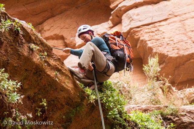
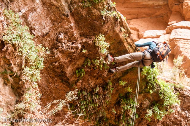
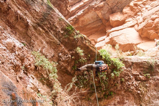
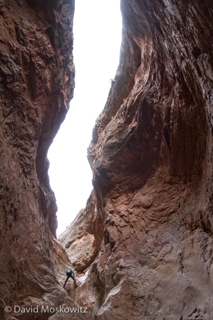
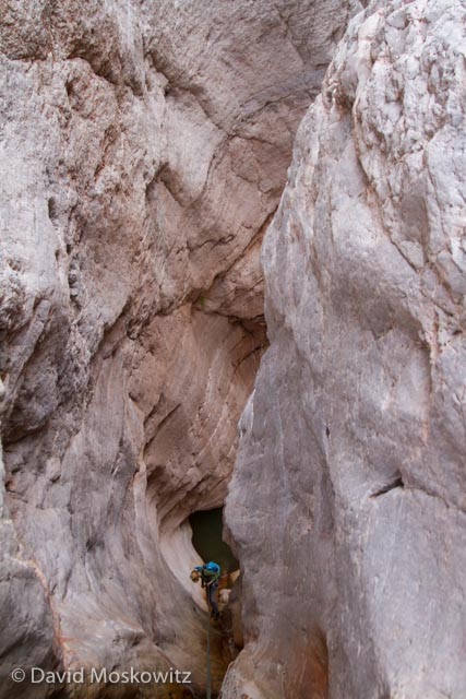
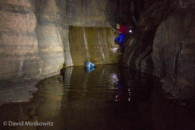
Dropping into Cove Canyon


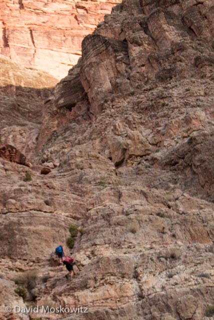
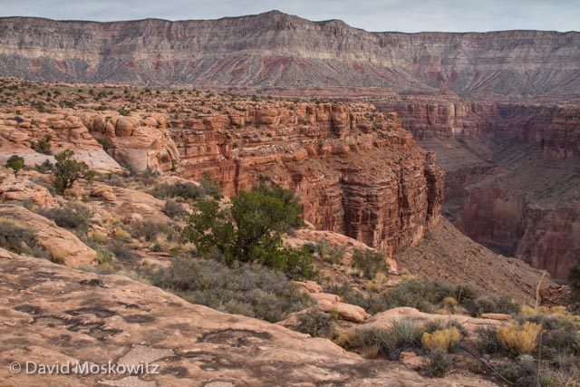
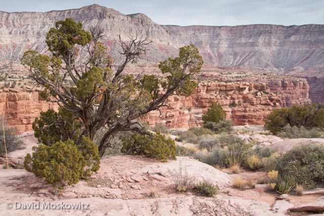
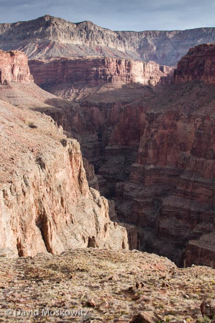
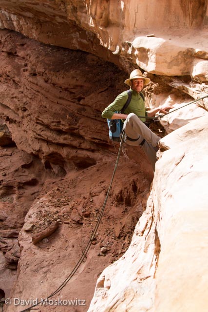
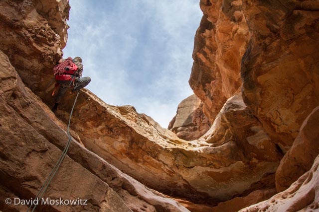
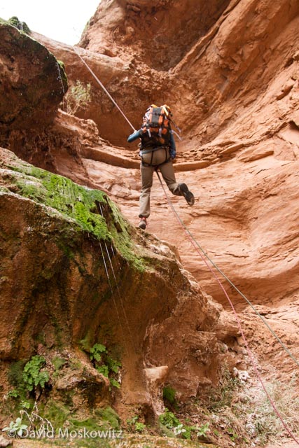
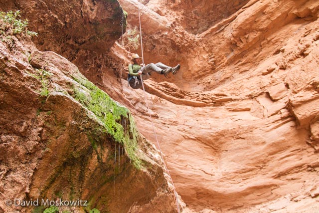
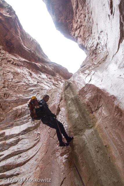
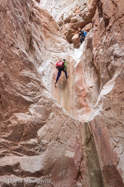
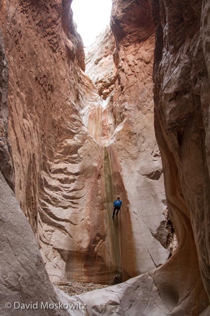
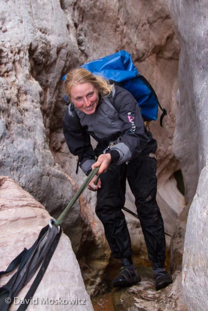
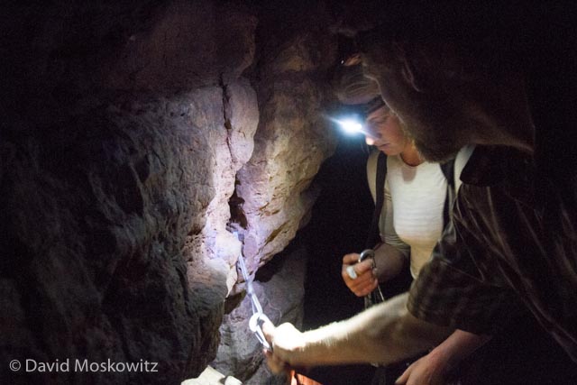
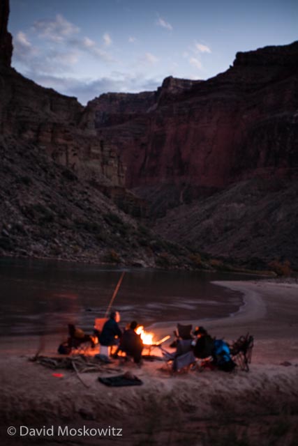
While thousands of boaters float down the Colorado River in the Grand Canyon every year, dozens of side canyons branching off the river receive much less attention. During my recent float trip, we explored several technical canyons. Because of the small amount of daylight in late November and December in the Canyon, side trips required an early start and several ended by headlamp in the dark. My favorite side trip was in Cove Canyon which comes into the Colorado around river mile 175. From our camp at the mouth of Cove Canyon six of us departed before first light. A bit over 12 hours later we made our way back into camp after navigating the final plunge pool and rappell via headlamp.

Grand Canyon Wildlife, Birds, and Tracks

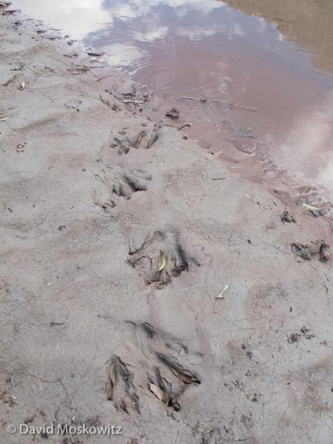
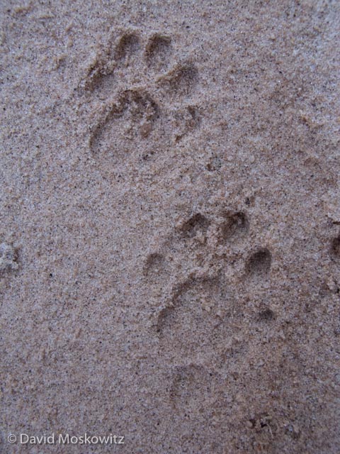
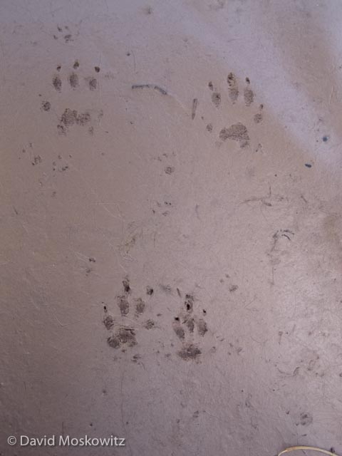
Wildlife and signs of wild animals abound along the Colorado River in the Grand Canyon. The silty banks of the river hold the tracks of many species large and small while birds, from tiny canyon wrens to California Condors can be spotted on the water, in the brush or soaring above the canyon walls. Here is a little bit of what I found on my recent float trip down the river.

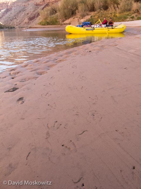
Animal Tracks in the Grand Canyon

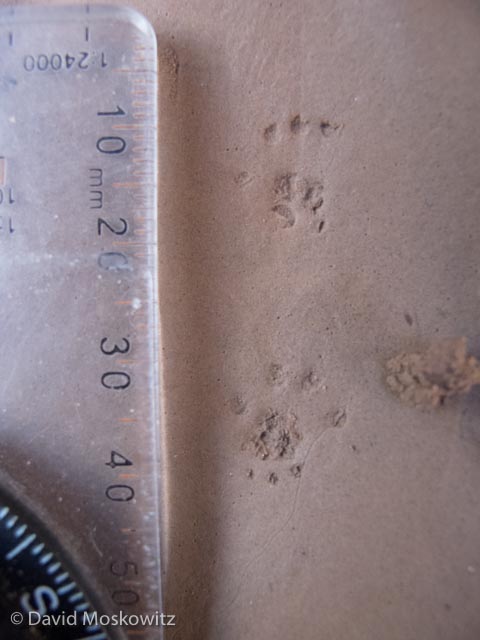
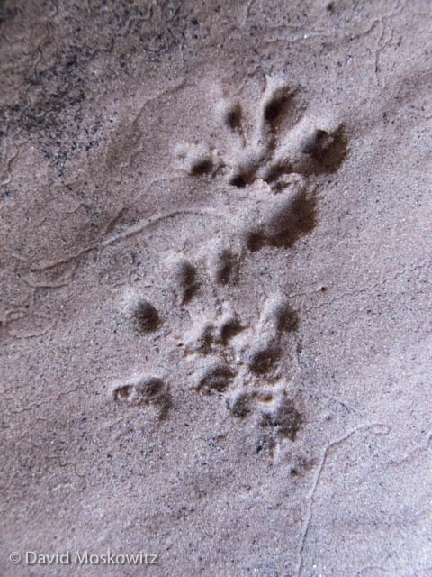
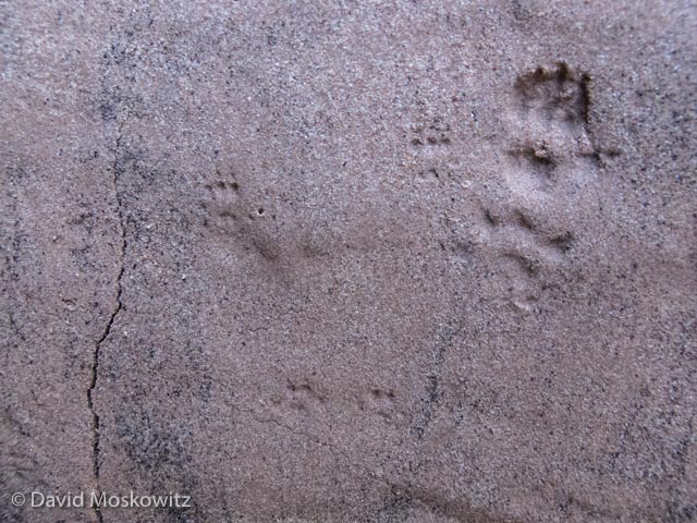
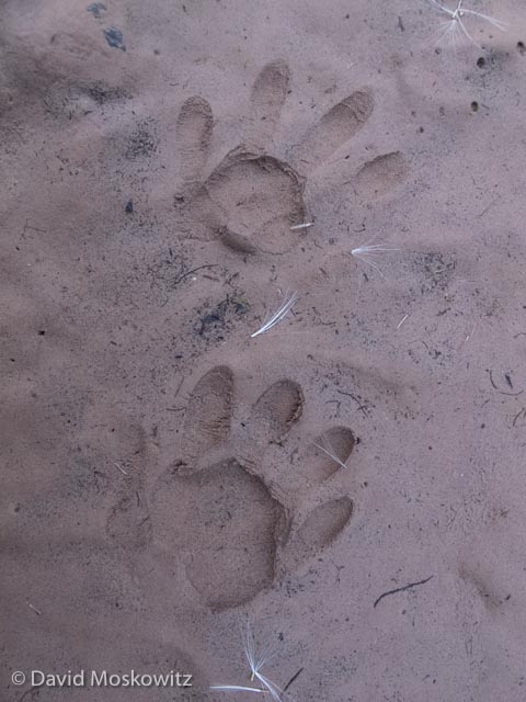
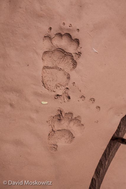
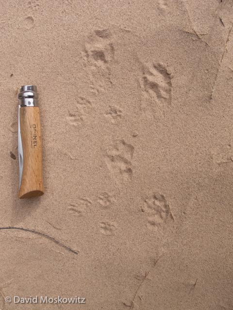
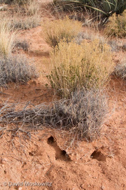
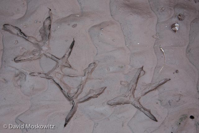
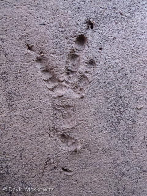
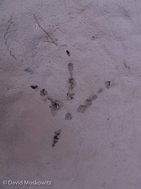
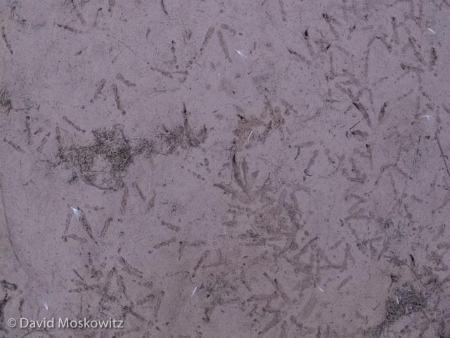
Footprints of a wild animals were abundant along the banks of the Colorado river. Here are a bunch of wildlife tracks I took while on the river along with a few clues on how to tell what they are!

 Grand Canyon Birds

Though I am not much of a birder I amassed a species list of about 35 birds during my November-December trip down the Canyon. The abundance and diversity of birds definately increased towards the end of the trip. Here are a few I managed to snap a photo of.

A great blue heron takes flight along the Colorado River. Grand Canyon, Arizona.

A great blue heron takes flight along the Colorado River. Grand Canyon, Arizona.

Ross’s x Snow goose hybrid. We saw a single pair on the river. They had probably stopped during their southern fall migration.

Ross’s x Snow goose hybrid. We saw a single pair on the river. They had probably stopped during their southern fall migration.

Canyon Wrens were one of the most common birds to see or hear along much of the river. Their beatiful lyrical song echoeing off the canyon walls was one of the most amazing sounds on the river. Grand Canyon, Arizona.

Canyon Wrens were one of the most common birds to see or hear along much of the river. Their beatiful lyrical song echoeing off the canyon walls was one of the most amazing sounds on the river. Grand Canyon, Arizona.

A common raven looks out from a perch on a sandstone ledge. Grand Canyon, Arizona.

A common raven looks out from a perch on a sandstone ledge. Grand Canyon, Arizona.

A first winter white-crowned sparrow. Grand Canyon, Arizona.

A first winter white-crowned sparrow. Grand Canyon, Arizona.

Rock wren. Grand Canyon, Arizona.

Rock wren. Grand Canyon, Arizona.

Patience and careful observation revealed this ruby-crowned kinglet in the brush up a side canyon. Grand Canyon, Arizona.

Patience and careful observation revealed this ruby-crowned kinglet in the brush up a side canyon. Grand Canyon, Arizona.

See more of my Bird Photography here!

Grand Canyon Mammals

While footprints revealed the presence of a great many more species of mammals than we actually had live sightings of our party saw bighorn sheep on several occasions and had some notable interactions with ringtails. Perhaps most unusual was the discovery of a ringtail in one of our party's tent when he retired for the evening!

A bighorn sheep ram foraging along the shore of the Colorado River. Grand Canyon, Arizona.

A bighorn sheep ram foraging along the shore of the Colorado River. Grand Canyon, Arizona.

A group of bighorn sheep ewes in Tuckup Canyon, a tributary to the Colorado River in the Grand Canyon, Arizona.

A group of bighorn sheep ewes in Tuckup Canyon, a tributary to the Colorado River in the Grand Canyon, Arizona.

Check out more of my mammal photography here!

Another Look at Northern Flying Squirrel Tracks

Perhaps because of the forest habitat they occupy and tendency not to travel for long distances on the the ground, clear footprints of the northern flying squirrel (Glaucomys sabrinus) have rarely been detected in the wild, or at least rarely documented. I personally have never definitively identified this species's tracks in any substrate other than loose snow. As such producing reliable illustrations for the tracks of flying squirrels is challenging. In writing my field guide I had less direct field data on this species than any other mammal species whose tracks are illustrated in the book. The illustrations, measurements and description of northern flying squirrel tracks in Wildlife of the Pacific Northwest are based on the following data sources:

  • Snow tracks found in conjunction with definitive flying squirrel sign, typically the landing mark at the end of a glide.
  • A plaster cast of a number of tracks of a single flying squirrel which was collected for me by Kevin Mack,  at PAWS in Lynwood, WA from a captive female northern flying squirrel which was being rehabilitated for release there.
  • Sketches, notes and photographs I took from study skins of northern flying squirrels from the Mammalogy Collection at the Burke Museum of Natural History and Culture at the University of Washington.
  • Photographs and illustrations of the tracks and signs of this species from other wildlife tracking literature, (all included in the bibliography of my field guide).

In the spring of 2012, while delivering a Tracking Certification with Dr. Mark Elbroch, author of a number of books on wildlife tracks in North America, Mark offered me the feedback that his most recent research on this topic suggests that his original depiction of northern flying squirrel feet in Mammal Tracks: A Guide to North American Species, along with my own are inaccurate. In Mark Elbroch's most recent book, co-authored with Jonah Evans and Michael Kresky, Field Guide to Animal Tracks and Scats of California, the authors present a revised illustration of the tracks of this species based on their inspection of study skins and footprints collected from sooted track plates. Following this conversation, I revisiting my own original research materials, as well as the literature and made a follow up trip back to the Burke Museum, where I reexamined study skins as well as a fresh specimen which was waiting to be processed.

As Elbroch, Evans, and Kresky depict, northern flying squirrels do have a distinctive, though subtle, anatomical feature in their hind feet which is unique among squirrels in the Pacific Northwest and California. Toe number 5, the outside toe, is longer than is typical for squirrels or other rodents. Inspecting the actual feet of a frozen flying squirrel as well as numerous study skins, this toe, while not quite as long as the central three toes is nearly so, and visually apears in a similar plane to them, while toe 1 is distinctly shorter and falls on a seperate plane. This feature is present in the tracks collected from the sooted track plate which is published in Elbroch, Evans and Kresky. While the only clear tracks in a natural substrate I have been able to examine, those of the captive animal's which were collected in sand, do not show this characteristic as distinctively as it appears in sooted track plates and on the actual feet themselves, I suspect that it would likely often be apparent in tracks in natural substrates.  This characteristic, not currently illustrated or described in Wildlife of the Pacific Northwest, could be used to distinguish the tracks of this species from the related Douglas (Tamiasciurus douglasii) and red squirrels (Tamiasciurus hudsonicus) which share the Pacific Northwest and much of the rest of North America with northern flying squirrels.

Because there is such limited data on this topic, I have included photographs and sketches from my research for review by others. Similarly, if others have photographs, sketches or access to northern flying squirrel's I would love to see their material and explore this subject further. Thanks much to Jeff Bradley at the Burke Museum, and the Burke Museum in general, as well as Mark Elbroch for their assistance with this topic.

The left hind foot of a frozen northern flying squirrel (Glaucomys sabrinus) from the Burke Museum’s Mammalogy Collection. Note that toe 5 is nearly as long as toes 2-4, while toe 1 is distinctly shorter.
The left hind foot of a frozen northern flying squirrel (Glaucomys sabrinus) from the Burke Museum’s Mammalogy Collection. Note that toe 5 is nearly as long as toes 2-4, while toe 1 is distinctly shorter.

Rubbings made from a plaster cast of the tracks of a captive northern flying squirrel in sand. Collected by Kevin Mack at PAWS in Lynwood Washington. Various feet are labeled.

Rubbings made from a plaster cast of the tracks of a captive northern flying squirrel in sand. Collected by Kevin Mack at PAWS in Lynwood Washington. Various feet are labeled.

A digital drawing over the rubbings to help enhance the appearance of the structure of the tracks.

A digital drawing over the rubbings to help enhance the appearance of the structure of the tracks.

Original notes and sketches from my book research on the species from 2009.

Original notes and sketches from my book research on the species from 2009.

Notes and sketches from my research at the Burke Museum from 2012.

Notes and sketches from my research at the Burke Museum from 2012.

Mount St. Helens Institute Track and Sign Certification

This past weekend the Mount St. Helens Institute, in collaboration with the Mount Adams Institute, hosted a Cybertracker Conservation Track and Sign Certification Event close to the town of Trout Lake in the southern Washington Cascades, a landscape with a diversity of plant communities, striking geography, and bountiful wildlife.

Matt Nelson, Track and Sign Specialist, assisted me in the delivery of the evaluation. Here Matt is leading a discussion around the remains of a mule deer which was killed and butchered by a human hunter and subsequently scavenged by coyotes. Questi…

Matt Nelson, Track and Sign Specialist, assisted me in the delivery of the evaluation. Here Matt is leading a discussion around the remains of a mule deer which was killed and butchered by a human hunter and subsequently scavenged by coyotes. Questions around this carcass led to a lengthy and detailed discussion on how to differentiate the patterns of sign left behind around carcasses by other large carnivores such as mountain lions, black bears, and wolves.

Naturalist Dan Daly inspecting a beaver chewed stick along the banks of the Klickitat River. Dan performed impressively and with a score of 98.5, earned his second Level 3 Certification. Nice work Dan!

Naturalist Dan Daly inspecting a beaver chewed stick along the banks of the Klickitat River. Dan performed impressively and with a score of 98.5, earned his second Level 3 Certification. Nice work Dan!

Matt Nelson photographed me leading a discussion on the identification of a collection of feathers from a Ruffed grouse found on the side of a forest road. David Scott (Track and Sign Specialist) and Casey McFarland (Specialist and Evaluator for Cyb…

Matt Nelson photographed me leading a discussion on the identification of a collection of feathers from a Ruffed grouse found on the side of a forest road. David Scott (Track and Sign Specialist) and Casey McFarland (Specialist and Evaluator for Cybertracker Conservation) are the authors of the excellent resource pictured here, Bird Feathers: A Guide to North American Species.

The camber of this primary wing feather is an important clue about the original owner of it. The heavy downward curve in wing weathers is typical for game birds such as Ruffed grouse. This curve helps give them explosive take off power, an important…

The camber of this primary wing feather is an important clue about the original owner of it. The heavy downward curve in wing weathers is typical for game birds such as Ruffed grouse. This curve helps give them explosive take off power, an important survival trait for ground birds trying to escape terrestrial predators.

Congratulations to everyone who earned a Track and Sign Certification through the Event! For a complete list of certified Trackers in North America click here.

Level 1

Corwin Scott

Hanna D. Gomes

Fred Engelfried

Level 2

Heather Harding

Levi Old

Level 3

Maureen Corlas

Ashley Conley

Daniel P. Daly

Wildlife Tracking in the Tatra Mountains of Slovakia

In late September, the Slovak Wildlife Society hosted a weekend Wildlife Tracking Workshop in Liptovský Mikuláš, a village in the Tatra Mountains of Slovakia. The Slovak Wildlife Society is involved with a range of conservation projects focusing primarily on the region's large carnivores including working to prevent negative interactions between wolves and bears with humans. Here are a few of the highlights from my trip to the region and the class with a collection of very fine European naturalists and wildlife trackers.

My initial impressions of northern Slovakia during my train ride through the country was that it reminded me much of the state of Montana, with the notable addition of castles.

My initial impressions of northern Slovakia during my train ride through the country was that it reminded me much of the state of Montana, with the notable addition of castles.

Tracks of a European Red deer (Cervus elaphus).

Tracks of a European Red deer (Cervus elaphus).

The right hind track of a European Brown Bear (Ursus arctos).

The right hind track of a European Brown Bear (Ursus arctos).

European river otter (Lutra lutra) tracks.

European river otter (Lutra lutra) tracks.

European lynx (Lynx lynx) track. Tatra Mountans, Slovakia.

European lynx (Lynx lynx) track. Tatra Mountans, Slovakia.

A spring in the forest used extentively by Wild Boar as a wallow. Tatra Mountains, Slovakia

A spring in the forest used extentively by Wild Boar as a wallow. Tatra Mountains, Slovakia

A tree close to a spring wild boar’s use as a wallow. Robin Rigg, Slovak Wildlife Society Founder and Director, inspects the scar and mud on the base of the tree is from repetitive rubbing from boars on the tree. Tatra Mountains, Slovakia.

A tree close to a spring wild boar’s use as a wallow. Robin Rigg, Slovak Wildlife Society Founder and Director, inspects the scar and mud on the base of the tree is from repetitive rubbing from boars on the tree. Tatra Mountains, Slovakia.

A red fox moves through the brush in morning light. Tatra Mountains, Slovakia.

A red fox moves through the brush in morning light. Tatra Mountains, Slovakia.

Participants in the wildlife tracking workshop Slovak Wildlife Society hosted.

Participants in the wildlife tracking workshop Slovak Wildlife Society hosted.

Evening light in the Tatra Mountains, Slovakia. 

Evening light in the Tatra Mountains, Slovakia.


Making Hay in the Caucasus Mountains of the Republic of Georgia

September is harvest season for folks who live in the Sveneti Region of Georgia's Caucasus Mountains. The Caucasus Mountains are a land steeped in history and located at a geographic and cultural crossroads of Asia and Europe. Traveling through the remote villages situated among the soaring ridges and peaks of the Caucasus Mountains, felt at points like a trip back in time. This feeling was perhaps most distinct in watching the process of cutting and storing hay which was in full swing during my time in the region.

Three men from the village of Iprali work in concert cutting wild hay in a high elevation meadow in the Sveneti region of the Republic of Georgia.

Three men from the village of Iprali work in concert cutting wild hay in a high elevation meadow in the Sveneti region of the Republic of Georgia.

Careful attention to keeping you blade sharp is required for cutting hay with a scythe. Men will typically sharpen their blade after each row of hay they cut and the distinctive sound of sharpening stones against the metal blades of scythes rung out…

Careful attention to keeping you blade sharp is required for cutting hay with a scythe. Men will typically sharpen their blade after each row of hay they cut and the distinctive sound of sharpening stones against the metal blades of scythes rung out across many of the mountain valley’s we traversed during our fall travels in the region.

Often, hay is carefully collected into mounds which are left to dry before being hauled back to the village and stored for the winter.

Often, hay is carefully collected into mounds which are left to dry before being hauled back to the village and stored for the winter.

Hay mounds dotted hillsides up and down the mountainsides across much of Sveneti during the fall. Caucasus Mountains, Republic of Georgia.

Hay mounds dotted hillsides up and down the mountainsides across much of Sveneti during the fall. Caucasus Mountains, Republic of Georgia.

Hay mounds are eventually collected and loaded onto either trucks or wooden sleds pulled by cattle to be hauled into the village.

Hay mounds are eventually collected and loaded onto either trucks or wooden sleds pulled by cattle to be hauled into the village.

Hay being hauled out of the mountains to the village of Ushguli. Sveneti, Republic of Georgia.

Hay being hauled out of the mountains to the village of Ushguli. Sveneti, Republic of Georgia.

A wooden hay sled sits in front of a modern barn built with a traditional design, while two cows rigged for hauling it rest in the shade. Hay is stored in the top while livestock are penned below during the winter. Sveneti, Republic of Georgia.

A wooden hay sled sits in front of a modern barn built with a traditional design, while two cows rigged for hauling it rest in the shade. Hay is stored in the top while livestock are penned below during the winter. Sveneti, Republic of Georgia.

A massive and growing ravine sits on the edge of a village in Sveneti. Intensive and long term cattle and other livestock production have left many hillsides scared with with such erosion, while thistles and other weedy species that tolerate heavy g…

A massive and growing ravine sits on the edge of a village in Sveneti. Intensive and long term cattle and other livestock production have left many hillsides scared with with such erosion, while thistles and other weedy species that tolerate heavy grazing pressure flourish in much of the range lands in Sveneti.

Part of the welcoming committee for the village of Ushguli. On our walk into the village we were also greeted by a horse, several pigs, and a very large but quite amiable dog. Caucasus Mountains, Republic of Georgia.

Part of the welcoming committee for the village of Ushguli. On our walk into the village we were also greeted by a horse, several pigs, and a very large but quite amiable dog. Caucasus Mountains, Republic of Georgia.

The abandoned village of Ghuli sits below the imposing summit of Mount Ushba. While wolves and bears are reported to still roam these mountains, during two weeks of trekking in the region I never saw sign of even a single wild hoofed mammal or any o…

The abandoned village of Ghuli sits below the imposing summit of Mount Ushba. While wolves and bears are reported to still roam these mountains, during two weeks of trekking in the region I never saw sign of even a single wild hoofed mammal or any other terrestrial wildlife larger than a fox. Millennia of pastoralism have left a heavy mark on this staggeringly beautiful landscape. Sveneti, Republic of Georgia


Jefferson Land Trust Track and Sign Certification

This past weekend the Jefferson Land Trust hosted a Track and Sign Evaluation in the northeastern section of Washington's Olympic Peninsula. Jason Lake, instructor for Ceder Root Folk School, volunteered four days of his time to assist in setting up and delivering the Evaluation. The evaluation was held on a combination of Lands owned or under conservation easements managed by the Land Trust and public lands in the area.

Jonathan Goff takes answers from Evaluation participant Heather Harding. Heather earned a Level 2 Track and Sign Certificate.

Jonathan Goff takes answers from Evaluation participant Heather Harding. Heather earned a Level 2 Track and Sign Certificate.

An aplodontia cut these stinging nettle stalks and dragged them back to the mouth of its burrow. Olympic Peninsula, Washington.

An aplodontia cut these stinging nettle stalks and dragged them back to the mouth of its burrow. Olympic Peninsula, Washington.

Erik Kingfisher, seen here inspecting the tracks of a Great Blue Heron, earned a Level 3 Track and Sign Certification.

Erik Kingfisher, seen here inspecting the tracks of a Great Blue Heron, earned a Level 3 Track and Sign Certification.

 Naturalist Justin Lake, who assisted me in delivering the evaluation, inspects tracks along the beach on the edge of the Strait of Juan De Fuca, Washington.


Naturalist Justin Lake, who assisted me in delivering the evaluation, inspects tracks along the beach on the edge of the Strait of Juan De Fuca, Washington.

 Naturalist Nicole Larson records her answers to track and sign questions along the Dosewallips River. Olympic Peninsula, Washington. Nicole earned a Level 2 Track and Sign Certificate.


Naturalist Nicole Larson records her answers to track and sign questions along the Dosewallips River. Olympic Peninsula, Washington. Nicole earned a Level 2 Track and Sign Certificate.

Thanks to everyone who participated in the Evaluation and...

Congratulations to the folks who earned certificates:

  • Level 1: Peter Craig, Sarah Spaeth, Isabelle Luna, Rachel Webber
  • Level 2: Lee Corum, Heather Harding, Dustin Ryerson, Nicole Larson
  • Level 3: Erik Kingfisher

For a list of all of the certified trackers in North America click here.

Mother of Rivers: the Mountains of Georgia's Caucasus Range

The massive relief of the Caucuses Range in the the Republic of Georgia's Sveneti Region are staggering in their own right for their sheer natural beauty. Though much less well known then the Alps in western Europe, the Causcuses, straddling the southern border between Europe and Asia are the highest mountain range in Europe. During the first part of my recent trip to the region, I spent several days trekking around Mount Ushba, one of the most striking mountains I have ever encountered. Like most of the highest peaks in Georgia, it sits along the international border with Russia.

Though not the highest peak in the range, at 4,710 m (15,453 ft), Mount Ushba is a massive peak and generally considered the most challenging mountaineering objective in the range. Seen hear at sunset with a steady stream of clouds forming and strea…

Though not the highest peak in the range, at 4,710 m (15,453 ft), Mount Ushba is a massive peak and generally considered the most challenging mountaineering objective in the range. Seen hear at sunset with a steady stream of clouds forming and streaming off of the lee side of the summit.

Mount Ushba (left), neighboring Mazerie Peak, and the massive rock covered lower portion of the Ushba Glacier photographed via moon and starlight.

Mount Ushba (left), neighboring Mazerie Peak, and the massive rock covered lower portion of the Ushba Glacier photographed via moon and starlight.

Murky waters pour out of the snout of the Ushba Glacier, one of the headwaters of the Inguri River, one of the largest and economically most important river in Georgia.

Murky waters pour out of the snout of the Ushba Glacier, one of the headwaters of the Inguri River, one of the largest and economically most important river in Georgia.

Intrepid traveler crossing the ragging glacial outflow several miles downstream from the snout of the Ushba glacier in the Republic of Georgia’s Sveneti region.

Intrepid traveler crossing the ragging glacial outflow several miles downstream from the snout of the Ushba glacier in the Republic of Georgia’s Sveneti region.

The torrent of water pouring over the glacier carved cliffs bellow Mount Ushba have carved out a deep ravine into the landscape. Svaneti Region, Republic of Georgia.

The torrent of water pouring over the glacier carved cliffs bellow Mount Ushba have carved out a deep ravine into the landscape. Svaneti Region, Republic of Georgia.

The Shkhara massif sits south and east of Mount Ushba and includes Mount Shkhara and several other 5000+ meter peaks, the highest part of the Caucuses in Georgia. Fall temperatures had turned the mountain ash red on the alpine mountain slopes and dusted the ridgetops, peaks, and glaciers with fresh snow.

The massive bulk of Jhanga peak and Mount Shkhara from the west, drapped in ice and fresh snow, give birth to another tributary to the Inguri River. Sveneti Region, Republic of Georgia.

The massive bulk of Jhanga peak and Mount Shkhara from the west, drapped in ice and fresh snow, give birth to another tributary to the Inguri River. Sveneti Region, Republic of Georgia.

A rainbow straddles the mountain valley and snout of the valley glacier flowing off of the Shkhara massif. Georgian Caucuses Mountains.

A rainbow straddles the mountain valley and snout of the valley glacier flowing off of the Shkhara massif. Georgian Caucuses Mountains.

Mountain ash’s brilliant red-orange after the onset of fall temperatures above the glacier fed river leading down to the tiny and remote village of Adishi. Sveneti Region, Republic of Georgia.

Mountain ash’s brilliant red-orange after the onset of fall temperatures above the glacier fed river leading down to the tiny and remote village of Adishi. Sveneti Region, Republic of Georgia.

The Lamaria Church, near the town of Ushguli, with the southern face of Mount Shkhara, 5,193 m (17,040 ft), in the background.

The Lamaria Church, near the town of Ushguli, with the southern face of Mount Shkhara, 5,193 m (17,040 ft), in the background.

Downstream, the impacts of primitive sewage systems, unbelievable garbage disposal practices, unfettered livestock access, old mining activity, and a massive hydroelectric dam take their toll on the Inguri River, but here at its headwaters it flows …

Downstream, the impacts of primitive sewage systems, unbelievable garbage disposal practices, unfettered livestock access, old mining activity, and a massive hydroelectric dam take their toll on the Inguri River, but here at its headwaters it flows free and beautiful off of some of the highest peaks in the world.


North Cascades National Park Wildlife Tracking Certification

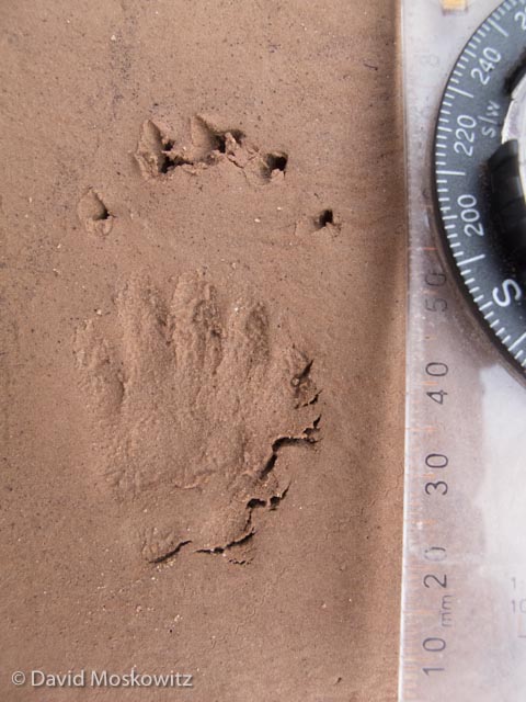
The right front foot of a mink (Neovison vison) in fine glacial silt found close to the mouth of Thunder Creek.

The right front foot of a mink (Neovison vison) in fine glacial silt found close to the mouth of Thunder Creek.

In mid-June North Cascades Institute hosted the first Wildlife Tracking Certification Event in North Cascades National Park. Besides a diversity of tracks and signs some challenging field conditions including some classic North Cascades rain and multi-element bushwacking/wading added to the experience for myself as the evaluator and for participants! Here are a few of the highlights from the Evaluation.

These tracks of a Douglas squirrel (Tamiasciurus douglasii) were found just down the shore from the mink.

These tracks of a Douglas squirrel (Tamiasciurus douglasii) were found just down the shore from the mink.

This unusual sign of a beaver (Castor canadensis) in the riparian forest along Thunder Creek stumped many.

This unusual sign of a beaver (Castor canadensis) in the riparian forest along Thunder Creek stumped many.

Roger Bean, who earned a Level III Track and Sign Certification contemplates the beaver feeding sign during the evaluation.

Roger Bean, who earned a Level III Track and Sign Certification contemplates the beaver feeding sign during the evaluation.

The weathered track of a black bear (Ursus americanus).

The weathered track of a black bear (Ursus americanus).

Terry Kem, founder of Deerdance, earned a Level III Cerftication as well on the evaluation, seen here photographing a sign post tree well used by black bears along Thunder Creek.

Terry Kem, founder of Deerdance, earned a Level III Cerftication as well on the evaluation, seen here photographing a sign post tree well used by black bears along Thunder Creek.

Moose (Alces alces) are rarely sighted in western portion of the North Cascades, but these pellets indicate one had passed by the Easy Pass Trailhead along the North Cascades Scenic Highway.

Moose (Alces alces) are rarely sighted in western portion of the North Cascades, but these pellets indicate one had passed by the Easy Pass Trailhead along the North Cascades Scenic Highway.

Scat from a bushytailed woodrat (left, Neotoma cinerea) and a pika (Ochotona princeps) were both discovered in a large talus field.

Scat from a bushytailed woodrat (left, Neotoma cinerea) and a pika (Ochotona princeps) were both discovered in a large talus field.

Susan Brown, a graduate student in the North Cascades Institutes Masters of Education program, assisted with the evaluation. Pictured here by a powerline pole that had been bitten and rubbed on by black bears. 

Susan Brown, a graduate student in the North Cascades Institutes Masters of Education program, assisted with the evaluation. Pictured here by a powerline pole that had been bitten and rubbed on by black bears.


Congratulations to everyone who participated in the Evaluation. Of 10 participants, 3 Level III , 3 Level II , and one Level I certificates were awarded. For a list of certified trackers in North America click here.

Alpine Skills Training at Northwest Outward Bound School

Outward Bound Instructor Sam Ecenia dives into Alpine Skills Training on Mount Hood to start of the summer field season for Northwest Outward Bound School’s summer season.

Outward Bound Instructor Sam Ecenia dives into Alpine Skills Training on Mount Hood to start of the summer field season for Northwest Outward Bound School’s summer season.

The first staff training of the year for Northwest Outward Bound School's Odin Falls Basecamp in Central Oregon was a great success. Myself and five participants headed out to eastside of Mount Hood. Blue skies and generally excellent weather made for five very productive days from a basecamp we established on a moraine to the south of the Elliot Glacier, culminating in a summit climb via the lovely Cooper Spur Route (see photos below). We also spent a day working on rescue skills and student management on the basalt cliffs by the school's Bascamp along the Deschutes River at the end of the training.

Along with being an instructor and trainer for Northwest Outward Bound School, I recently joined the Board of Directors for the school. After months of being involved with all the many things that go on behind the scenes to help ensure that Outward Bound Instructors have the chance to deliver life changing experiences to our students in the field, spending a week in the field with this group of instructors  in the backcountry was a good reminder for me about why the work that Outward Bound does is so powerful for students and instructors alike.

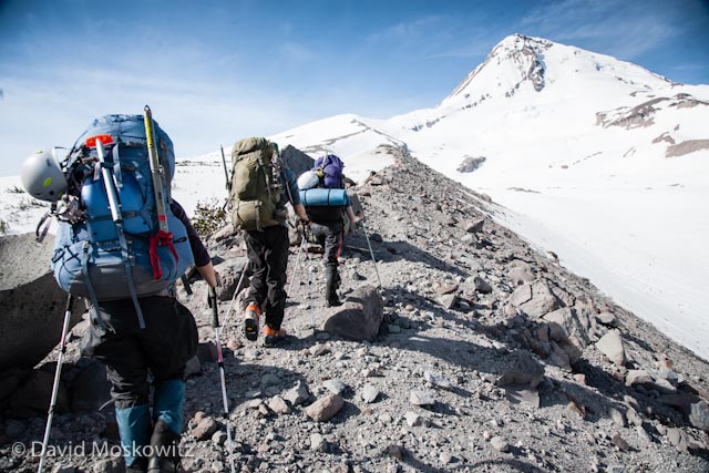
Heading up towards our camp on Mount Hood.

Heading up towards our camp on Mount Hood.

We set up our camp at the end of this glacial moraine above the terminus of the Elliot Glacier.

We set up our camp at the end of this glacial moraine above the terminus of the Elliot Glacier.

Our camp on the moraine above the Elliot Glacier on Mount Hood

Our camp on the moraine above the Elliot Glacier on Mount Hood

Six year Outward Bound veteran Jess Stuecklen practices her self arrest skills.

Six year Outward Bound veteran Jess Stuecklen practices her self arrest skills.

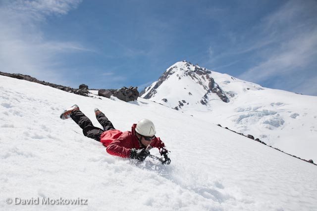
Outward Bound Instructor Sam Ecenia self arrests after a face first digger. Being able to stop yourself from sliding on steep snow is a fundamental alpine climbing skill.

Outward Bound Instructor Sam Ecenia self arrests after a face first digger. Being able to stop yourself from sliding on steep snow is a fundamental alpine climbing skill.

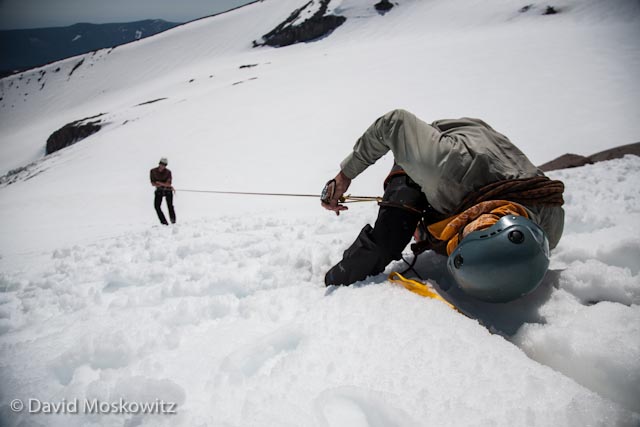
Outward Bound Instructor John Rudolph practicing his crevasse rescue skills–building a snow anchor and transferring the weight of a fallen climber from his harness to the anchor.

Outward Bound Instructor John Rudolph practicing his crevasse rescue skills–building a snow anchor and transferring the weight of a fallen climber from his harness to the anchor.

Jess bounds in a snow anchor. Participants had 15 minutes to construct an anchor and transfer the “fallen climber” to it during this drill.

Jess bounds in a snow anchor. Participants had 15 minutes to construct an anchor and transfer the “fallen climber” to it during this drill.

Outward Bound Instructor Molly Hayes relaxes in camp after a full day of skills practice.

Outward Bound Instructor Molly Hayes relaxes in camp after a full day of skills practice.

Mount Hood as seen from our camp location.

Mount Hood as seen from our camp location.

We left our camp at 2 am for our peak bid, arriving at the base of the steep terrain close to the summit just as the sun was about to rise 

We left our camp at 2 am for our peak bid, arriving at the base of the steep terrain close to the summit just as the sun was about to rise


Hard snow up to about 55 degrees made for fun and exciting climbing conditions on the way up.

Hard snow up to about 55 degrees made for fun and exciting climbing conditions on the way up.

Sunrise over the Columbia River as seen from about 9000′ on the Cooper Spur route

Sunrise over the Columbia River as seen from about 9000′ on the Cooper Spur route

Laura Berglund and Sam Ecenia pause for a moment as we get into the steepest portion of the climb

Laura Berglund and Sam Ecenia pause for a moment as we get into the steepest portion of the climb

.

View from a belay close to the summit.

View from a belay close to the summit.

Sam Ecenia constructing a snow anchor for the final pitch of the climb. One of the basic educational concepts of Outward Bound is to “Impell People into Value’s Forming Experiences”. In classic Outward Bound fashion participants in the training prac…

Sam Ecenia constructing a snow anchor for the final pitch of the climb. One of the basic educational concepts of Outward Bound is to “Impell People into Value’s Forming Experiences”. In classic Outward Bound fashion participants in the training practice all of the components of the peak ascent on the days leading up to the climb and then were impelled to put the skills into use to ensure the safety and success of our team endeavor on the climb.

After leading the final pitch of the climb, Jess Stuecklen belays Laura Berglund as she crests the summit of Mount Hood, the tallest peak in the Oregon Cascades.

After leading the final pitch of the climb, Jess Stuecklen belays Laura Berglund as she crests the summit of Mount Hood, the tallest peak in the Oregon Cascades.

View of the final portion of the Cooper Spur route which ascends the wind sculpted lower slopes before weaving through the bands of rocks to reach the summit.

View of the final portion of the Cooper Spur route which ascends the wind sculpted lower slopes before weaving through the bands of rocks to reach the summit.

John Rudolph demonstrates one of Outward Bounds educational tenets–craftsmanship–in the fine meal he prepared for us at the end of our summit day. Nothing says excellence in alpine cooking like long strands of gooey melted cheese!

John Rudolph demonstrates one of Outward Bounds educational tenets–craftsmanship–in the fine meal he prepared for us at the end of our summit day. Nothing says excellence in alpine cooking like long strands of gooey melted cheese!

The Northwest Outward Bound School Mission is to conduct safe, adventure-based experiences structured to inspire self discovery, self reliance, compassion for others, and care for our environment.For more information about Northwest Outward Bound Sc…

The Northwest Outward Bound School Mission is to conduct safe, adventure-based experiences structured to inspire self discovery, self reliance, compassion for others, and care for our environment.For more information about Northwest Outward Bound School, vist nwobs.org.

The silhouettes of Mount Adams and Mount Rainer at sunrise as seen from the northeast side of Mount Hood. Northwest Outward Bound runs courses in some of the most stunning and wild places in the Pacific Northwest including mountaineering courses in …

The silhouettes of Mount Adams and Mount Rainer at sunrise as seen from the northeast side of Mount Hood. Northwest Outward Bound runs courses in some of the most stunning and wild places in the Pacific Northwest including mountaineering courses in the Oregon and Washington Cascades. To sign up for courses visit outwardbound.org.